Sierra del Coloradito to Piedra Santa Traverse
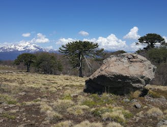
Extraordinay remote and scenic hike across classic high volcanic landscapes and araucarias forests
Difficult Hiking
- Distance
- 15 km
- Ascent
- 625 m
- Descent
- 1 km

Go hiking in La Araucanía with curated guides of the best hikes across the region. With over 42 3D trail maps in FATMAP, you can easily discover and navigate the best trails in La Araucanía.
No matter what your next adventure has in store, you can find a guide on FATMAP to help you plan your next epic trip.
Get a top hiking trail recommendation in La Araucanía from one of our 3 guidebooks, or get inspired by the 42 local adventures uploaded by the FATMAP community. Start exploring now!
Extraordinay remote and scenic hike across classic high volcanic landscapes and araucarias forests
Difficult Hiking
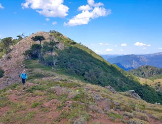
Beautiful steep hike by native forests along the ridge that reveals the Lonquimay Volcano. Includes the cerro Malalcahuello Summit
Difficult Hiking
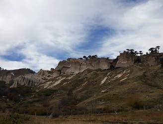
Super scenic and interesting geological hike on the high plains of Lonquimay
Moderate Hiking