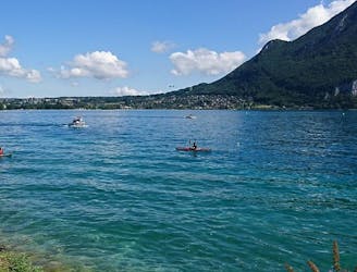
Lac Annecy
Moderate Mountain Biking
- Distance
- 40 km
- Ascent
- 394 m
- Descent
- 394 m
Explore Bauget Alps with curated guides of the best hiking trails, and more. With over 37 3D trail maps in FATMAP, you can easily discover and navigate the best trails in Bauget Alps.
No matter what your next adventure has in store, you can find a guide on FATMAP to help you plan your next epic trip.
Get a top trail recommendation in Bauget Alps from one of our 5 guidebooks, or get inspired by the 37 local adventures uploaded by the FATMAP community. Start exploring now!
Also in Savoie, France
Moderate Mountain Biking
Difficult Mountain Biking
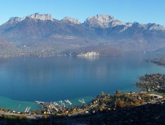
Here you can find the fantastic views, specially view on top La Tournette and behind the massif of Mont Blanc and the chain of the Aravis.
Moderate Hiking

Mont Blanc at your fingertips! The highest peak in Europe and the main summits of the Bauges are revealed before you, as is the Belledonne chain, not to mention the Chartreuse and Vanoise mountains.
Moderate Resort Ski Touring

That view! When you arrive at the top of the resort (1845 m), enjoy an exceptional panoramic view of the mountains of the Massif des Bauges, the Chartreuse, the Belledonnes and in the background the Mont Blanc.
Moderate Resort Ski Touring