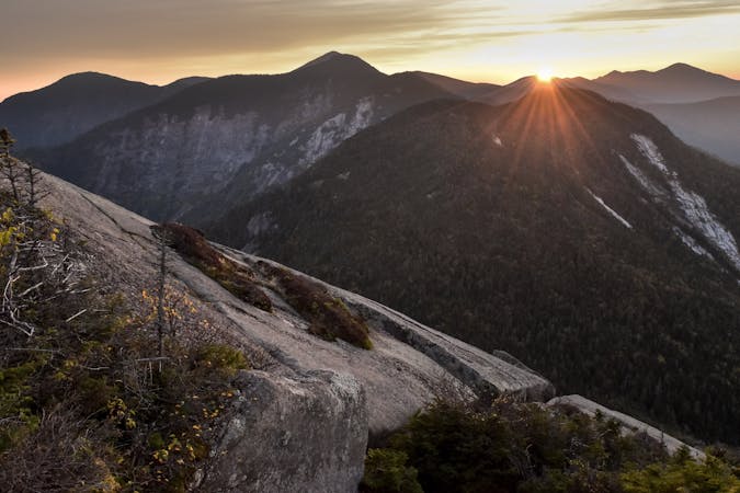
The Devil's Path
A rugged trail run bagging five of the Catskill High Peaks.
Severe Trail Running
- Distance
- 35 km
- Ascent
- 2.6 km
- Descent
- 2.6 km
From the highly acclaimed Devil’s Path to beautiful fire towers and lakes, go for a trail run in one of New York’s wildest forests.
Trail Running Moderate, Difficult, Severe
Nearing 6,000 square miles, the Catskill Mountains offer critically acclaimed trail running less than 100 miles from New York City and Albany. The dramatic high mountain peaks rise quickly from the Hudson River Valley and the expansive network of trail has something for everyone. Whether you’re passing through or looking for somewhere to plan a “runcation”, the Catskills are a summer destination in New York that can’t be overlooked.
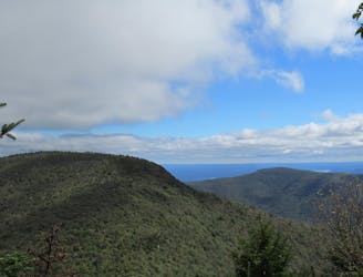
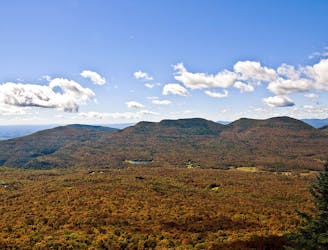
As the centerpiece of the Catskill Mountains, the infamous Devil’s Path is one of the most sought-after traverses in the entire state. Nearly 22-miles, the route is traditionally run east to west, summiting several High Peaks along the way. The mountains frequently offer dramatic views of nearby peaks but must be earned through arduous climbs and descents down fall lines. Expect three points of contact at many times and know that there isn’t an “easy” part of the traverse. If you favor trekking poles for technical trail runs, bring them along. While hikers often complete the trail in two days, trail runners often attempt the entire trail in one day. It’s beauty and ruggedness rival other epic northeast routes like the Adirondack Great Range and even the Presidential Traverse in New Hampshire!
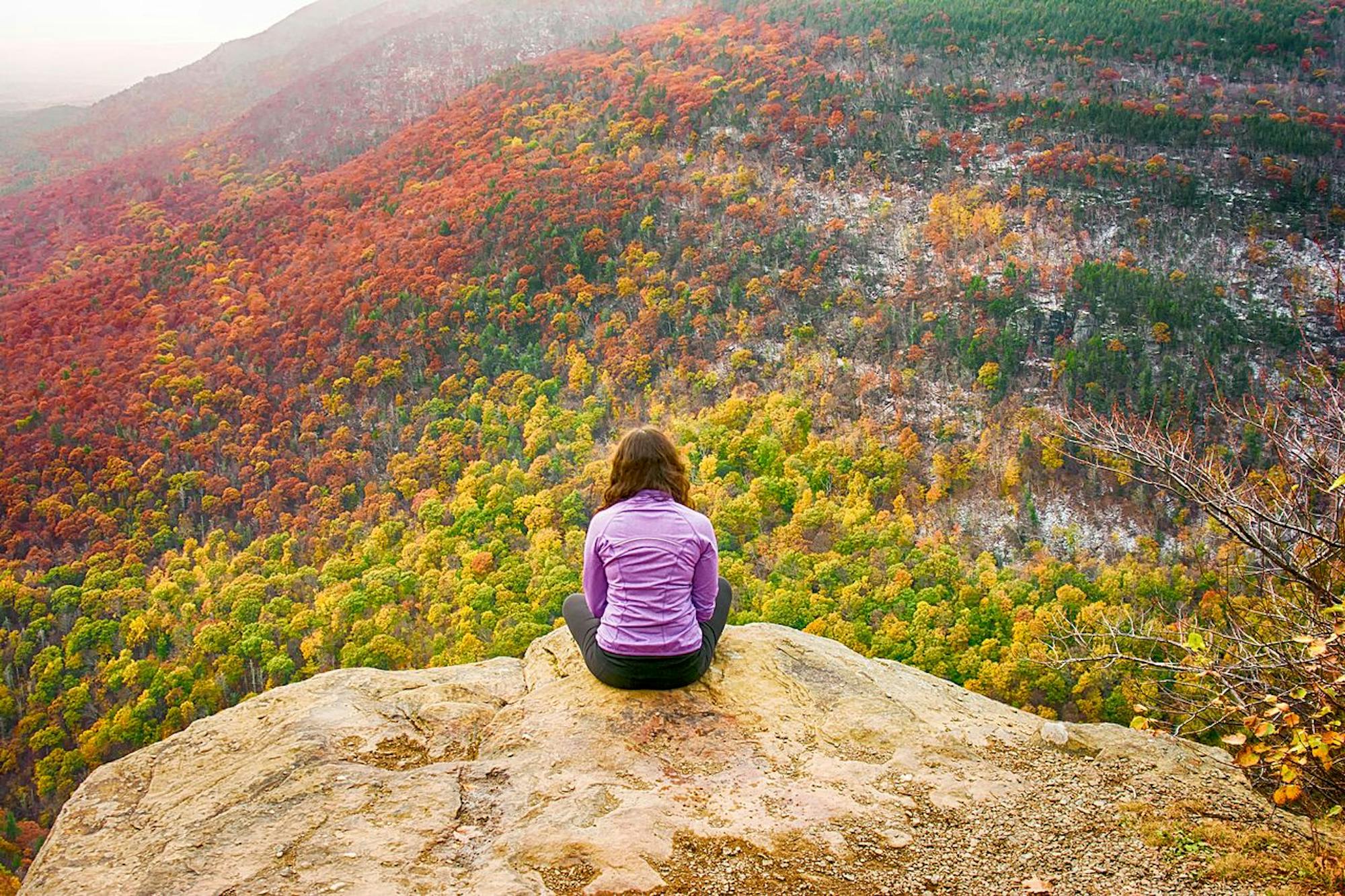
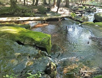
The Sugarloaf Mountain and Indian Head Mountain Loops are two popular 6-mile trail runs that include short segments of the Devil’s Path. The Sugarloaf Mountain Loop incorporates a unique area known for its rock “chairs”, as they appear. Catskill Mountaineer even suggests they are "...the most elaborate rock structures in the Catskill Mountains." Heading over to Indian Head Mountain, enjoy dramatic views and picturesque boreal forest on what is possibly the most visited route in this guidebook.
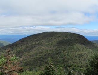
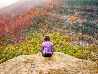
Slightly north, the Kaaterskill High Point offers both southern and norther approach routes. According to sources, it was once believed that the adjacent Round Top Mountain was the region’s high point due to its perspective relative to nearby mountains. It was later corrected to the Kaaterskill High Point, which has an elevation near 3,650’, roughly 200’ above Round Top. Both hikes incorporate part of New York’s Long Path, then connect to the official high point one of several ways. Plan to spend some time exploring the summit when you arrive - you can find multiple USGS Survey Markers, lush views on Hurricane Ledge, and two plane crashes all in the vicinity.
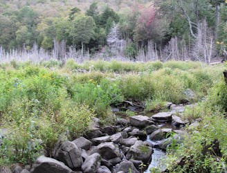
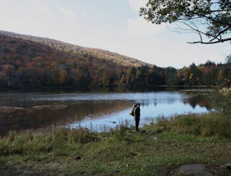
For a shorter run, Huckleberry Point offers incredible views from a rocky overlook beginning at the DEC Trailhead. Less than 5 miles round-trip, this is an easier run showcasing the beauty of the nearby Hudson Valley. The Overlook Mountain and Echo Lake route also offers something for everyone. Many choose a 5-mile out-and-back trek to the historic Overlook Mountain. An old ranger station, remnants of a hotel, abandoned fire tower, and rocky overlook can all be found around the summit. Don’t hesitate to explore a little off the beaten path. For those looking for a longer run or even an overnight camping trip, follow the main trail to Echo Lake, a pristine mountain lake nestled along the southern base of Plattekill Mountain. A lean-to shelter and plenty of primitive sites along the lake make this one of the most highly sought-after camping spots in the region.
Sources:
http://www.catskillmountaineer.com/IH-sugarloaf.html
https://en.wikipedia.org/wiki/KaaterskillHighPeak http://www.catskillmountaineer.com/KM-KHPnorth.html
A rugged trail run bagging five of the Catskill High Peaks.
Severe Trail Running
A challenging trail run connecting three trails and summiting Sugarloaf Mountain.
Severe Trail Running
A relentless trail run to the summit of Indian Head Mountain.
Severe Trail Running
A trail run in the Catskills with a historic fire tower and serene lake.
Difficult Trail Running
A short run in the Catskills to an killer vista at Huckleberry Point.
Moderate Trail Running
A popular route to summit the Kaaterskill High Peak.
Difficult Trail Running
An intense, lesser-traveled approach to the Kaaterskill High Peak.
Severe Trail Running
11 routes · Trail Running