Alta Via Dolomiti 2
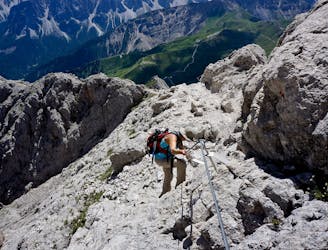
The strenuous “Way of the Legends” high altitude hiking trail across the Dolomites.
Difficult Hiking
- Distance
- 169 km
- Ascent
- 8.2 km
- Descent
- 10 km

Go hiking in Val Gardena/Alpe di Siusi with curated guides of the best hikes across the region. With over 28 3D trail maps in FATMAP, you can easily discover and navigate the best trails in Val Gardena/Alpe di Siusi.
No matter what your next adventure has in store, you can find a guide on FATMAP to help you plan your next epic trip.
Get a top hiking trail recommendation in Val Gardena/Alpe di Siusi from one of our 5 guidebooks, or get inspired by the 28 local adventures uploaded by the FATMAP community. Start exploring now!

The strenuous “Way of the Legends” high altitude hiking trail across the Dolomites.
Difficult Hiking
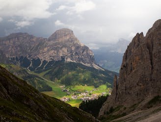
Rewarding hike to one of the peaks of Sella Group
Difficult Hiking

Escursione ad anello dalla cima del Dantercepies fino ai piedi della funivia.
Severe Hiking

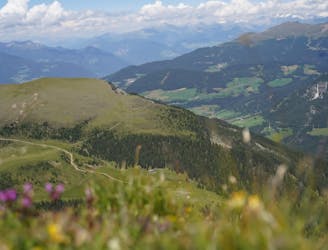
Percorso che attraversa le Alpi di Siusi fino ad arrivare alle pendici del Sassolungo fino a Santa Caterina
Easy Hiking
A three days hike in the hearth of Val Gardena, in the Dolomites
Difficult Hiking
Sellajoch über Plattkofelhütte zum Plattkofel
Moderate Hiking

10 routes · Hiking