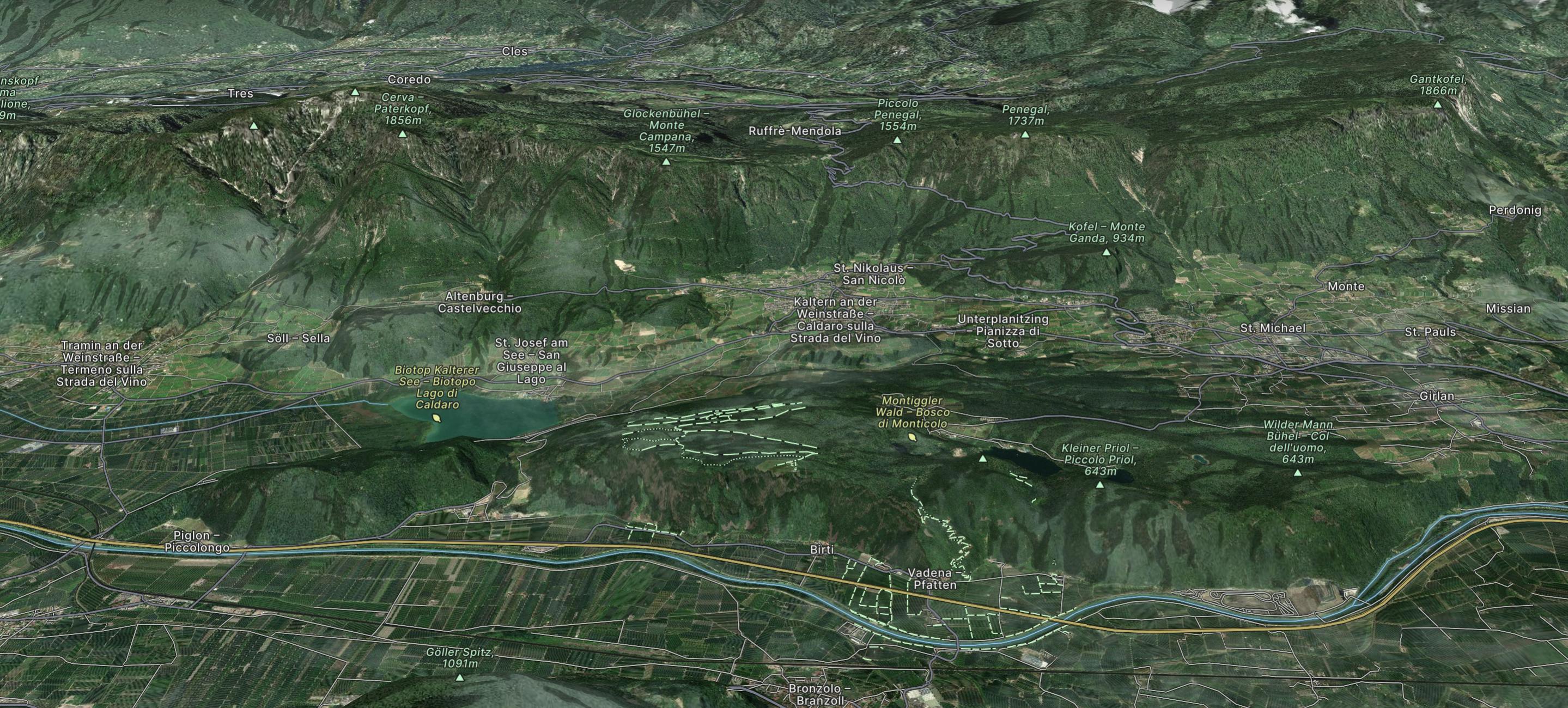
Sass Dlacia to Cortina d’Ampezzo

www.runskitirol.com/trails/sass-dlacia-to-cortina
Moderate Trail Running
- Distance
- 25 km
- Ascent
- 952 m
- Descent
- 1.4 km
Go trail running in Trentino-Alto Adige with curated guides of the best trail runs across the region. With over 502 3D trail maps in FATMAP, you can easily discover and navigate the best trails in Trentino-Alto Adige.
No matter what your next adventure has in store, you can find a guide on FATMAP to help you plan your next epic trip.
Get a top trail running recommendation in Trentino-Alto Adige from one of our 42 guidebooks, or get inspired by the 502 local adventures uploaded by the FATMAP community. Start exploring now!
www.runskitirol.com/trails/sass-dlacia-to-cortina
Moderate Trail Running

Percorso religioso tra la natura che parte di fronte alla chiesetta di Canale d'Agordo e raggiunge il sentiero per Falcade.
Easy Trail Running

https://www.runskitirol.com/trails/obernberger-see
Easy Trail Running

https://www.runskitirol.com/trails/jaufenkamm
Difficult Trail Running

The LimoneXtreme SkyRace is 22 km of true skyrunning with 2,055m vertical climb set in the spectacular lakeside location of Limone with the start and finish on the Lungolago Marconi.
Severe Trail Running

Malga Sorgazza -> Forcella Quarazza -> Cima d'asta
Severe Trail Running

nice and steep skyrun up to the summit 2734m
Extreme Trail Running
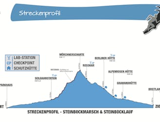
Der traditionelle jährliche Steinbocklauf (und Steinbockmarsch) im Zillertal. Ca. 30 km Strecke und 1871 Aufstieg.
Difficult Trail Running