552 m away
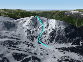
Canal de les Solanelles
Popular off piste with great terrain variety.
Difficult Freeride Skiing
- Distance
- 1.3 km
- Ascent
- 0 m
- Descent
- 416 m
Amazing freeride lines through the forest.
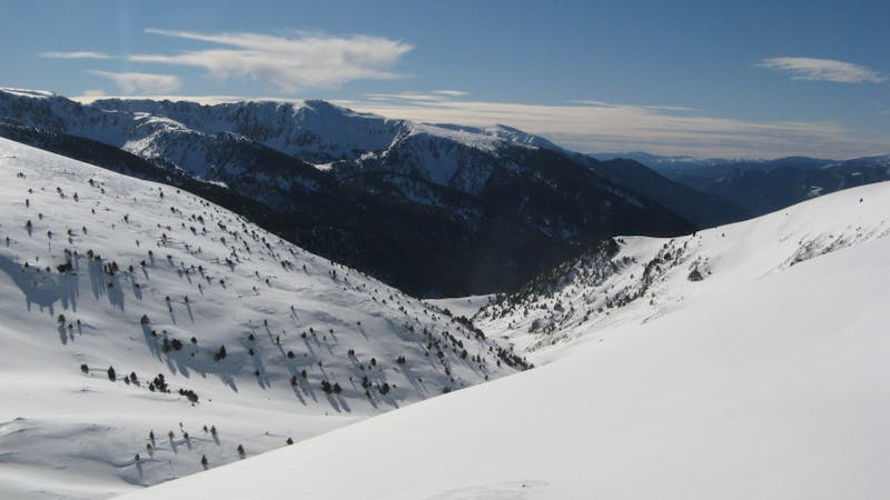
Freeride Skiing Moderate

Just amazing! These are lines that you will remember. At the hard left corner of the Isard piste, which is accessed from the Encampanada draglift, you have to hike up the ridge on your left. It's an approximately 15 minutes walk that will carry you to heaven. There are a few fences that will help you to stay in the right direction at the top of the ridge. Once at the top you can start riding, following the fences and the ridge on your right. The first section is often a hard area hit by the wind but as soon as you start riding into the scattered small pines an opening will show up and a full run will open up below you. Just one word now: Enjoy.
Moderate
Slopes become slightly steeper at around 25-30 degrees.

Exposure is limited to that of the slope itself. Getting hurt is still likely if the slope is steep and/or the snow is hard.
Close to help in case of emergency.
552 m away
Popular off piste with great terrain variety.
Difficult Freeride Skiing
587 m away

An area for experienced freeriders
Severe Freeride Skiing
588 m away

One of the El Tarter's classic off piste lines
Moderate Freeride Skiing
821 m away

A deep, fun creek
Moderate Freeride Skiing
1 km away

Steep off-piste riding through challenging terrain
Moderate Freeride Skiing
1.3 km away

Steep off-piste through the forest
Moderate Freeride Skiing
1.6 km away

Short technical steep line
Difficult Freeride Skiing
1.6 km away

A wide freeride area
Moderate Freeride Skiing
1.6 km away

Popular off piste for intermediate riders
Moderate Freeride Skiing
1.7 km away

Short technical couloir
Difficult Freeride Skiing
22 routes · Freeride Skiing