427 m away
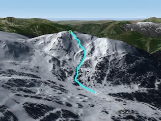
Canal d'Encampanada

One of the El Tarter's classic off piste lines
Moderate Freeride Skiing
- Distance
- 757 m
- Ascent
- 0 m
- Descent
- 319 m
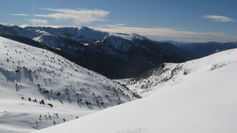
A deep, fun creek
Freeride Skiing Moderate

This is a popular freeride skiing route which is generally considered to be moderate. It's not remote, it features low exposure (e1) and is typically done between December and March. From a low point of 2.1 km to the maximum altitude of 2.3 km, the route covers 693 m, 0 vertical metres of ascent and 152 vertical metres of descent. It's graded 2.2 and Labande grade 1.
A great creek going deep through a very mellow pitch with great terrain variety for epic adventures. The creek can be ridden in good snow conditions and sometimes the last section will provide a little challenge - don't fall in the stream!
Moderate
Slopes become slightly steeper at around 25-30 degrees.

Exposure is limited to that of the slope itself. Getting hurt is still likely if the slope is steep and/or the snow is hard.
Close to help in case of emergency.
427 m away
One of the El Tarter's classic off piste lines
Moderate Freeride Skiing
475 m away

An area for experienced freeriders
Severe Freeride Skiing
488 m away
Popular off piste with great terrain variety.
Difficult Freeride Skiing
821 m away

Amazing freeride lines through the forest.
Moderate Freeride Skiing
827 m away

Short technical steep line
Difficult Freeride Skiing
841 m away

A wide freeride area
Moderate Freeride Skiing
861 m away

Short technical couloir
Difficult Freeride Skiing
967 m away

Steep off-piste riding through challenging terrain
Moderate Freeride Skiing
1.2 km away

Steep, varied terrain
Difficult Freeride Skiing
1.3 km away

Short, technical, steep lines.
Difficult Freeride Skiing
22 routes · Freeride Skiing