82 m away
Pic alt de Cubil north-east

Extreme freeride lines through couloirs and steep slopes
Severe Freeride Skiing
- Distance
- 1.3 km
- Ascent
- 0 m
- Descent
- 520 m
An extreme freeride line for experienced riders
Freeride Skiing Severe

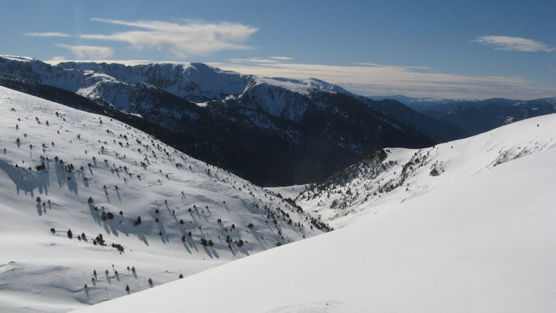
This is one of the most respected areas in the whole resort and is not often ridden. An area which has been hosting a World Freeride Tour stop, Pic de Cubil north-west has plenty of challenges for all those able to pick a line. After an intense 2.5 hour hike up the western ridge from Enradort top station, this mountain makes an impression. The run begins with a wide, fairly steep slope at the very top leading into a wider area followed by a fun rolling area. For hiking up crampons and ice axe is recommended in order to deal with any potential difficulties near the top of the climb up the ridge.
Severe
Steep skiing at 38-45 degrees. This requires very good technique and the risk of falling has serious consequences.

As well as the slope itself, there are some obstacles (such as rock outcrops) which could aggravate injury.
Away from help but easily accessed.
82 m away
Extreme freeride lines through couloirs and steep slopes
Severe Freeride Skiing
861 m away

Steep terrain and couloirs from Pic de Cubil
Severe Freeride Skiing
862 m away

Steep lines on alpine terrain
Severe Freeride Skiing
1.3 km away

An easy access off-piste area
Moderate Freeride Skiing
1.5 km away

Tree runs for advanced riders.
Moderate Freeride Skiing
2 km away

Backcountry route for experienced riders
Difficult Freeride Skiing
2.2 km away

An easy acces off-piste area
Moderate Freeride Skiing
2.4 km away

Fun off-piste through the woods
Easy Freeride Skiing
2.5 km away

A classic long off-piste area with easy terrain
Easy Freeride Skiing
2.9 km away

Short, technical, steep lines.
Difficult Freeride Skiing
22 routes · Freeride Skiing