132 m away
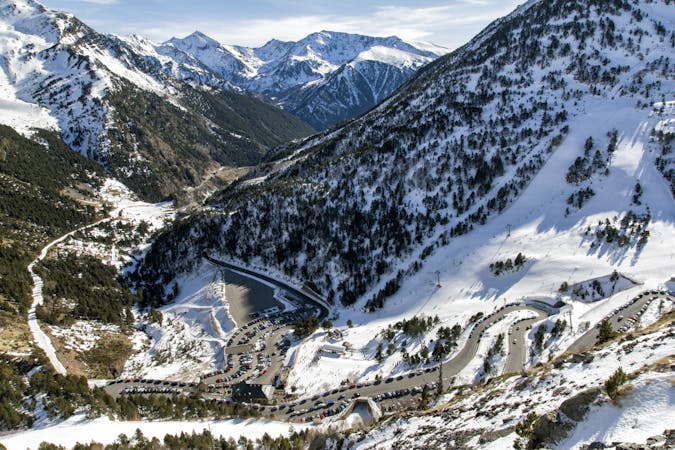
Pic d'Arcalis East line

A complex traverse and a long walk to the last part of the "Pic d'arcalis".
Extreme Freeride Skiing
- Distance
- 888 m
- Ascent
- 13 m
- Descent
- 345 m

Another expedition line with some good gradient, where really good steep skiing skills are required.
Freeride Skiing Extreme

Again a really long access line until the start of the run, with a steep walk required from "Les Portelles" lifts area. Follow "Les Portelle's front chairlift line", the walk is about an hour and requires you to negotiate some steep terrain. Continue straight after the "Pic d'Arcalis steep line" until the finding the gully with an "easy entrance". The line is steep (50 degrees at some stages) until a narrow section into the highest part. The area keeps some steepness after the entrance but the line is less narrow and due to the time of the hike a good weather window is needed. Even more important for the descent of the face; remember that navigation mistake can be fatal. The line gets a good amount of snow fall due to the 2781 meter height of the summit. Avalanche risk is pretty important in this area of the mountain due to the steepness. The line finishes on the green piste "Megaverda" which leads back to "La Coma" ski area after a little flat section at the end of the line.
Extreme
Extreme skiing terrain above 45 degrees. These routes are reserved for experienced experts.
132 m away

A complex traverse and a long walk to the last part of the "Pic d'arcalis".
Extreme Freeride Skiing
252 m away

Expedition line with a really long walk needed and a really high level entrance.
Extreme Freeride Skiing
538 m away

A long hike required for a really committing line into steep and rocky terrain for expert skiers only.
Extreme Freeride Skiing
779 m away

A small short cut line close to the slope without many difficulties, other than navigation
Moderate Freeride Skiing
788 m away

A nice line where a good walk is required with a short section of steep skiing.
Severe Freeride Skiing
797 m away

A line with a long walk needed and with some real steepness in the line itself.
Extreme Freeride Skiing
1 km away

Shortcut line between pistes with moderate steepness as well as easy terrain.
Difficult Freeride Skiing
1 km away

Shortcut line close to the slopes.
Moderate Freeride Skiing
1 km away

A long traverse line close to the slopes, initially on top of a ridge before some steep and rocky skiing.
Extreme Freeride Skiing
1.1 km away

A long line with a small cliff in the middle.
Severe Freeride Skiing

20 routes · Freeride Skiing