373 m away
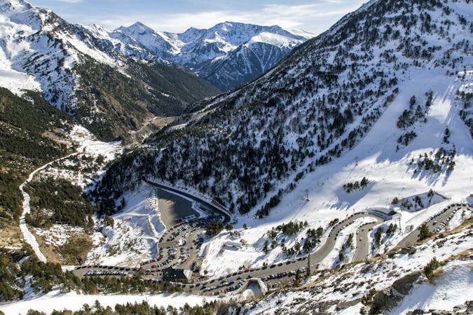
Cabagnou's in between rocks line

A steep line requiring an hour long access hike.
Extreme Freeride Skiing
- Distance
- 737 m
- Ascent
- 22 m
- Descent
- 301 m

A long approach to a steep line in 2 different sections.
Freeride Skiing Severe

1 hour is needed from the top of "Creussans" chairlift. Firstly climb the Pic de Cabagnou via the ridge and then ski down until the flat part. The line is steep but not extreme with a maximum gradient of 45 degrees. The first part of the line is short and finishes into a flat area before a second 45 degree section. However rocks are present in the bottom of the line and good route choice is really important to avoid falls. The line gets a lot of sun so make sure there's enough snow before heading in into the lower section in the spring. Remember that the E facing sections of the line can be wet and heavy or frozen. Avalanche risk is pretty important in both steep parts around here. The line finishes on the red piste "L'Estany" which leads back to "La Coma" ski area.
Severe
Steep skiing at 38-45 degrees. This requires very good technique and the risk of falling has serious consequences.
373 m away

A steep line requiring an hour long access hike.
Extreme Freeride Skiing
726 m away

A long line close to the slopes with a mix of steep and flat areas.
Extreme Freeride Skiing
728 m away

A long line where some walking is needed and with some real steepness in the line.
Extreme Freeride Skiing
745 m away

Really step entrance line into a narrow gully reserved only for expert skiers.
Extreme Freeride Skiing
915 m away

A steep skiing line which requires a long access hike.
Extreme Freeride Skiing
1 km away

A long traverse line with a really steep entrance onto a ridge side.
Extreme Freeride Skiing
1.1 km away

A easy and gentle line close to the slope passing alongside a river.
Moderate Freeride Skiing
1.4 km away

Shortcut line between pistes with moderate steepness as well as easy terrain.
Difficult Freeride Skiing
1.5 km away

A long line with a small cliff in the middle.
Severe Freeride Skiing
1.5 km away

Easy line close to the slopes, with a steep entrance being the only slightly tricky bit.
Difficult Freeride Skiing

20 routes · Freeride Skiing