534 m away
La Coma junction line

Shortcut line between pistes with moderate steepness as well as easy terrain.
Difficult Freeride Skiing
- Distance
- 597 m
- Ascent
- 1 m
- Descent
- 128 m
A steep skiing line which requires a long access hike.
Freeride Skiing Extreme
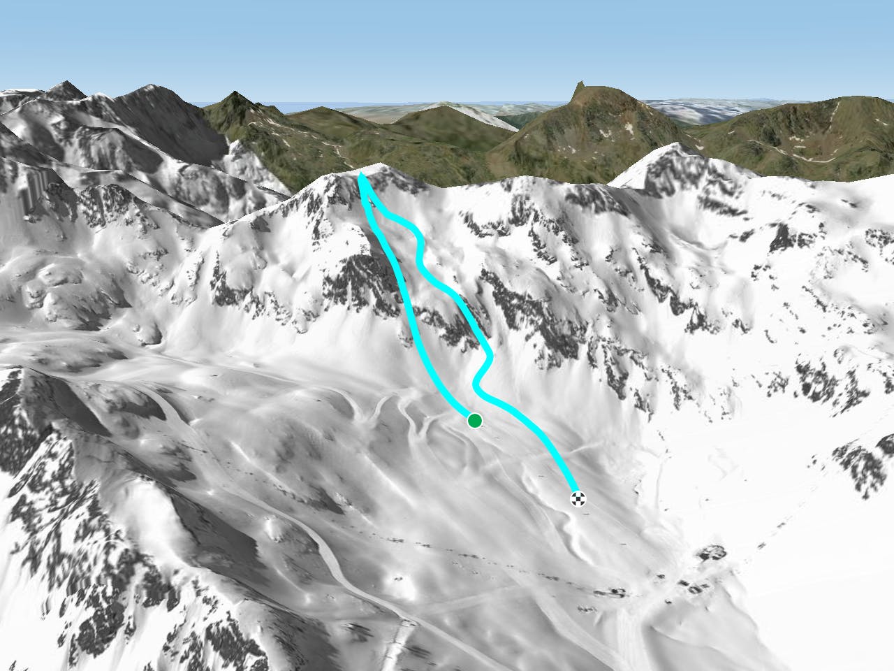
This is an easy navigation line; walk until the top of the summit in front of the "Els Orris" lift. The walk is really long (about 1 - 1.5 hours), but skins can save some time. The hike is steep and a little gully marks the way to the top. The line is pretty steep in the top and middle part where some 50 degree sections can be found. In addition the entrance is pretty technical and good skills are required, and due to the long walk a good weather window is needed. Below the couple of steep parts the line can feel like a piste. The line faces East so expect a variety of snow conditions. Avalanche risk is pretty important around here in both steep parts but the flat area is much safer. The line finishes on the green piste "Els Orris" which leads back to "La Coma" area and the bottom of Arcalis ski resort.
Extreme
Extreme skiing terrain above 45 degrees. These routes are reserved for experienced experts.

As well as the slope itself, there are some obstacles (such as rock outcrops) which could aggravate injury.

Little chance of being seen or helped in case of an accident.
534 m away
Shortcut line between pistes with moderate steepness as well as easy terrain.
Difficult Freeride Skiing
554 m away

A easy and gentle line close to the slope passing alongside a river.
Moderate Freeride Skiing
563 m away

A long line with a small cliff in the middle.
Severe Freeride Skiing
570 m away

Easy line close to the slopes, with a steep entrance being the only slightly tricky bit.
Difficult Freeride Skiing
639 m away

A steep line requiring an hour long access hike.
Extreme Freeride Skiing
735 m away

A long traverse line close to the slopes, initially on top of a ridge before some steep and rocky skiing.
Extreme Freeride Skiing
744 m away

Shortcut line close to the slopes.
Moderate Freeride Skiing
758 m away

Small line into an arete with some steepness into a gully.
Extreme Freeride Skiing
811 m away

Long traverse line where a small and steep line can be found into a small gully.
Severe Freeride Skiing
889 m away

A short line which feels like a piste but is slightly steep at the end.
Severe Freeride Skiing

20 routes · Freeride Skiing