524 m away
L'Estany's traverse line

A long traverse line with a really steep entrance onto a ridge side.
Extreme Freeride Skiing
- Distance
- 1.8 km
- Ascent
- 42 m
- Descent
- 479 m
A easy and gentle line close to the slope passing alongside a river.
Freeride Skiing Moderate
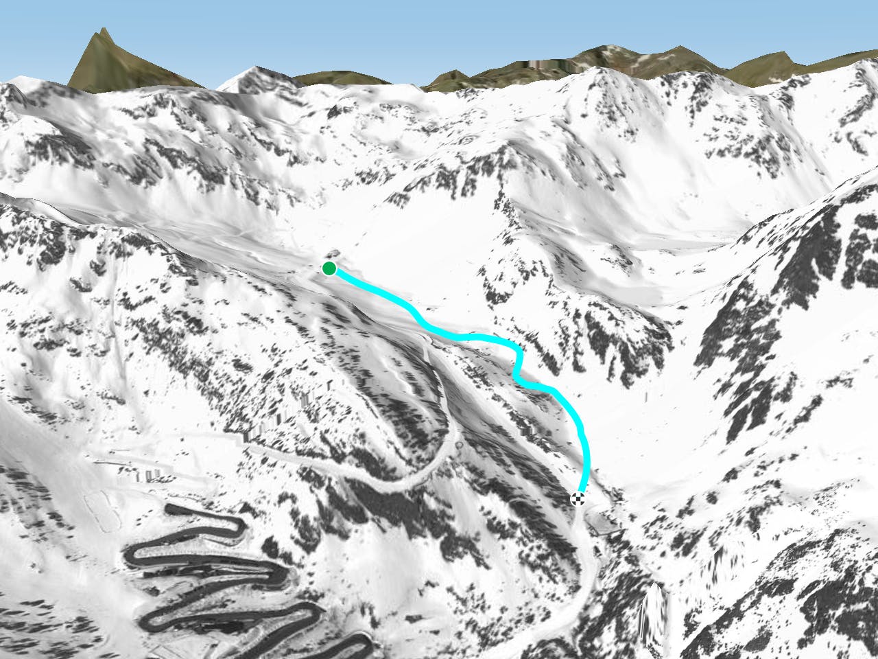
This is an easy access line; just continue straight after "Creussans" chairlift. The line is not steep and can feel like a piste but there are some rocks about if there is low snow cover. The line gets a lot of sun so make sure there's enough snow before heading in as there can be a lack of snow. Avalanche risk is pretty low around here other than the left ridge in the middle of the line where avalanches could possibly happen. The main hazard to be aware of on this line is the river in the middle. The line finishes on the red piste "La Canaleta" which leads back to the bottom of Arcalis ski area.
Moderate
Slopes become slightly steeper at around 25-30 degrees.

As well as the slope itself, there are some obstacles (such as rock outcrops) which could aggravate injury.

Close to help in case of emergency.
524 m away
A long traverse line with a really steep entrance onto a ridge side.
Extreme Freeride Skiing
554 m away

A steep skiing line which requires a long access hike.
Extreme Freeride Skiing
599 m away

Short line with some steepness into the lowest section which is often in the sun.
Severe Freeride Skiing
600 m away

A short line which feels like a piste but is slightly steep at the end.
Severe Freeride Skiing
691 m away

Long traverse line where a small and steep line can be found into a small gully.
Severe Freeride Skiing
699 m away

Easy line close to the slopes, with a steep entrance being the only slightly tricky bit.
Difficult Freeride Skiing
762 m away

Small line into an arete with some steepness into a gully.
Extreme Freeride Skiing
794 m away

A long line with a small cliff in the middle.
Severe Freeride Skiing
872 m away

Shortcut line between pistes with moderate steepness as well as easy terrain.
Difficult Freeride Skiing
890 m away

Short cut line between slopes, close the trees with some steepness.
Severe Freeride Skiing

20 routes · Freeride Skiing