4 km away
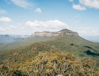
Lindeman Pass, Blue Mountains

Exposed, hard to follow, not for the faint-hearted, but for those who tackle Lindeman Pass, the adventure is worth it.
Severe Hiking
- Distance
- 9.2 km
- Ascent
- 1.4 km
- Descent
- 1.4 km
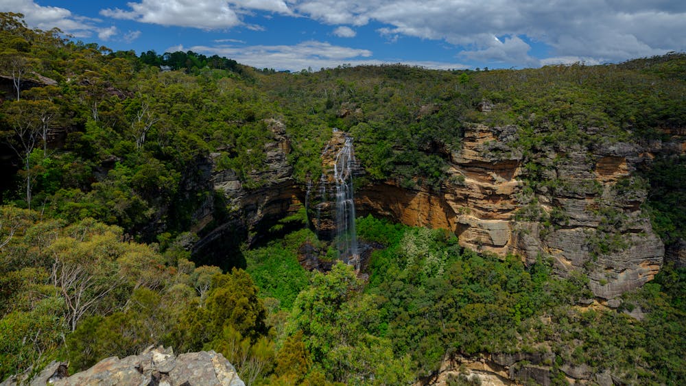
Moderately challenging, this 6.2km loop showcases the best of the Blue Mountains scenery, not to mention waterfalls... lots of waterfalls.
Hiking Moderate

An iconic hike in the Blue Mountains, this Valley of the Waters to Wentworth Falls via National Pass is one of the iconic trails in the national park. Invariably, that means you are highly likely to encounter other hikers along the route. However, with lookouts and rest points aplenty, you should always be able to find some quiet stretches to enjoy the incredible scenery.
Setting out from the picnic area on Fletcher Street, follow the Valley of the Waters trail down towards Isobel Creek. From here, you can get your fill of waterfalls, with detours and stops aplenty. Shortly after Edith Falls the trail forks, and from here you'll take the National Pass Track.
One of the great tracks in the Blue Mountains, the National Pass Track offers unrivalled views of the Blue Mountains as it snakes along the base of the cliff. Climbing up towards Wentworth Falls, there are plenty of lookouts and waterfall viewing points to take in, before following the impressive Undercliff and Overcliff Tracks back to Fletcher Street.
Trails in the Blue Mountains have been heavily affected by recent heavy rainfall and bush fires. Always check the NPNSW website before setting out on a hike like this.
Moderate
Hiking along trails with some uneven terrain and small hills. Small rocks and roots may be present.

Away from help but easily accessed.
4 km away
Exposed, hard to follow, not for the faint-hearted, but for those who tackle Lindeman Pass, the adventure is worth it.
Severe Hiking
5.6 km away
A challenging, multi-day hike boasting spectacular views, bush camping and a variety of native forests.
Extreme Hiking