1.2 km away
Salzburg's Cultureweg
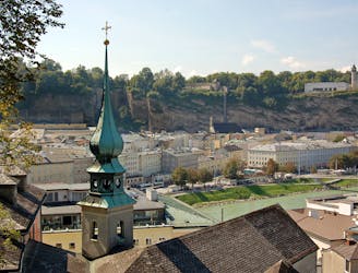
A trail run oozing with culture & history: the ultimate tour of Salzburg
Easy Trail Running
- Distance
- 12 km
- Ascent
- 511 m
- Descent
- 511 m
Short route for some quick action during the lunch break
Trail Running Easy

This is a popular trail running route which is generally considered to be easy. It's not remote, it features low exposure and is typically done all year round. From a low point of 415 m to the maximum altitude of 423 m, the route covers 7.8 km, 34 vertical metres of ascent and 34 vertical metres of descent.
Most of the time directly next to the river Salzach which makes it a very scenic route. No elevation gain though!
Easy

The path is on completely flat land and potential injury is limited to falling over.
Close to help in case of emergency.
1.2 km away
A trail run oozing with culture & history: the ultimate tour of Salzburg
Easy Trail Running
5.6 km away
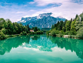
A trail that will make you feel like singing "the hills are alive!" as you reach the peak
Moderate Trail Running