15 m away
Birgitzköpfl Main

A nice open run which can hold good powder but needs a thick covering of snow.
Moderate Freeride Skiing
- Distance
- 1.1 km
- Ascent
- 0 m
- Descent
- 455 m
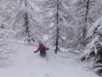
Fantastic tree skiing.
Freeride Skiing Moderate

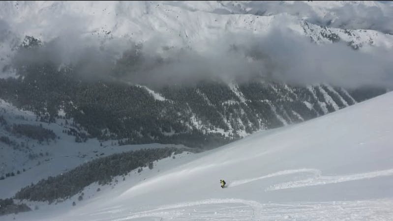
From the top of the Birgitzköpfl chairlift, make a long 100 - 200 metres traverse (depending on the exact line you want to ski) skier's left to some wide, shrub-filled shoulders separated by some narrow gullies. Pick a line down these, staying skier's right of a very deep gully to your left, heading for a patch of small trees above the beginners ski slope. Upon reaching the trees, enjoy realising how much better they look to ski through than they did from a distance, and blast down them! At the bottom of them, join the beginners slope and ski back to the chairlift.
Moderate
Slopes become slightly steeper at around 25-30 degrees.

Exposure is limited to that of the slope itself. Getting hurt is still likely if the slope is steep and/or the snow is hard.

Away from help but easily accessed.
15 m away
A nice open run which can hold good powder but needs a thick covering of snow.
Moderate Freeride Skiing
26 m away

An excellent little off piste detour which generally holds good snow long after the last storm.
Moderate Freeride Skiing
27 m away

A short off piste line which provides some nice skiing but is mainly used as a way to access the Götzens ski area.
Easy Freeride Skiing
39 m away

Brilliant tree skiing.
Moderate Freeride Skiing
2 km away
A small and very worthwhile detour which often has good snow long after the last storm.
Difficult Freeride Skiing
2.8 km away

A nice little 150 metre high face with some good freeride terrain.
Moderate Freeride Skiing
2.9 km away

A run with a bit of everything, from open faces to tight trees.
Moderate Freeride Skiing
2.9 km away

Easily accessed freeride terrain which holds good snow for days after a storm
Difficult Freeride Skiing
2.9 km away
Formerly a piste, this is now a classic off piste run down to the village of Axams.
Moderate Freeride Skiing
2.9 km away

A great little run down a north-east face which is usually either powder snow or moguls.
Difficult Freeride Skiing
10 routes · Freeride Skiing