2 m away
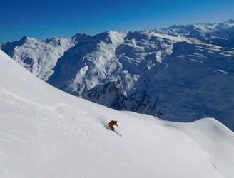
2000er #2 (Variation)

Easily accessible route with a lot variations, all visible from the 2000er lift.
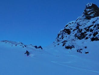
Difficult Freeride Skiing
- Distance
- 1.3 km
- Ascent
- 2 m
- Descent
- 310 m
Steep and difficult route in a wide couloir of the Pfaffenbühel, good snow conditions required.
Freeride Skiing Severe

This route is extreme and requires a very high level of steep skiing technique, but also good snow conditions and a safe avalanche situation. You access the route with the 8er Jet gondola and the 2000er chairlift. At the exit of the chairlift, you have to ski in direction of the mountain in front of you. Traverse skiers right, immediately at the avalanche barriers, from here you can see the north face you need to cross, until you reach the ridge you see from the lift top station. Here there are normally are tracks but if not, try to do one more run here in the area of the 2000er, because breaking trail through the fresh powder is really exhausting and time-consuming. You need to traverse for 400m and always try to stay as high as possible. It may take 10 to 15 minutes, because there are some passages you need to keep your speed and some flat parts, but it's really worth the effort. Space out while crossing, because avalanche danger could be high in this area. After you've reached the ridge, first of all take a minute and enjoy the breathtaking panorama. From here you need to follow the ridge for about 400 meters again until you reach a flattening of the ridge and the gradient increases beyond. From here you need to ski down the hill and stay on the left, as far as possible. After 350m you should reach a vertical ridge again, where you can look into the big couloir. At the top there are still some cliffs, but on a crest you can easily go left beneath the cliffs and drop into the couloir. The first part is getting really steep and you need to space out. After you've reached the couloir it is possible to regroup at the counter hill, to be aware of an avalanche triggers from a second or third skier. Now here you can ski straight down the hill for 400 more meters until you reach the piste leading back to the 8er Jet.
This route requires good snow and weather conditions and also a high level of skiing ability. The route is good in the months from January to March, but in springtime it is possible that the snow gets too heavy and sticky, so also the avalanche danger is too high.
Severe
Steep skiing at 38-45 degrees. This requires very good technique and the risk of falling has serious consequences.

As well as the slope itself, there are some obstacles (such as rock outcrops) which could aggravate injury.

In the high mountains or remote conditions, all individuals must be completely autonomous in every situation.
2 m away
Easily accessible route with a lot variations, all visible from the 2000er lift.
Difficult Freeride Skiing
2 m away

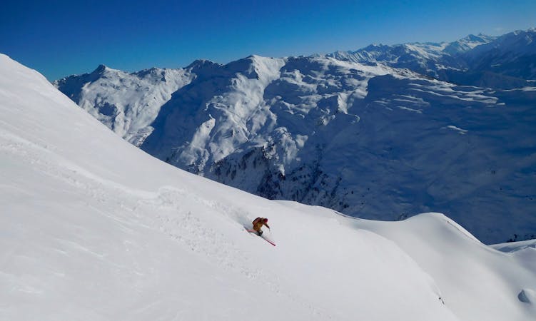
Long joyful descent in a winder wonderland
Difficult Freeride Skiing
2 m away
Long joyful route in a big area without any lifts and a kind of Alaska feeling.
Difficult Freeride Skiing
2 m away

Beautiful easy route with a long descent and a breathtaking panorama
Difficult Freeride Skiing
2 m away

Amazing route near the Metzen east face, hike required.
Difficult Freeride Skiing
2 m away

Easy accessible steep route. If you hike it is possible to enjoy a longer run.
Severe Freeride Skiing
2 m away

Beautiful route with a long descent and a breathtaking panorama
Difficult Freeride Skiing
2 m away

Easily accessible route with a lot variations, all visible from the 2000er lift.
Difficult Freeride Skiing
2 m away

Breathtaking route with a hike and 700 metres of descent.
Difficult Freeride Skiing
2 m away
The Big Mountain Contest face and THE extreme line in Hochfügen
Extreme Freeride Skiing
6 routes · Freeride Skiing

50 routes · Freeride Skiing · Ski Touring

10 routes · Freeride Skiing

10 routes · Freeride Skiing