2.6 km away
9
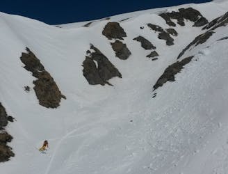
A hard ski route with a nice angle for skiing.
Difficult Freeride Skiing
- Distance
- 1.1 km
- Ascent
- 0 m
- Descent
- 264 m
Decent from Ischgl to Kappl
Also in Graubünden, Switzerland
Freeride Skiing Difficult
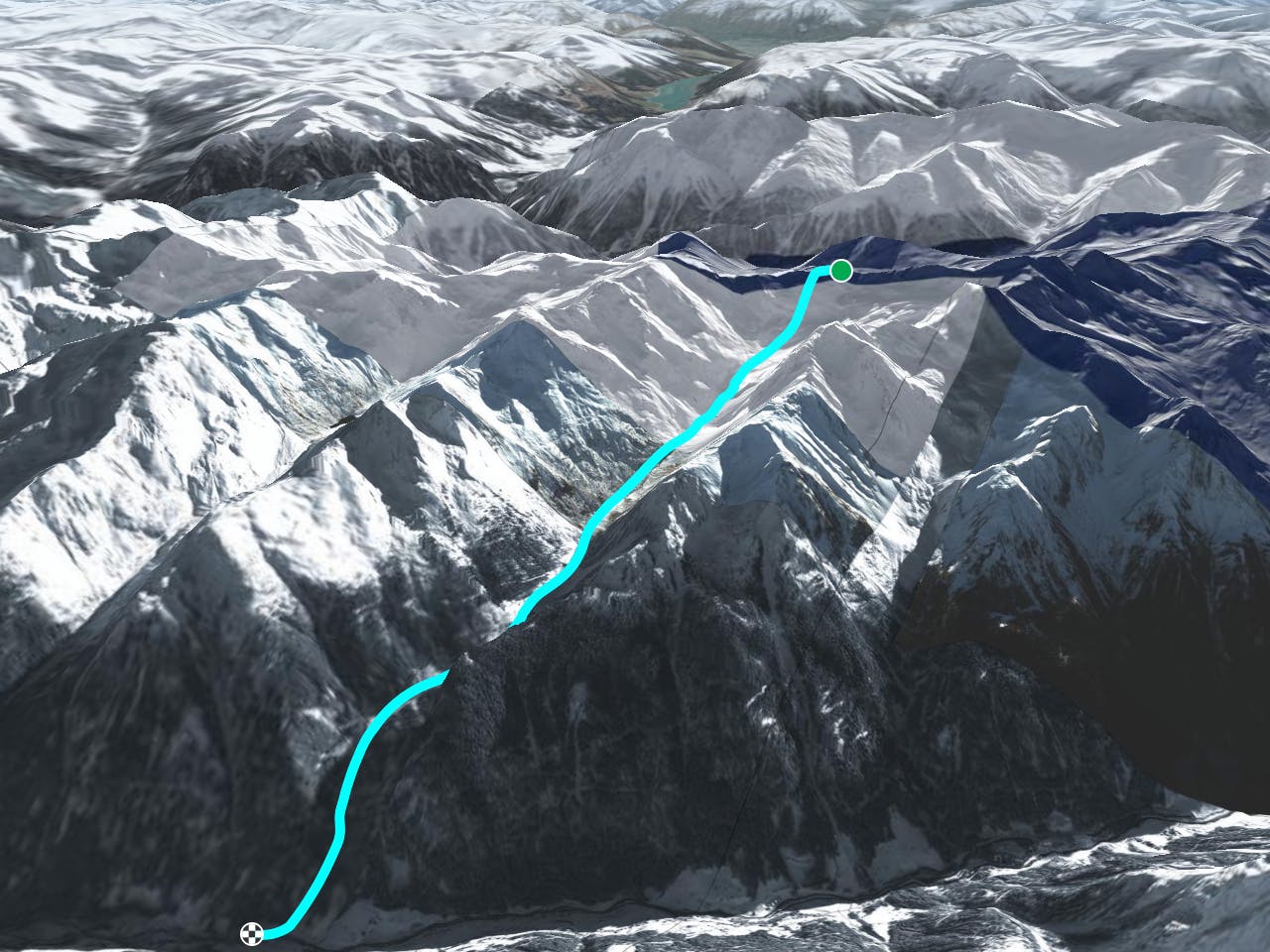
This is a popular freeride skiing route which is generally considered to be difficult. It's remote, it features medium exposure (e2) and is typically done between February and April. From a low point of 1.2 km to the maximum altitude of 2.7 km, the route covers 8.2 km, 141 vertical metres of ascent and 1599 vertical metres of descent.
30 min hike up to peak; put skies on and have fun
Difficult
Serious gradient of 30-38 degrees where a real risk of slipping exists.

As well as the slope itself, there are some obstacles (such as rock outcrops) which could aggravate injury.
Away from help but easily accessed.
2.6 km away
A hard ski route with a nice angle for skiing.
Difficult Freeride Skiing
3.5 km away
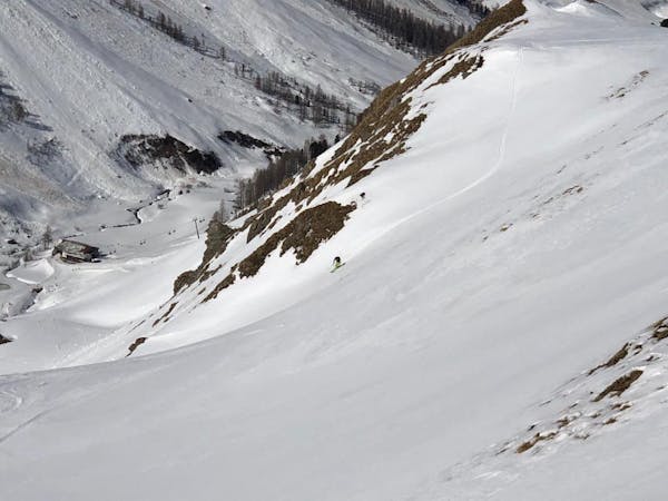
Popular freeride run in the resort.
Difficult Freeride Skiing
3.6 km away
A short ski route from Pardatschgratbahn, Pardoramabahn or Gratbahn towards Idalp.
Moderate Freeride Skiing
4.3 km away
A straightforward short run into the Obese Velillalp.
Moderate Freeride Skiing
5.4 km away
This is a popular freeride run after a big dump because it is easy accessible.
Difficult Freeride Skiing
5.5 km away
This is a popular free ride run, like the 26 run, in the resort after a big dump because it is easy accessible.
Difficult Freeride Skiing
6.6 km away
A brilliant couloir which is best skied in spring snow.
Severe Freeride Skiing
7.2 km away
This is a popular freeride run for beginners. Its easily accessible and does not require a hike or bootpack.
Moderate Freeride Skiing

50 routes · Freeride Skiing · Ski Touring
8 routes · Freeride Skiing

10 routes · Freeride Skiing