4.9 km away
Alpenrose Ride
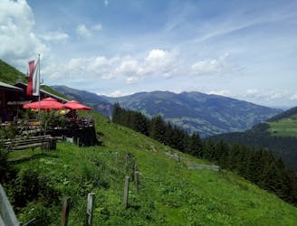
A scenic cruise to a family-friendly hut.
Easy Mountain Biking
- Distance
- 18 km
- Ascent
- 876 m
- Descent
- 876 m
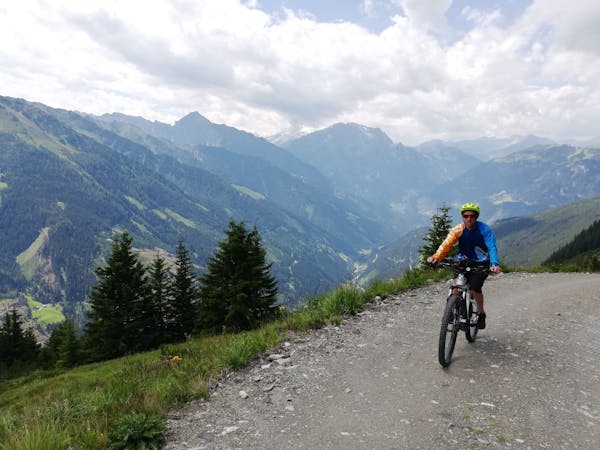
Breathtaking, varied scenery makes this one of the best valley rides in Austria.
Mountain Biking Easy

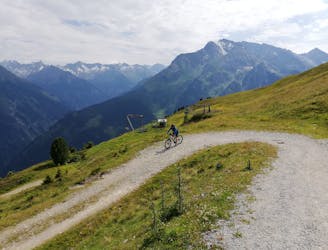
An easy ride technically, this is an ideal place for beginners to enjoy some views and wild mountain ambience without having to deal with any challenging trails. 90% of the route is on a road, and only the upper section - starting at Grüne Wald Hut - is on a trail.
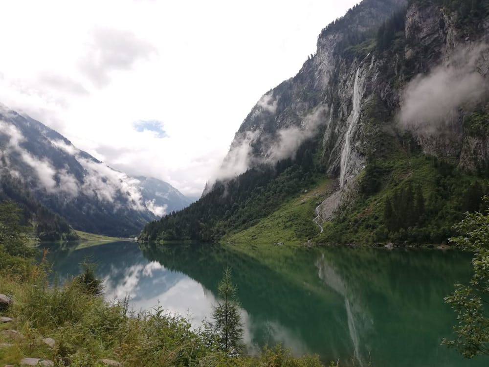
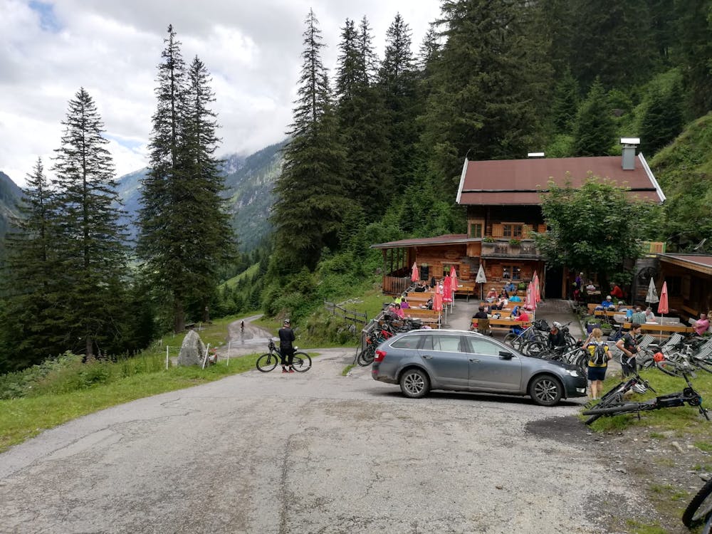
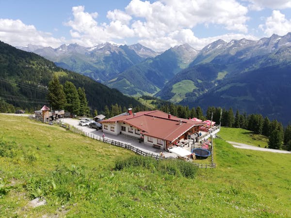
The trip begins at the Gasthaus Wasserfall, accessed from Mayrhofen by either shuttle bus (ask in the tourist information office for more information), car (via an €8 toll) or - if you're really keen - pedal power. The road bike up to the Gasthaus is described in FATMAP so check it out and see how keen you're feeling!
Regardless of how you get there, the view and atmosphere at the Gasthaus are extraordinary - huge rock slabs and countless waterfalls give it an ambience similar to that of the Norwegian fjords. Take half an hour to sit and soak in the view and ambience.
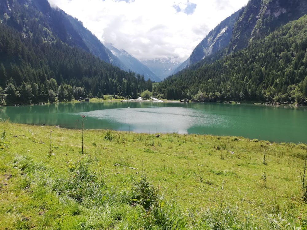
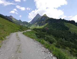
Suitably adjusted to the mountain environment, start riding up alongside the blue and beautiful Stausee Stillup lake. The road takes you through a couple of short tunnels both otherwise it's just great, easy riding in a fabulous location. You'll pass a few huts and farms en route before eventually climbing up to the welcoming Grüne Wald Hut, where the tarmac ends. It would be perfectly possible to do the ride up to here on a road bike but doing so would mean that you miss out on the upper section of the valley, which is well worth a visit.
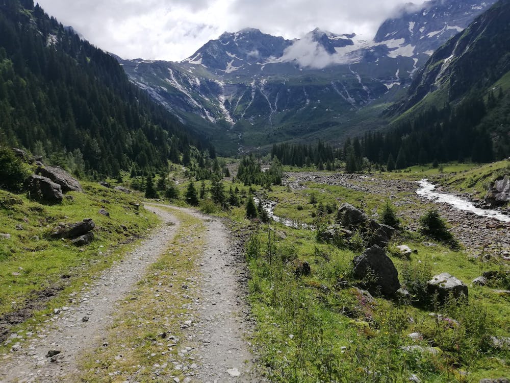
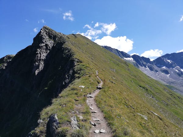
Carry on past the Grüne Wald Hut and ride onto a muddy jeep track. Follow this is as it traverses and then climbs up into the upper valley, which feels incredibly wild and desolate with an atmosphere more reminiscent of British Columbia than Tirol. You cross a few small streams on the way up the valley and the track is quite rocky but never hard to ride. Keep following the track until it doubles back on itself and becomes a hiking trail. Park the bike up and spend some time savouring your surroundings before turning around and blasting back to civilisation.
Easy
Mostly smooth and non-technical singletrack with unavoidable obstacles 2in/5cm tall or less. Avoidable obstacles may be present. Ideal for beginner riders.

The path is on completely flat land and potential injury is limited to falling over.

Away from help but easily accessed.
4.9 km away
A scenic cruise to a family-friendly hut.
Easy Mountain Biking
5.6 km away
Peaceful forest tracks lead to a gorgeous Tirolian mountain hut.
Moderate Mountain Biking
7 km away
A tough climb out of a beautiful valley leads to a ripping descent.
Moderate Mountain Biking
7 routes · Mountain Biking
8 routes · Mountain Biking · Hiking · Road Biking

24 routes · Mountain Biking
8 routes · Mountain Biking · Hiking · Road Biking