2.1 km away
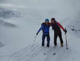
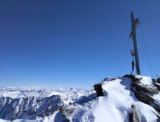
Kraspessspitze
A roundtrip from a great ski area to a great mountain hut!
Difficult Ski Touring
- Distance
- 12 km
- Ascent
- 982 m
- Descent
- 1.7 km
A fun little mini adventure which feels remote despite its proximity to civilisation.
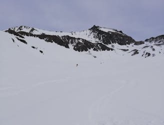
Ski Touring Severe

This is a great way to ski from the summit of a prominent peak in the heart of the Sellrain valley. The couloir itself can actually be seen on the drive up to the Kühtai so take some time to spot it on your way to the ski area.
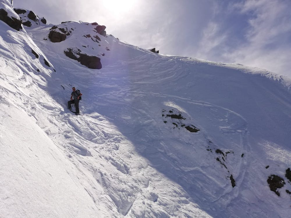
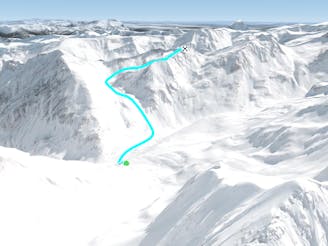
Start by riding the Dreiseenbahn chairlift and then skiing very briefly down the Dreiseen piste. Branch left off this and go directly east into the valley leading up to the imposing looking Gaiskogelscharte col. Put skins on and skin straight up to the col. The final section of the ascent to the col is quite steep and will involve either some tricky kick turns or 10 minutes or so of bootpacking.
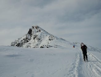
From the col turn left and bootpack/scramble up the fun and easy south ridge of the Gaiskogel. The ridge is exposed in places and involves some scrambling but it's never difficult and you'll be able to enjoy the ambience of moving up and through some beautiful mountains.
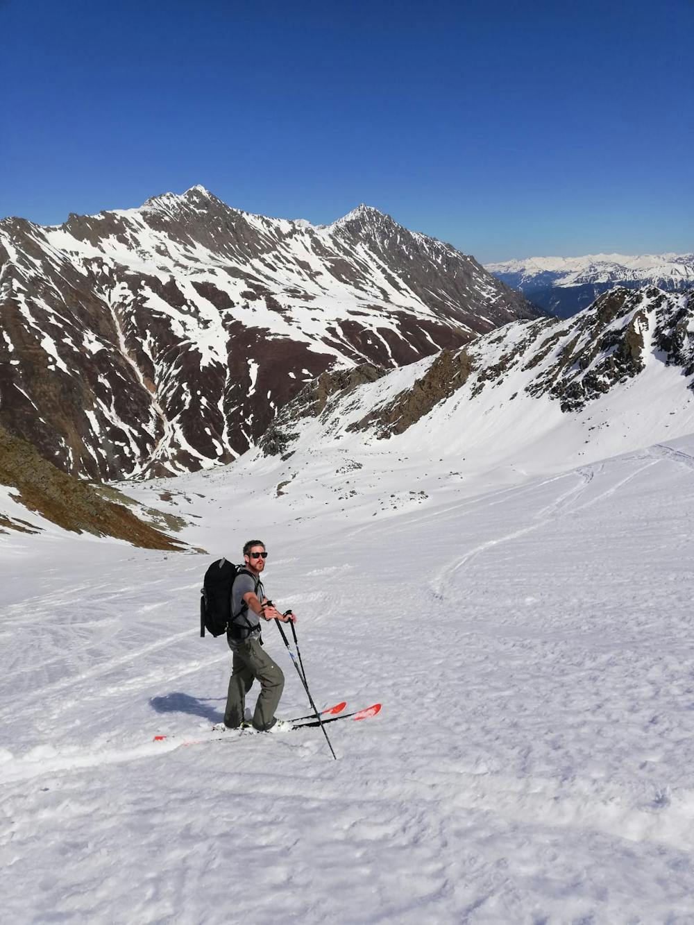
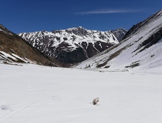
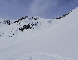
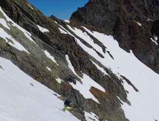
Once on top, take a moment to look down at Kühtai ski area and then drop due north into the very narrow couloir that leaves directly from the summit. The couloir is initially only a couple of metres wide but it quickly widens and then, after about 100 vertical metres it disperses into a large slope below. Ski the slope and follow it as it naturally takes you rightwards into a wide, mellow valley. Ski the valley wherever the snow looks best and then, as it begins to roll over into steeper terrain, push out right into trees and down a fun little gully.
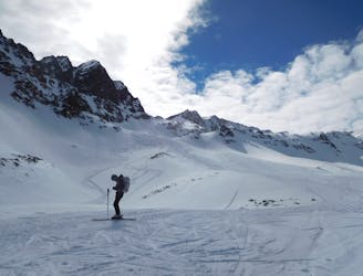
At the foot of the gully you reach a river. Turn right and follow the river to a bridge, which in turn leads you back onto the road from Kühtai. Walk down to the bus stop in Haggen village and catch the bus either back to Kühtai or down to Innsbruck.
Severe
Steep skiing at 38-45 degrees. This requires very good technique and the risk of falling has serious consequences.

As well as the slope itself, there are some obstacles (such as rock outcrops) which could aggravate injury.

Little chance of being seen or helped in case of an accident.
2.1 km away
A roundtrip from a great ski area to a great mountain hut!
Difficult Ski Touring
2.1 km away
Lift access helps to make this a short tour with big rewards
Difficult Ski Touring
2.4 km away
A wild peak in a stunning position.
Moderate Ski Touring
2.4 km away
A wild and remote peak with spectacular views across some rarely visited valleys.
Moderate Ski Touring
3.2 km away
A classic little 2 hour ski tour
Difficult Ski Touring
3.4 km away
A mellow tour up a peaceful valley and then into a huge, open bowl.
Moderate Ski Touring
6.1 km away
Einer der schönsten Anstiege im Sellrain traumhafter Rundumblick und herrliche Firnhänge belohnen den steilen Anstieg durch das wundervolle Kar.
Moderate Ski Touring
6.1 km away

Lange Skihochtour in das Herz der Stubaier Alpen.
Severe Ski Touring
6.1 km away
Nordseitige Pulverabfahrten mit einem einsamen kreuzlosen Gipfel
Easy Ski Touring
9.4 km away
A very popular ski tour to the summit of a relatively easy 3000er.
Moderate Ski Touring
5 routes · Ski Touring

4 routes · Ski Touring

50 routes · Freeride Skiing · Ski Touring

25 routes · Ski Touring