12 m away
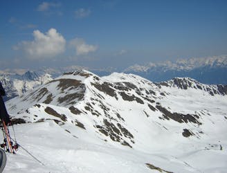
Zuckerhütl
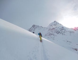
A wonderful, varied and scenic tour to the highest peak in the Stubai range.
Difficult Ski Touring
- Distance
- 8.2 km
- Ascent
- 920 m
- Descent
- 920 m
Some gnar along the way to the classical Stubaier tours
Ski Touring Severe

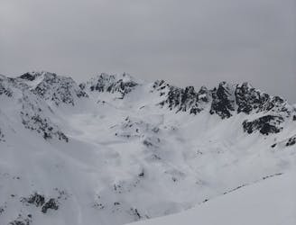
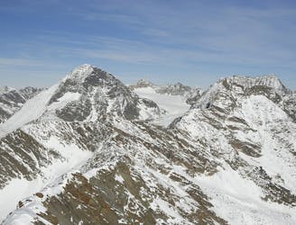
If you have ever done the Zuckerhütl or Wilder Pfaff and you have an eye for the extreme, you have definitely seen this line. Maybe even considered it and that's why you came to look here. Well, it's possible!


Start your tour the same way as you would going to the Zuckerhütl, but after entering the Sulzenauferner you keep right, going to the Pfaffenkogel summit. Close to the summit there is little notch (on the left of the summit as you go up). It's pretty obvious.
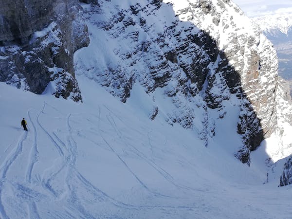
If there is little snow, you can make a 15-20m rappel into the line. Bring some tat to make an anchor. In these conditions, the line is quite gnarly. Like, really narrow. And steep. Almost the whole way is around 45°, maybe a bit steeper. The only turn you will make is a jump turn. It's more like survival skiing than anything else. If that's what you want to practice, go for it. Bring an axe if you expect anything else than powder.
With more snow cover, the line can be a lot more forgiving, with more room to turn. Maybe even nice!
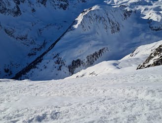
Severe
Steep skiing at 38-45 degrees. This requires very good technique and the risk of falling has serious consequences.

As well as the slope itself, there are some obstacles (such as rock outcrops) which could aggravate injury.
Away from help but easily accessed.
12 m away
A wonderful, varied and scenic tour to the highest peak in the Stubai range.
Difficult Ski Touring
3.1 km away
A long tour through the northern Stubai Alps.
Extreme Ski Touring
3.8 km away
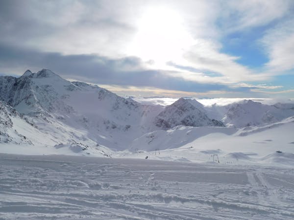
This is a mainly downhill day to get the ski legs in, with the option of a ski summit by going up a side valley.
Moderate Ski Touring
5.1 km away
Get top to the top of this iconic peak in the Stubaier Alps!
Difficult Ski Touring
8.7 km away

Skitour über den Schwarzenbergerferner und Gratkletterei auf einen Gipfel mit einer Rundumsicht, die ihresgleichen sucht!
Difficult Ski Touring
8.7 km away

Über Eis und Steilrinnen auf einen Panoramagipfel der Stubaier Alpen
Difficult Ski Touring
8.7 km away

Eine einfache, unvergletscherte Skitour im Schatten steiler Felswände.
Moderate Ski Touring
8.7 km away

Einsame sonnseitige Frühjahrsabfahrt.
Moderate Ski Touring
8.7 km away
A day tour up the classic Kuhscheibenspitze, 3189m
Difficult Ski Touring
8.7 km away
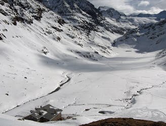
A long glacial skin to a short roped climb leading to one of two cols, before a long descent to the Franz Senn Hut.
Difficult Ski Touring
5 routes · Ski Touring

17 routes · Ski Touring

25 routes · Ski Touring
6 routes · Ski Touring