8.5 km away
Stempeljoch
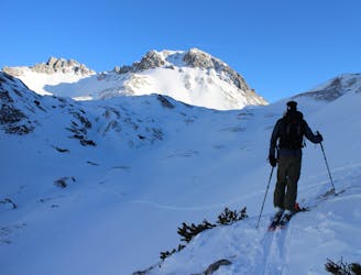
A truly wild tour through a series of stunning valleys.
Difficult Ski Touring
- Distance
- 14 km
- Ascent
- 977 m
- Descent
- 2.5 km
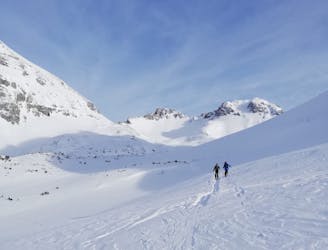
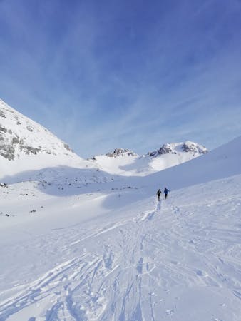
Crossing the Karwendel via its highest peak, this is an epic ski touring adventure by any standards.
Ski Touring Severe
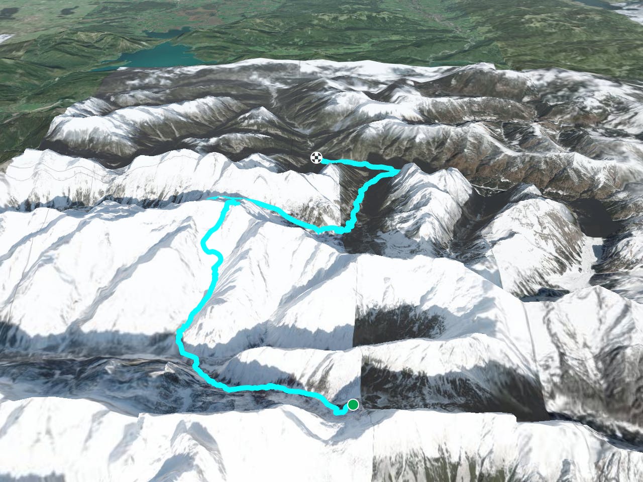
With so much ground to cover today, and much of it being south facing and potentially avalanche prone, it's important to get an early start. Ideally you'll ski away from the hut by head torch and arrive at the foot of the long climb up to Birkkarspitze at first light.
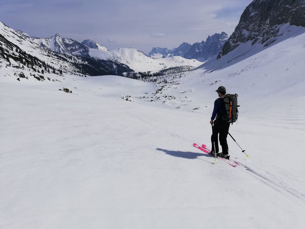
Ski west out of the valley that houses the Hallerangerhaus on a jeep track that quickly becomes a smaller path through the trees. Although the track will be snow covered it's still relatively clear where it goes because of the occasional signpost and the clearing through the trees that the path follows. Most of the skiing on the track is easy but there is a point close to the bottom of the valley where you need to make an extremely exposed traverse across the top of some 50 metre cliffs above a riverbed. The snow is often icy here, and a fall would be fatal so no matter that you might still be half asleep, you need to concentrate and make sure you traverse in control.
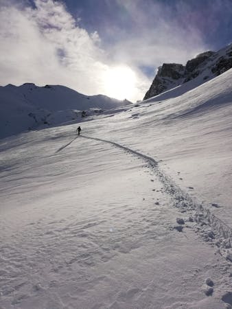
Once in the valley floor ski out west towards the village of Scharnitz on a jeep track and then quickly branch off this to the foot of the valley leading to the Birkkarspitze. The initial climb into the valley is through thick trees and depending on conditions it can be easier to climb to the treeline mainly on foot, only skinning through the more open sections of trees.
From the treeline make a long traverse due north, next to a river. This section is mainly quite low angled but sections of it are exposed above cliffs hanging above the river, so put ski crampons on and be very careful. Eventually the traverse leads to mellow terrain beneath a wall of slab rock with a ramp on the right hand side of it.
Scramble up to the ramp and then climb up it (exposed) to the secondary part of the valley. Go briefly up this and then climb the wide slope to the left. This can be climbed on the left or right side but the best route (depending on conditions) is usually to start on the right and then move over to the left and following a vague, wide gully to the third and final part of the valley that leads to the Birkkarspitze.
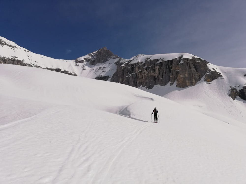
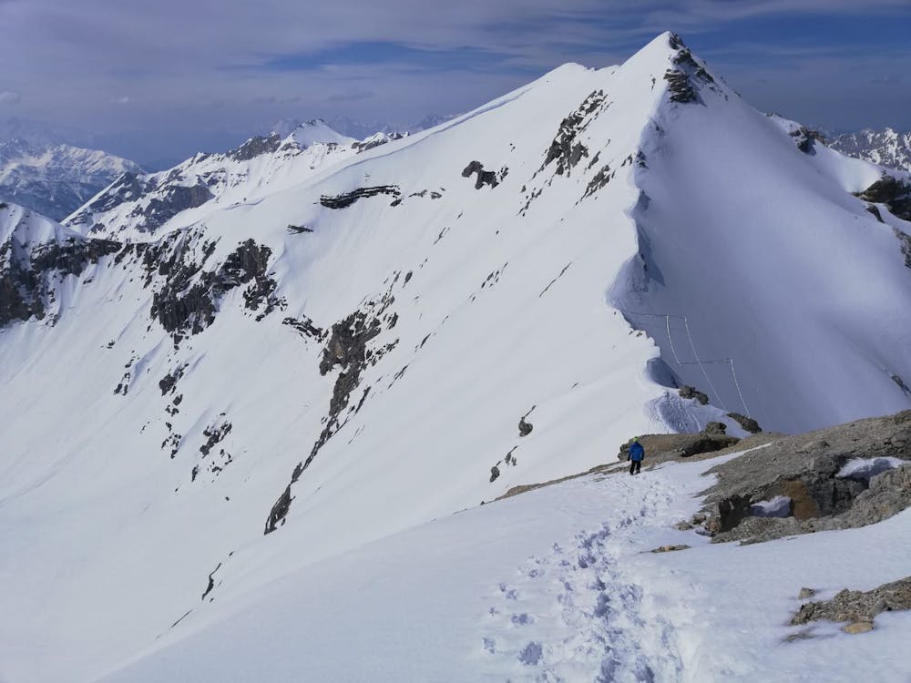
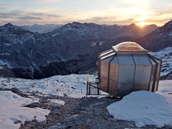
Cross some rolling terrain, heading north towards the intimidating final slope beneath the Birkkarspitze. At the foot of the final slope, swap skins and skis for crampons and bootpack up the slope (which gets to about 40 - 45 degrees) to the Birkkarspitze's west ridge. When you crest the ridge you are just 10 metres away from the incredible Birkkarhütte - a tiny hut which clings seemingly impossibly to a rocky col. There is room for a couple of people to sit in the hut and after a long climb it makes for a perfect spot to pause and eat some food.
After a break, ditch your skis at the hut and scramble up to the summit of the Birkkarspitze via some via ferrata and exposed, easy scrambling. The very final section of the ascent is up a steep, exposed snow slope and this may look unjustifiably dangerous if your snow climbing skills are not of a high level. It seems a shame to miss the summit having got this close, but it's better to live and fight another day than to take any unnecessary risks.
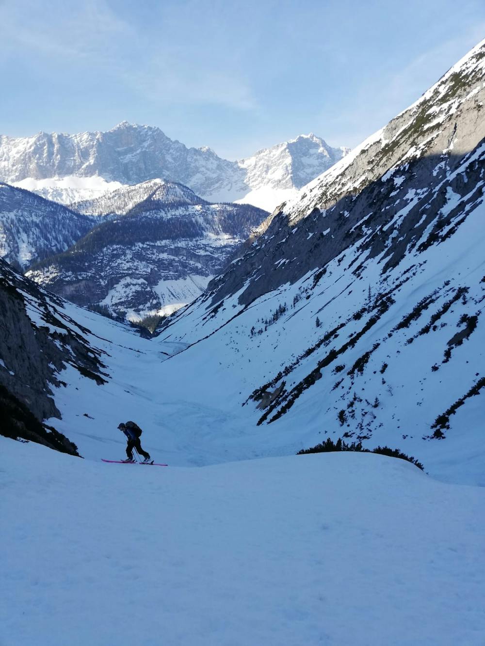
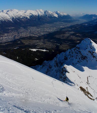
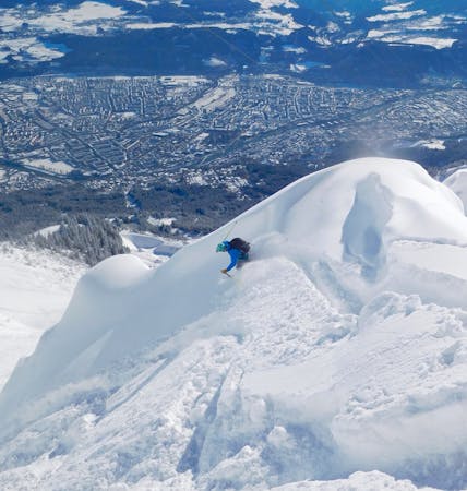
Whether you tag the summit or not, return to the hut, put your skis on and ski into the valley to the north, which provides pitch after pitch of fun, open skiing. As the valley steepens and narrows, traverse around rightwards to end up directly above the Karwendelhaus hut. Sections of this traverse are extremely exposed, so although you've already had a long, hard day, keep concentrating all the way until you reach the hut.
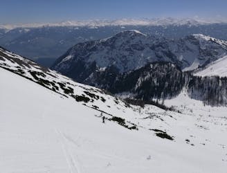
Once there, make a final short skin to a broad col and then ski east down mellow terrain down to a jeep track. Follow the jeep track all the way down to the road, which you reach 2 kilometres from the village of Hinterriß. Sections of the jeep track are exposed to avalanches from above so don't linger for too long on it. There are brief 5 - 10 minute uphill sections but these are easily bootpacked and skins are not necessary.
Once on the road, turn left and stroll triumphantly into Hinterriß. There is a guest house in the village but it is not open in the winter, and there is no public transport back to civilisation so you'll need to organise a pick up from Hinterriß or, if you're exceptionally lucky, you might be able to hitch a lift back from a hiker who's spent the day in the area.
The town you're aiming for is Mittenwald, from where there are regular trains to Munich and Innsbruck. Whether you go back to either of those cities or check into a hotel in Mittenwald, a large feed and a few drinks are essential to cap off 2 fabulous days in truly wild mountains.
Severe
Steep skiing at 38-45 degrees. This requires very good technique and the risk of falling has serious consequences.

In case of a fall, death is highly likely.
Little chance of being seen or helped in case of an accident.
8.5 km away
A truly wild tour through a series of stunning valleys.
Difficult Ski Touring
8.5 km away
The first half of a magnificent 2 day ski journey
Severe Ski Touring
8.5 km away
A trip into the wild and untamed Karwendel range - the largest uninhabited area in the Alps - followed by an exciting ski back to the Inn Valley.
Difficult Ski Touring
5 routes · Ski Touring
5 routes · Ski Touring

17 routes · Ski Touring

50 routes · Freeride Skiing · Ski Touring
8 routes · Freeride Skiing · Ski Touring
4 routes · Ski Touring

25 routes · Ski Touring
7 routes · Alpine Climbing · Mountain Biking · Hiking · Ski Touring