6.2 km away
Rosslaufspitze
An excellent tour just a few steps from the Inntal
Moderate Ski Touring
- Distance
- 11 km
- Ascent
- 1.1 km
- Descent
- 1.1 km
Skitour heading up a face and walking on a long ridge with a perfect freeride afterwards
Ski Touring Difficult

This is a popular ski touring route which is generally considered to be difficult. It's very remote, it features medium exposure (e2) and is typically done between December and March. From a low point of 1.5 km to the maximum altitude of 2.6 km, the route covers 13 km, 1091 vertical metres of ascent and 1118 vertical metres of descent. You'll need skins to complete it safely.
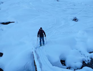
Approach through the valley, at the end of the valley continue up the mountain towards the ridge. Then turn right and follow the ridge until a final couloir (not to steep) leads to the summit
Difficult
Serious gradient of 30-38 degrees where a real risk of slipping exists.

As well as the slope itself, there are some obstacles (such as rock outcrops) which could aggravate injury.

Little chance of being seen or helped in case of an accident.
6.2 km away
An excellent tour just a few steps from the Inntal
Moderate Ski Touring
6.8 km away
Short ski tour with a little ridge climb and a beautiful descent
Moderate Ski Touring