8 m away
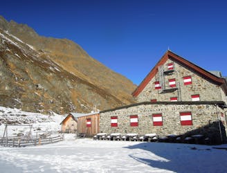
Ruderhofspitze von Franz-Senn-Hütte

Beeindruckende Skihochtour auf den vierthöchsten Gipfel der Stubaier Alpen.
Difficult Ski Touring
- Distance
- 8.3 km
- Ascent
- 1.3 km
- Descent
- 28 m
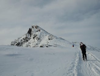
A highpoint before descent from the Franz Senn Hut to the valley
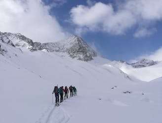
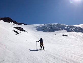
Ski Touring Difficult

Our highpoint for today is Kraulscharte, a col at 3069m. You can either go with a daypack and return to the hut, or take all your stuff and do a steeper N facing descent direct to the valley.
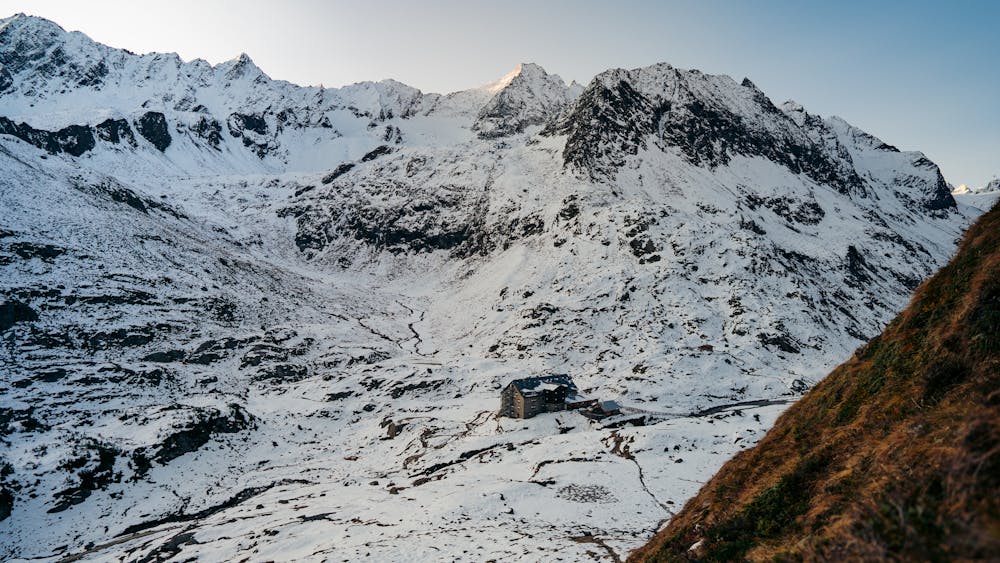
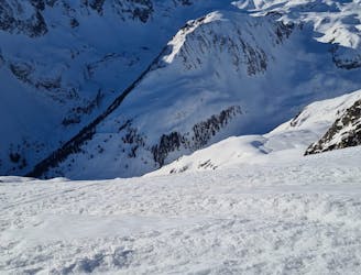
From the hut initially there are 2 possible routes. The most direct, not marked here, but visible on the local map, is SSW from the hut, taking the line of the summer footpath. This is shorter in distance, but steeper for longer, so less suitable in icy conditions or for those wanting a mellow start to the day. It can also be taken in descent if you are returning to the hut. The mellow alternative that is marked is to follow the main valley floor to the SSE, the SW, taking the long, easy slopes that lead up to a number of saddles on the ridge, one of which is known as the Kraulscharte. There is another col, a little higher up the glacier to the R, around a rocky spur, that is marked at 3142m.
From here, if you are not reversing your ascent route to the hut, you can descend, slightly further skier’s R, looking for a frozen lake at 2430m, on your R. A little way past this, at about 2410m, you will need to bootpack up a short steep mixed section to the ridge above, at about 2460m. On the far side head down to the N, negotiating a short steep section near the top, then roughly following again N, until you can take the approximate line of the streambed, passing to the L of some cliffs at about 2100m, which are to the skier’s R of the streambed. From here steeper wooded terrain takes you down to the main valley floor, and over the river to the parking, at Oberberg, at 1740m.
Alternatively, if you have chosen to return to the hut the descent takes the main route following the summer footpath, on a steepish L-wards traverse lower down.
Difficult
Serious gradient of 30-38 degrees where a real risk of slipping exists.

As well as the slope itself, there are some obstacles (such as rock outcrops) which could aggravate injury.

In the high mountains or remote conditions, all individuals must be completely autonomous in every situation.
8 m away
Beeindruckende Skihochtour auf den vierthöchsten Gipfel der Stubaier Alpen.
Difficult Ski Touring
15 m away

Eine zu Recht bekannte und oft begangene Gletschertour.
Moderate Ski Touring
19 m away
An out and back trip to the summit of the Wildes Hinterbergel, 3288m.
Difficult Ski Touring
21 m away

Eine einfache unvergletschere Skitour im Tourengebiet der Franz-Senn-Hütte.
Easy Ski Touring
27 m away
Steiles Skitourenhighlight über der Franz-Senn-Hütte.
Severe Ski Touring
7.6 km away
A tour to the peak of one of the Stubai Seven Summits.
Severe Ski Touring
7.6 km away
A very popular ski tour to the summit of a relatively easy 3000er.
Moderate Ski Touring
7.7 km away
A gorgeous mountain facing Neustift.
Severe Ski Touring
8.3 km away
Get top to the top of this iconic peak in the Stubaier Alps!
Difficult Ski Touring
8.6 km away

Über Eis und Steilrinnen auf einen Panoramagipfel der Stubaier Alpen
Difficult Ski Touring
5 routes · Ski Touring

17 routes · Ski Touring

25 routes · Ski Touring