9.7 km away
Bergisel Panorama
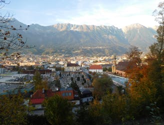
A great little hit of wilderness which is easily reached from the city.
Moderate Trail Running
- Distance
- 2.8 km
- Ascent
- 122 m
- Descent
- 119 m
https://www.runskitirol.com/trails/kalkkogel-through-alpenklubscharte
Trail Running Moderate

This is a popular trail running route which is generally considered to be moderate. It's remote, it features high exposure and is typically done between May and October. From a low point of 1.6 km to the maximum altitude of 2.5 km, the route covers 15 km, 1263 vertical metres of ascent and 1255 vertical metres of descent.
A beautiful and in parts very technical round through the Kalkkögel mountains. Slow going in parts, amazing views the whole time.
Moderate

Some trail sections have exposed ledges or steep ascents/descents where falling could cause serious injury.

Away from help but easily accessed.
9.7 km away
A great little hit of wilderness which is easily reached from the city.
Moderate Trail Running