801 m away
Muttelbergscharte - Walmendinger Horn
There are many ways down, and even more entrances!
Difficult Freeride Skiing
- Distance
- 3.1 km
- Ascent
- 17 m
- Descent
- 661 m
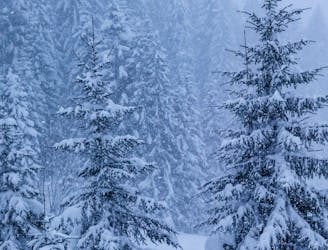
This is a strange place. An old cable car, end of the valley and somehow still a sleepy spot with amazing freeride terrain.
Freeride Skiing Difficult

Leave the Gondola through the front-door and turn right immediately to hike up all the way to the summit. There is often a trail, pedestrians like the views, but after big dumps skins are helpful. Since the trail is steep, best to then stay slightly lookers right of it.
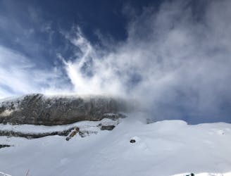
Once you reach the peak, you get an excellent sense of the options. North is Hoher Ifen. We will make our way over there now. South East you can see the faces of Kanzelwand, also plenty of options (I'll put a few up as well). The West-Couloir from here is also skiable in good conditions, but often needs a short rappel. Not the best, but worth to tick off.
We ski East first to the tilt over North-East to reach the base of the Ifen T-Bar. Head down East but stay clear of the North-Face up here. It has cliffs and at least we haven't spotted a line straight through even in the best winters. There is nice boulder to hop off until you see the bushes start on the left. Now drop over into slightly steeper north-facing terrain. Plenty of options over the meadows, through short chutes, beautiful trees until you see the trees getting tighter post meadows. This is where the trail starts. Just follow and make it to the T-Bar. The last meters need some skating steps.
Fun run.
Difficult
Serious gradient of 30-38 degrees where a real risk of slipping exists.

As well as the slope itself, there are some obstacles (such as rock outcrops) which could aggravate injury.
Away from help but easily accessed.
801 m away
There are many ways down, and even more entrances!
Difficult Freeride Skiing
804 m away

There are many ways down and in good conditions (and for good skiers) you can actually go straight and blast through the bushes.
Difficult Freeride Skiing
3.8 km away
A beautiful freeride line that's safe in most conditions
Moderate Freeride Skiing
3.9 km away

A beautiful Freeride run from Ifen over the Gottesacker into Wäldele. Good in most conditions.
Difficult Freeride Skiing