Velingrad - Samovoditsa - Kladova
Hiking route from Velingrad to Byalata Skala and Kladova
Hiking Moderate
- Distance
- 9.3 km
- Ascent
- 935 m
- Descent
- 57 m
- Duration
- 3-4 hrs
- Low Point
- 750 m
- High Point
- 1.6 km
- Gradient
- 14˚

English translation below
- •
- •
- •
- •
- •
- •
- •
- •
- •
- •
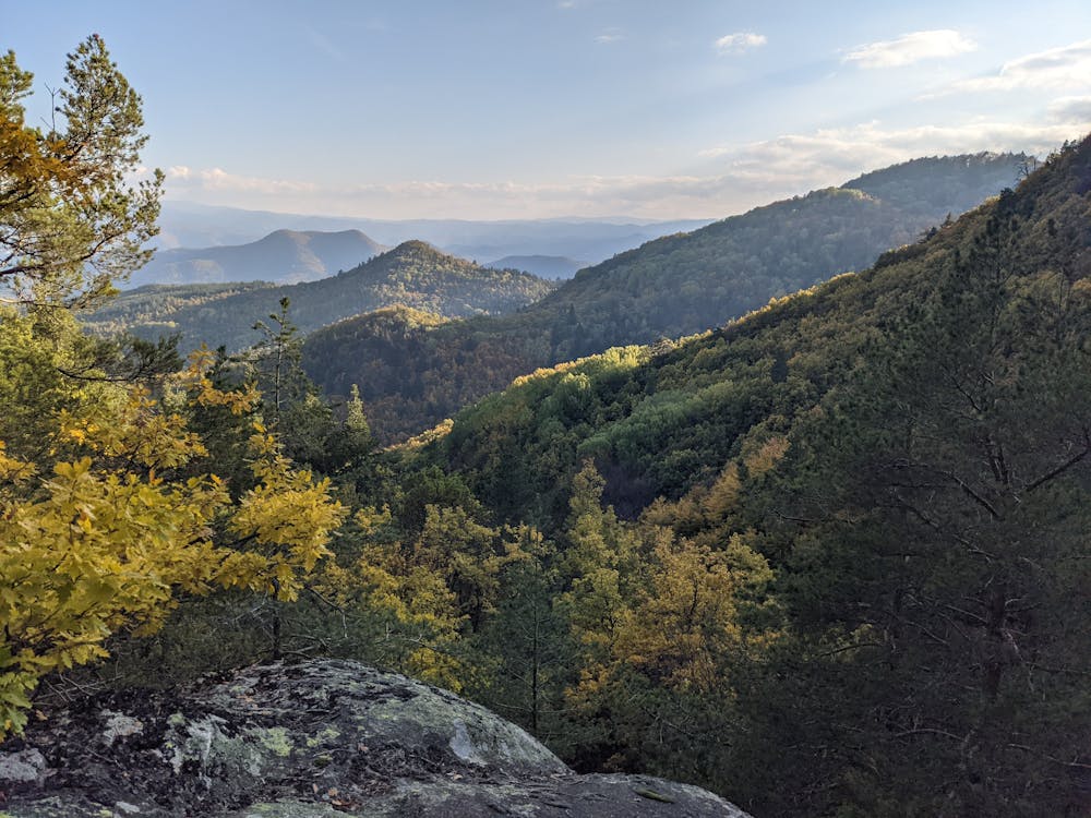
Description
Кратко описание на маршрута
0.0 км - начало на маршрута от пешеходната зона пред Община Велинград. Поемате на север по ул. “Тошо Стайков”;
0.5 км - завийте вдясно по маркираната пътека преди болница “Вита”;
1.1 км - параклис “Свети Георги”. Продължете на северозапад по горския път през поляните;
2.7 км - параклис “Свети Никола”. Продължете на запад по горския път;
2.9 км - разклон в местността Никульова черква. Продължете по десния път;
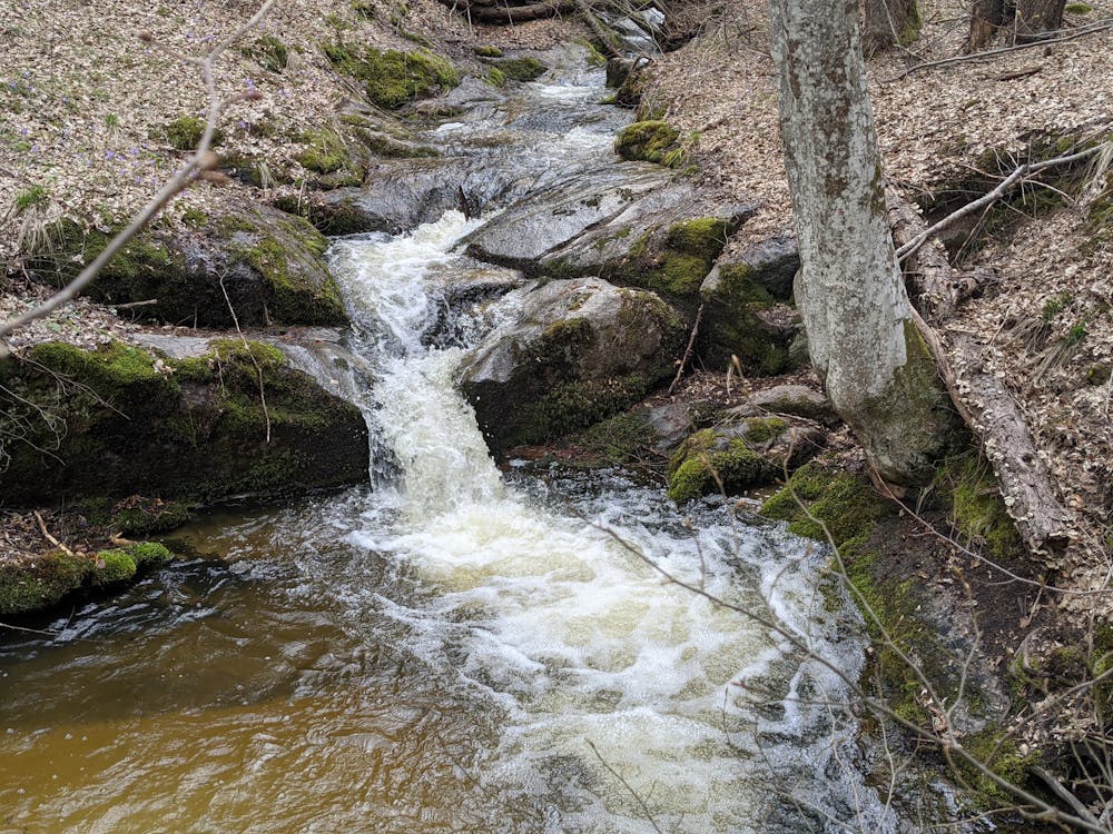
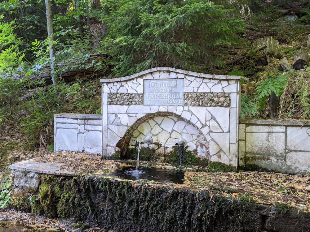
3.7 км - местност Стария чарк. Зона за пикник и чешма. От другата страна на реката има заслон. Маршрута продължава по маркираната пътека над чешмата и пейките;
5.9 км - излизате на горски път в местността Самоводица. Продължете надясно по пътя;
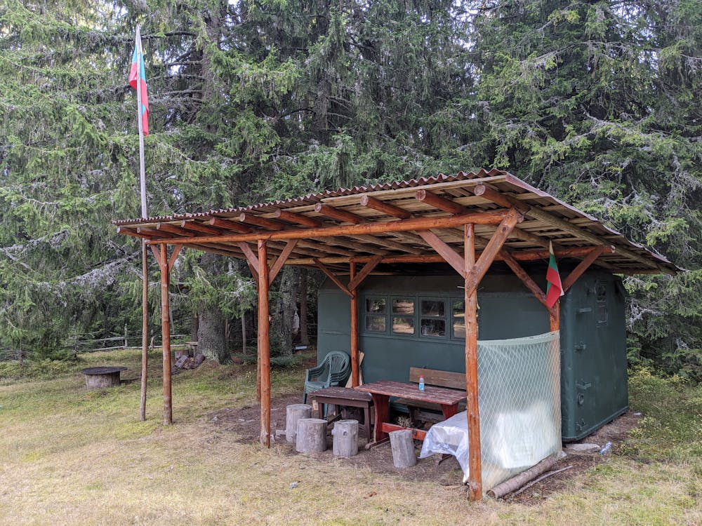
6.1 км - ловна хижа “Самоводица”. В двора на хижата има чешма. При нужда може да се потърси подслон в хижата. Маршрута продължава напред по горския път;
6.2 км - напускате горския път и поемате по маркираната пътека вляво. Започва изкачване;
6.8 км - излизате на горски път, който прави няколко серпентини. Маркираната пътека пресича напряко през серпентините;
7.3 км - местност Женското светилище. Представлява интересна възвишение и скали вляво от пътеката. Маршрута продължава нагоре;
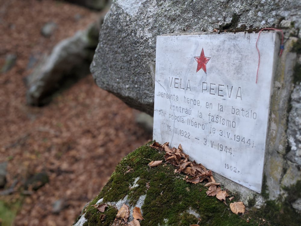
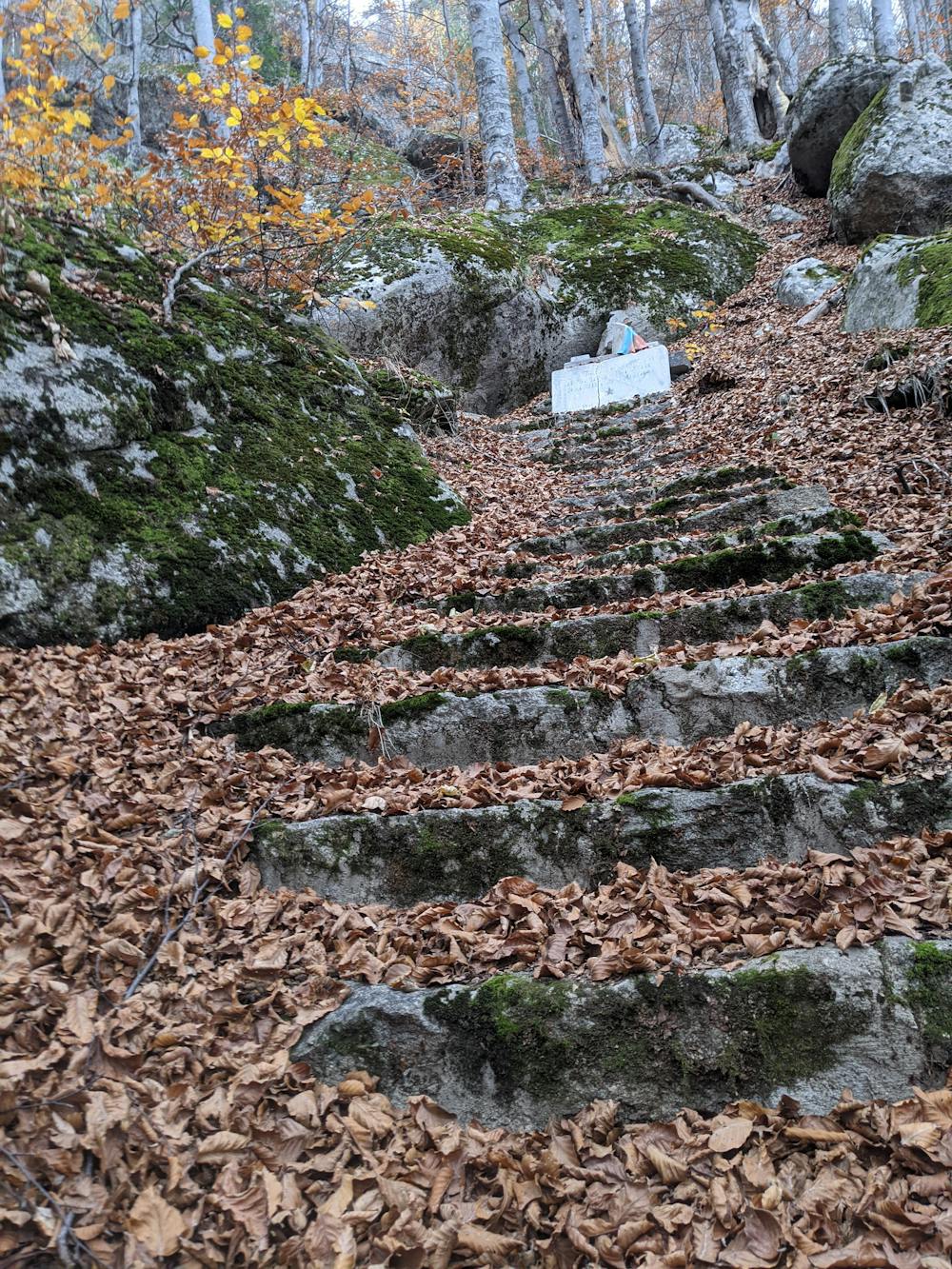
7.8 км - местност Бялата скала. Вляво от пътеката, в подножието на скалите има няколко паметни плочи, отбелязващи лобното място на Вела Пеева;
8.3 км - чешма;
8.5 км - чешма;
8.7 км - достигате до горски път. Завийте на дясно;
9.1 км - пресичате малък поток. Пътеката продължава вляво, нагоре към поляните;
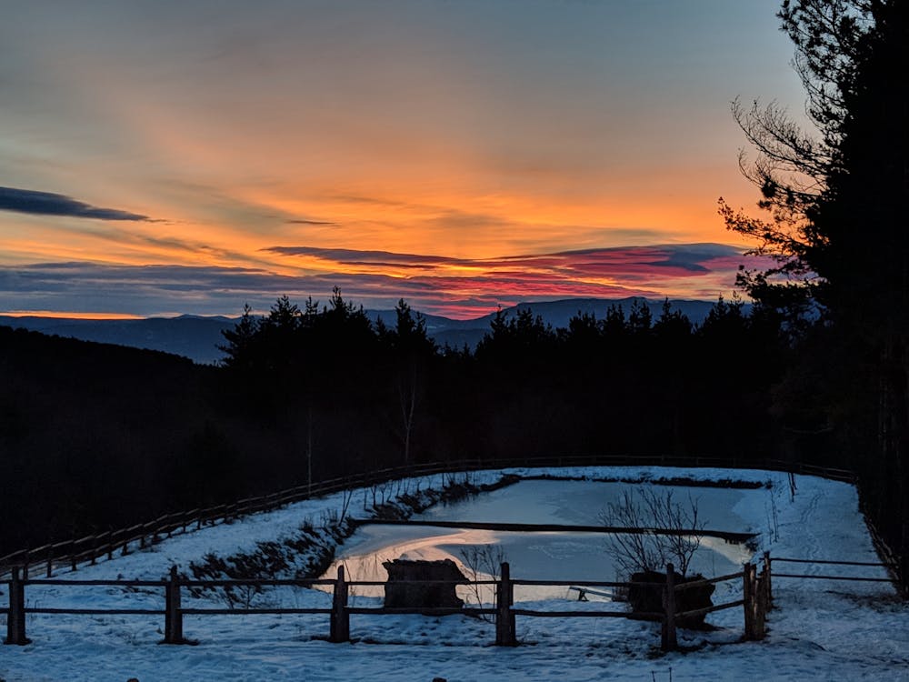
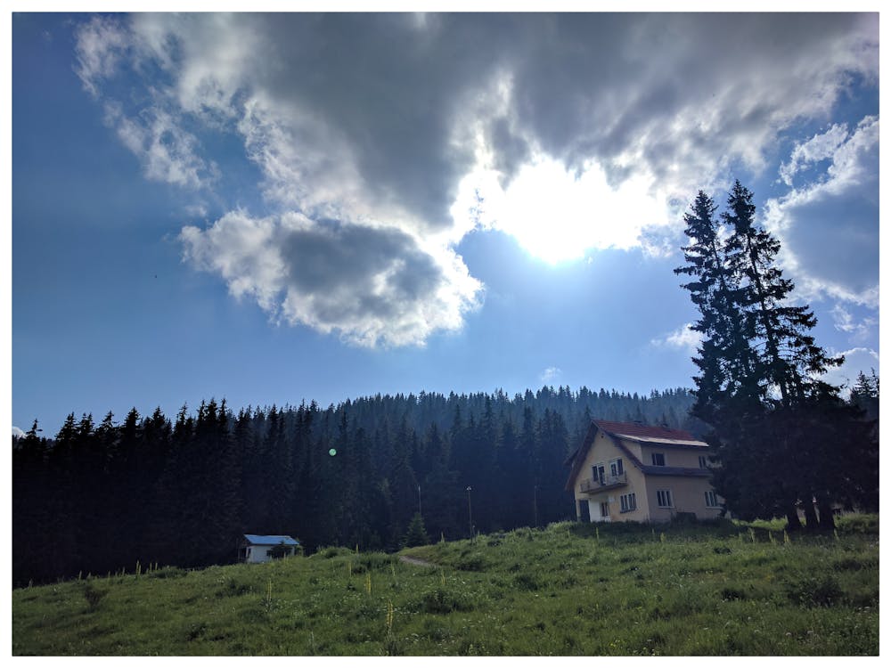
9.5 км - достигате сградата на бившата хижа “Кладова”. Край на маршрута.
Short description of the route
0.0 км - the starting point of the route is in front of Velingrad Municipility where the pedestrian zone is. Head north by "Tosho Staykov" street;
0.5 км - reaching Vita hospital. Take the marked trail on the right side of the building;
1.1 км - "Saint George" chapel. The forest road is heading northwest, continue walking through the meadows;
2.7 км - "Saint Nikola" chapel. Continue west on the forest road;
2.9 км - fork at the Nikulyova chapel area. Take the right path;
3.7 км - "Staria chark" area. Rest area with a spring. There's a shelter across the river. The route continues above the spring and the benches, where you will find the marked trail;
5.9 км - you go out on the forest route in Samovoditsa area. Continue right on the route;
6.1 км - "Samovoditsa" hunting lodge. There's a spring into the yard. You can search for shelter into the lodge in case of need. The path continues forward down the forest route;
6.2 км - the forest route ends. Take the marked trail on the right. Here the climbing begins;
6.8 км - you will find yourself on a forest road which is meandering. The marked path goes right through it;
7.3 км - "Jenskoto sanctuary" area. Consists of interesting eminence together with rock formations on the left side of the trail. The path continues uphills;
7.8 км - "Byalata skala" area. You will find few memorial tablets of Vela Peeva's place of death, under the rock formation on the left side of the path.
8.3 км - spring;
8.5 км - spring;
8.7 км - you will reach a forest path. Turn right here;
9.1 км - crossing a small stream. The path continues on the left, up to the meadows;
9.5 км - reaching the old building of "Kladova" hut. End of the route.
Difficulty
Moderate
Hiking along trails with some uneven terrain and small hills. Small rocks and roots may be present.
Low Exposure

The path is on completely flat land and potential injury is limited to falling over.
Remoteness

Away from help but easily accessed.
Best time to visit
Features
- Historical
- Picturesque
- Dog friendly
- Wild flowers
- Water features
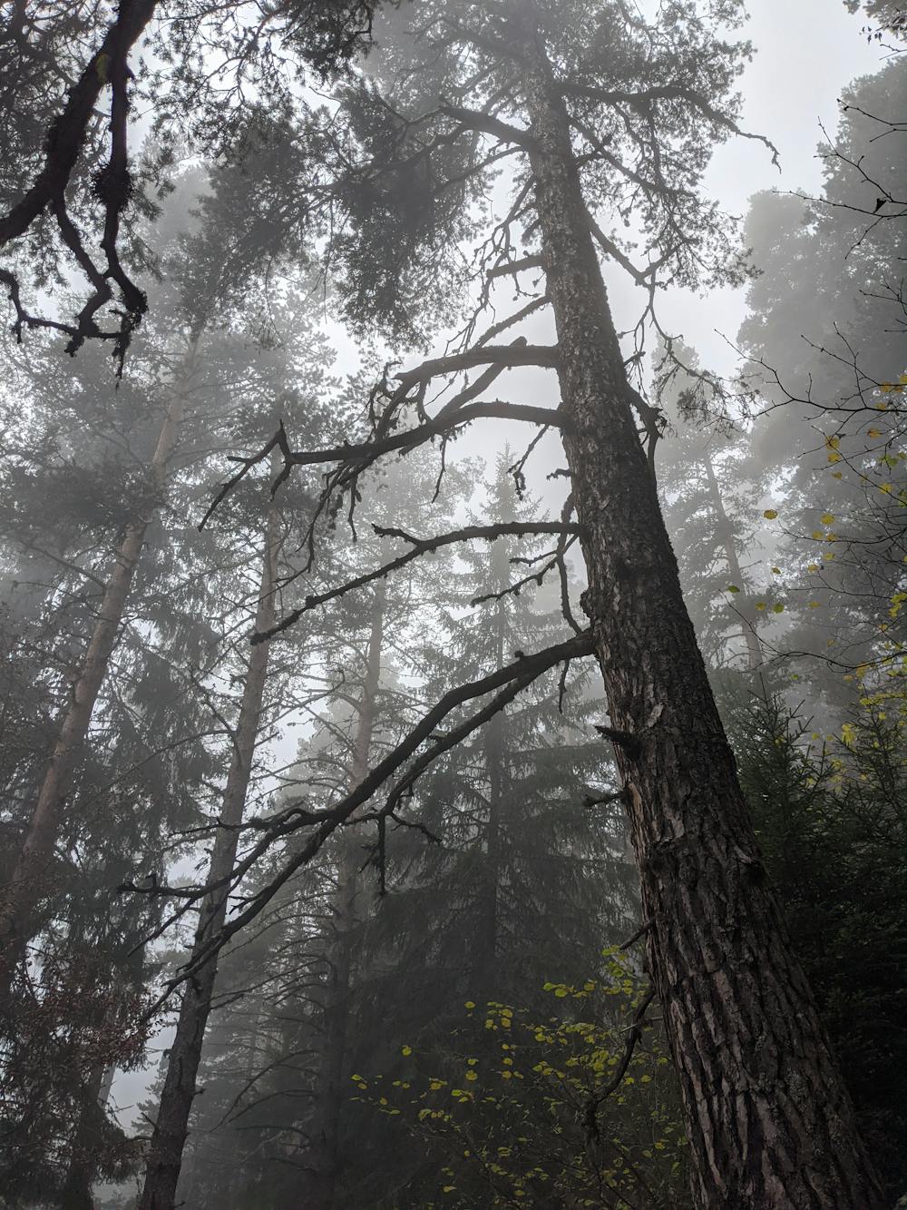
- Forestry or heavy vegetation