1 m away
Grotto Canyon | C'est Notre Monde
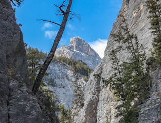
Grotto Canyon, hiking on a frozen river in Kananaskis Country
Easy Hiking
- Distance
- 5.2 km
- Ascent
- 253 m
- Descent
- 253 m
A very difficult and technical route.
Hiking Extreme

This traverse is very technical and very difficult.
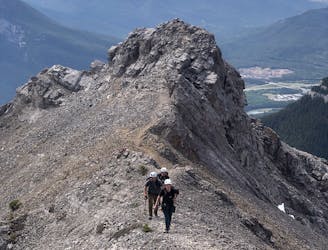
You will begin your climb right away, and it will feel never-ending. The climb up Ankle Biter is on loose rock, but it is a fairly well-defined trail up. You will still need to pay attention to stay on the right trail and not get sucked into the valley. Once you get up top, you will see the route you are heading to.
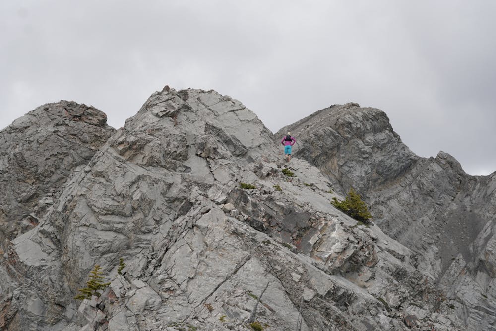
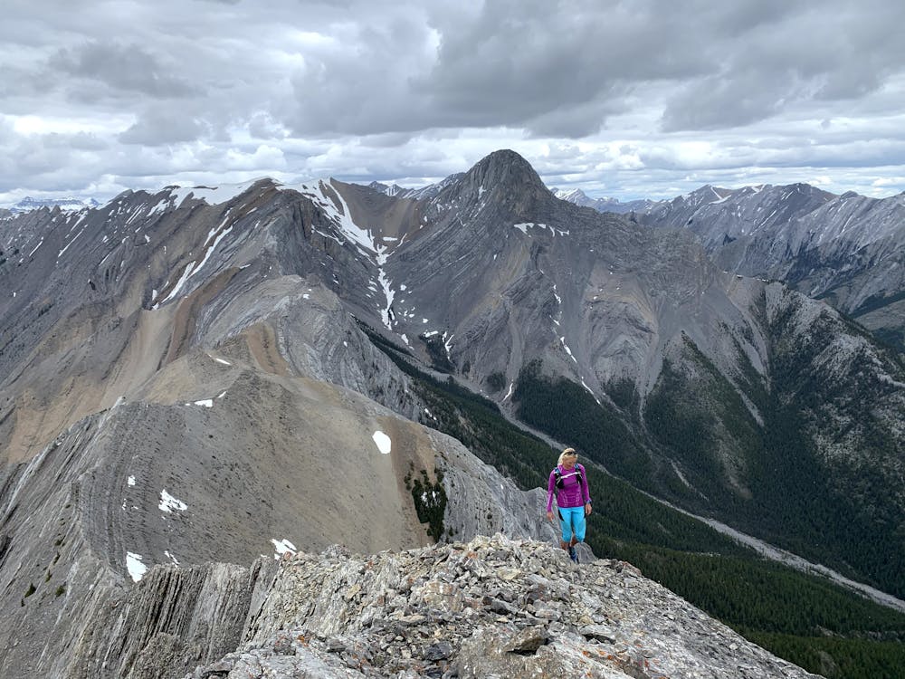
As you traverse across and up the ridge, you will get to some very spicy scrambling and route finding. This is where you need to move slowly and make sure the rock will hold you. This rock in this traverse is very fragile and can crumble apart easily.
You will go through phases on the ridge of very technical sections with nice breaks where it opens up, and you can relax a little bit.
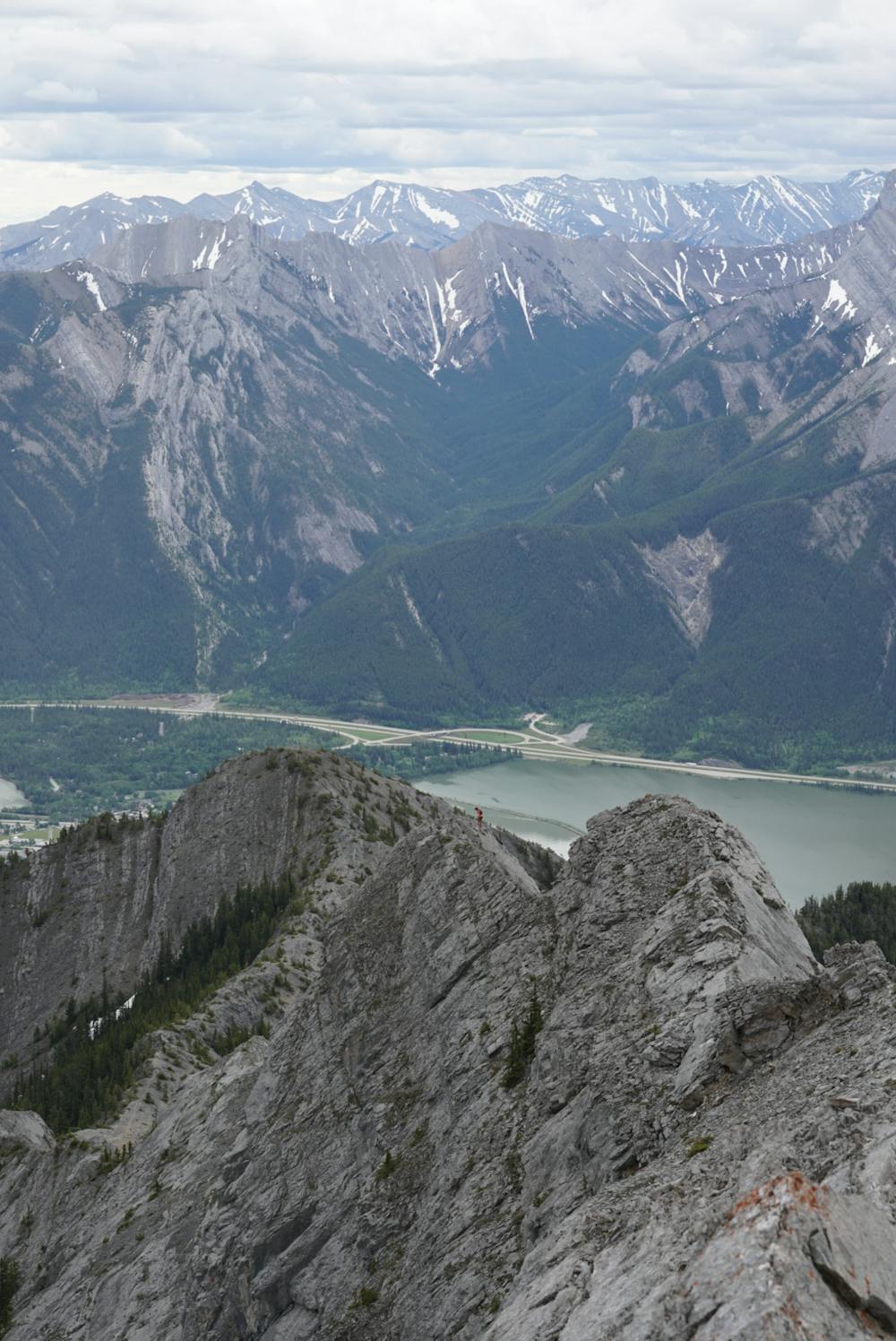
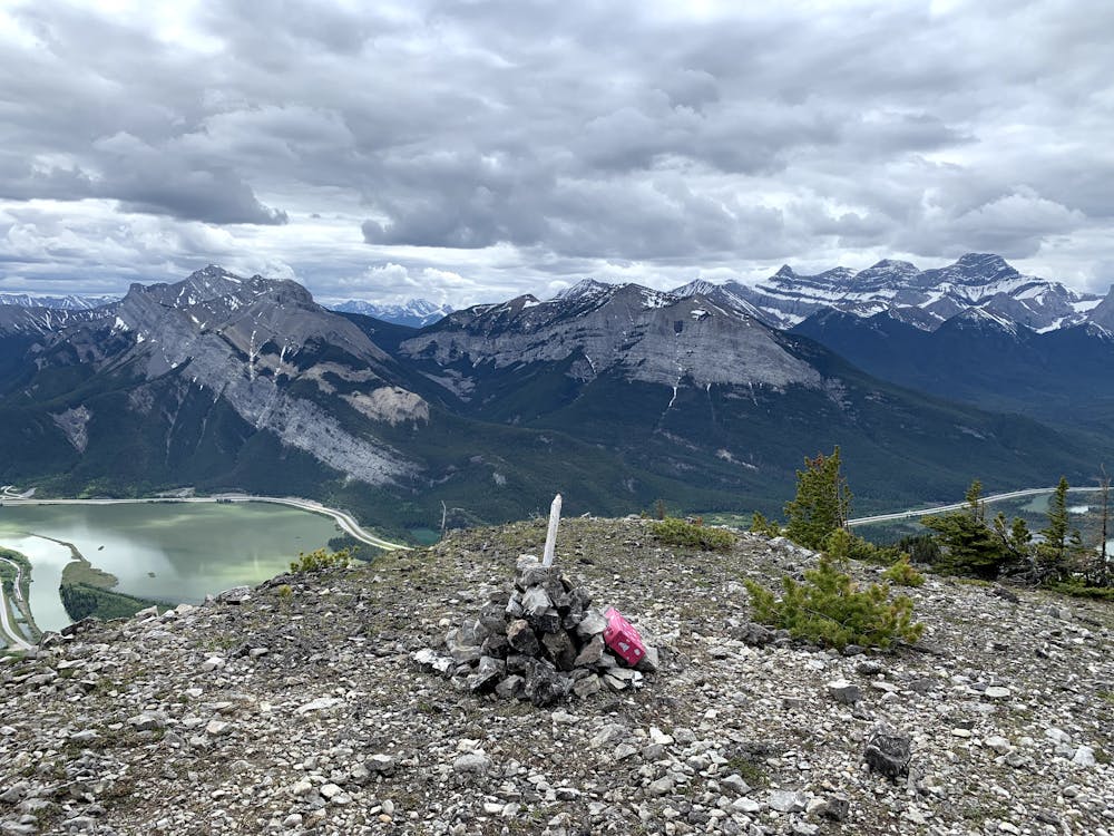
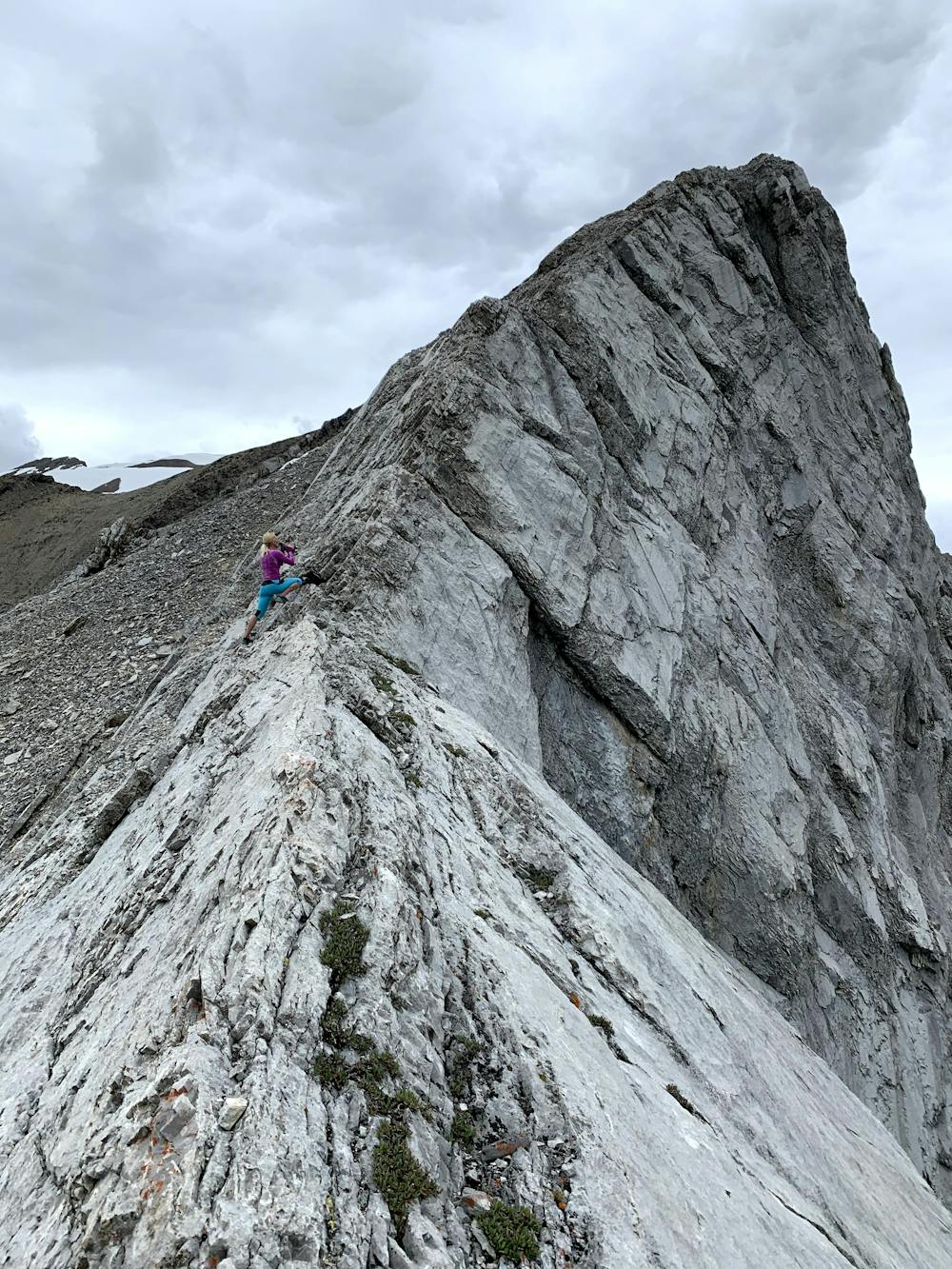
Once at Gap Peak, you can see the whole route to Mount Fable. Off Gap, it is knife-edge, but you can skirt to the right and stay on a shelf for the majority of the way. You will cross some unique rocks where you will feel like you are on another planet.
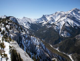
You might come to snow with overhanging cornices, but you can get around them and stay on solid rock ground. However, you want to make sure you are not walking on any of the snow for safety reasons.
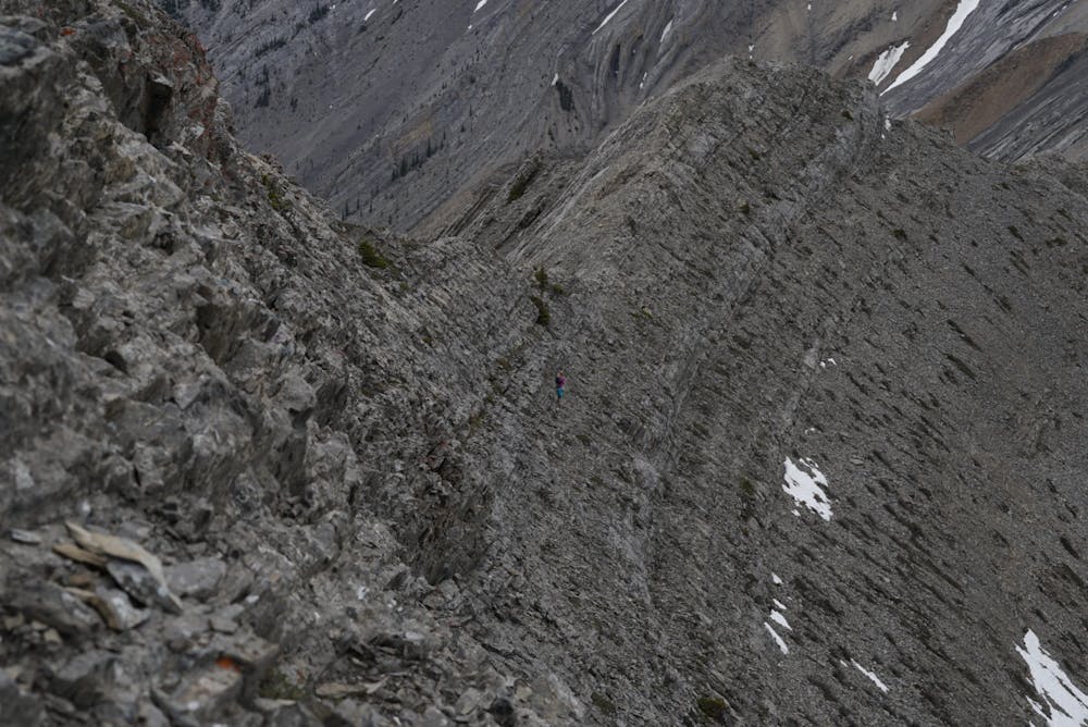
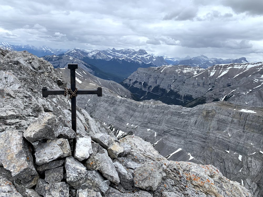
As you drop down to the saddle and look up to Mount Fable, it seems so far, but you just have the last climb left. You will have some loose rock. Some route finding is required to get up to the top. Once on the summit, you'll be met by an iron cross.
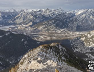
As you head down, you will head descend some scree into the valley. there might still be some snow and some water trickling off the massive wall across the valley. You will head out in the river bed. There is no easy way. You just want to pick the best route, staying in the river bed. You can sometimes locate the old trail in the trees, but it is not worth searching for. The floods destroyed the trail and riverbed. A good rule of thumb while in the river is to always stay right at any junction until you meet the road.
Warning: near the end, you might enter Lafarge. you can get through, just be courteous and safe while heading through there. A lot of people end up taking that trail for ease and safety.
There is a gas station where you can get snacks and drinks—even beer to celebrate the trip. You would ideally want to park a car at each end, as the run or hike along the highway is a grind at the end of a big day. You can always take your chances hitching a ride back to Grotto pond.
Extreme
Scrambling up mountains and along technical trails with moderate fall exposure. Handholds are necessary to navigate the trail in its entirety, although they are not necessary at all times. Some obstacles can be very large and difficult to navigate, and the grades can often be near-vertical. The challenge of the trail and the steepness of the grade results in very strenuous hiking. Hikes of this difficulty blur the lines between "hiking" and "climbing".

Some trail sections are extremely exposed where falling will almost certainly result in serious injury or death.
In the high mountains or remote conditions, all individuals must be completely autonomous in every situation.
1 m away
Grotto Canyon, hiking on a frozen river in Kananaskis Country
Easy Hiking
17 m away
A stenuous scrambling to breathtaking views
Difficult Hiking
3.4 km away
A difficult scramble up Heart Mountain, followed by a very scenic ridge hike to complete the loop, with 360 views of the surrounding peaks.
Severe Hiking
3.4 km away
An easy scramble at the entrance of the Canadian Rockies
Difficult Hiking