14 m away
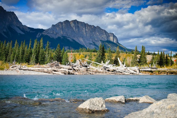
Heart Mountain | C'est Notre Monde
An easy scramble at the entrance of the Canadian Rockies
Difficult Hiking
- Distance
- 10 km
- Ascent
- 959 m
- Descent
- 959 m
A difficult scramble up Heart Mountain, followed by a very scenic ridge hike to complete the loop, with 360 views of the surrounding peaks.
Hiking Severe

This is a fun but challenging scrambling route which can be completed in either direction, although counter clockwise is the recommended route as it makes for an easier decent.
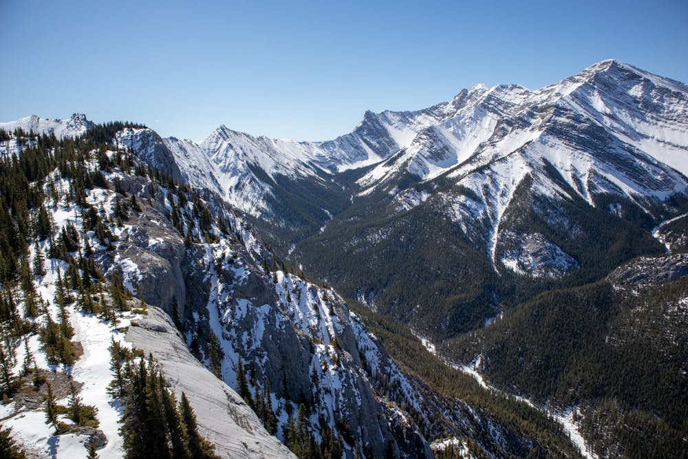
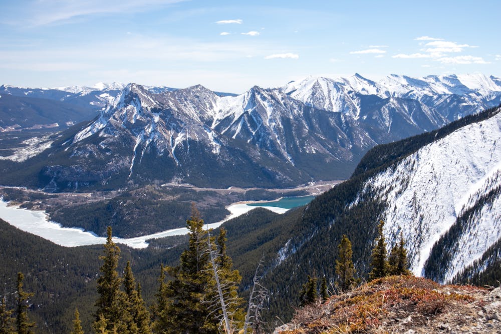
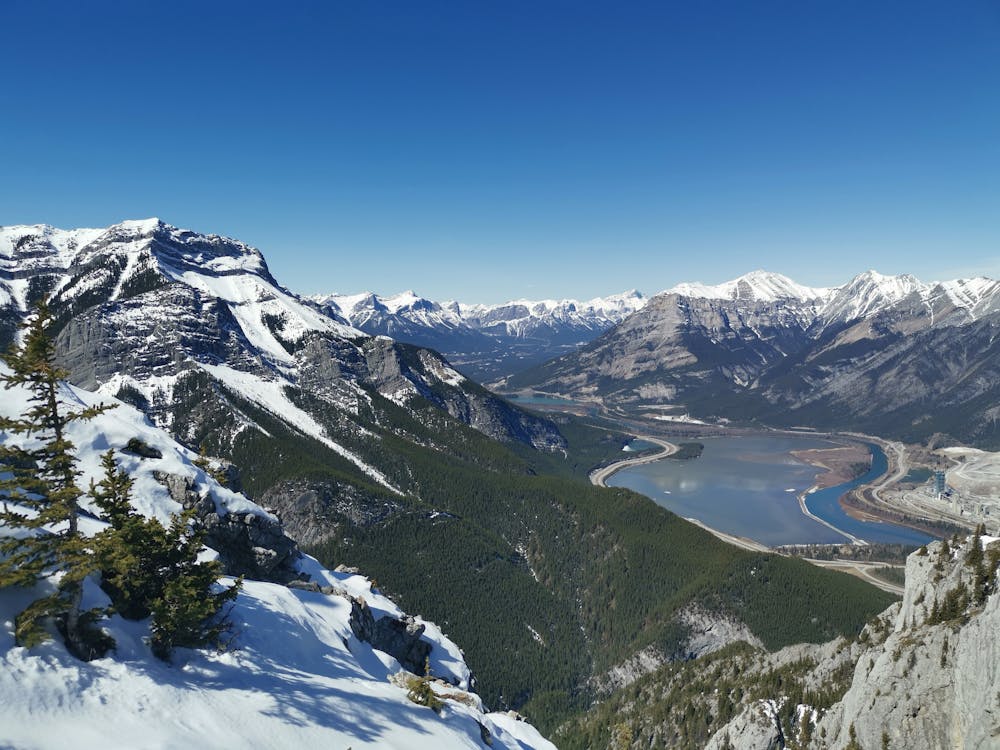
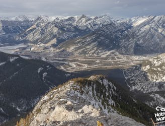
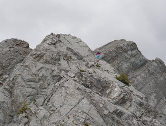
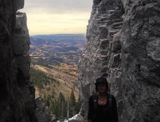
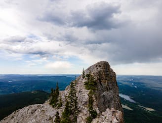
The trail starts out through the forest, but you very quickly start to hike up the ridge of Heart Mountain, where you are immediately rewarded with open views down the valley overlooking Lac des Arcs. The route up heart mountain is a scramble, and around 3/4 of the way up you hit a large rock wall, at this point there is a blue marker on the wall indicating which direction to go in, be sure not to miss it, as there is also a scree slope to the right that looks like it is the trail, but it isn't and there is no way up from there. The blue markers continue whilst you scramble up the rocks towards the summit of heart mountain, which has 360 views of the surrounding peaks. This is a great place to have lunch & enjoy the awesome views.
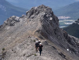
A lot of hikers only summit Heart Mountain and then descend the same way but completing this loop is well worth the effort; it's a pretty open ridge walk the entire way, giving amazing views in all directions - you can even see Calgary from the peak of Grant MacEwan! As not as many people complete the loop you will find it a much quieter hike once you continue past Heart Mountain, and it really does make for a great day in the mountains.
The descent on the other side is much more simple, it's still steep, but you soon make it back into the treeline where it becomes a really nice forest walk back to the highway. This is a long hike - plan around 6-7 hours to complete, and if hiking in early or late season, micro spikes are essential. This hike can be completed year round, however it is much more challenging in winter and requires snowshoes & good micro spikes.
Severe
Hiking challenging trails where simple scrambling, with the occasional use of the hands, is a distinct possibility. The trails are often filled with all manner of obstacles both small and large, and the hills are very steep. Obstacles and challenges are often unexpected and can be unpredictable.

Some trail sections have exposed ledges or steep ascents/descents where falling could cause serious injury.

Away from help but easily accessed.
14 m away
An easy scramble at the entrance of the Canadian Rockies
Difficult Hiking
3.4 km away
A very difficult and technical route.
Extreme Hiking
3.4 km away
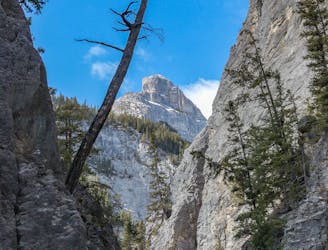
Grotto Canyon, hiking on a frozen river in Kananaskis Country
Easy Hiking
3.4 km away
A stenuous scrambling to breathtaking views
Difficult Hiking
9.8 km away
The iconic walk on the Rockies Iconic Gateway Peak
Severe Hiking
9.9 km away
A classic Kananaskis hike with some scree skiing on the way down!
Moderate Hiking
4 routes · Hiking