17 m away
Epic Rockies Hikes: Mount Yamnuska
A classic Kananaskis hike with some scree skiing on the way down!
Moderate Hiking
- Distance
- 9.1 km
- Ascent
- 899 m
- Descent
- 899 m
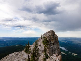
The iconic walk on the Rockies Iconic Gateway Peak
Hiking Severe

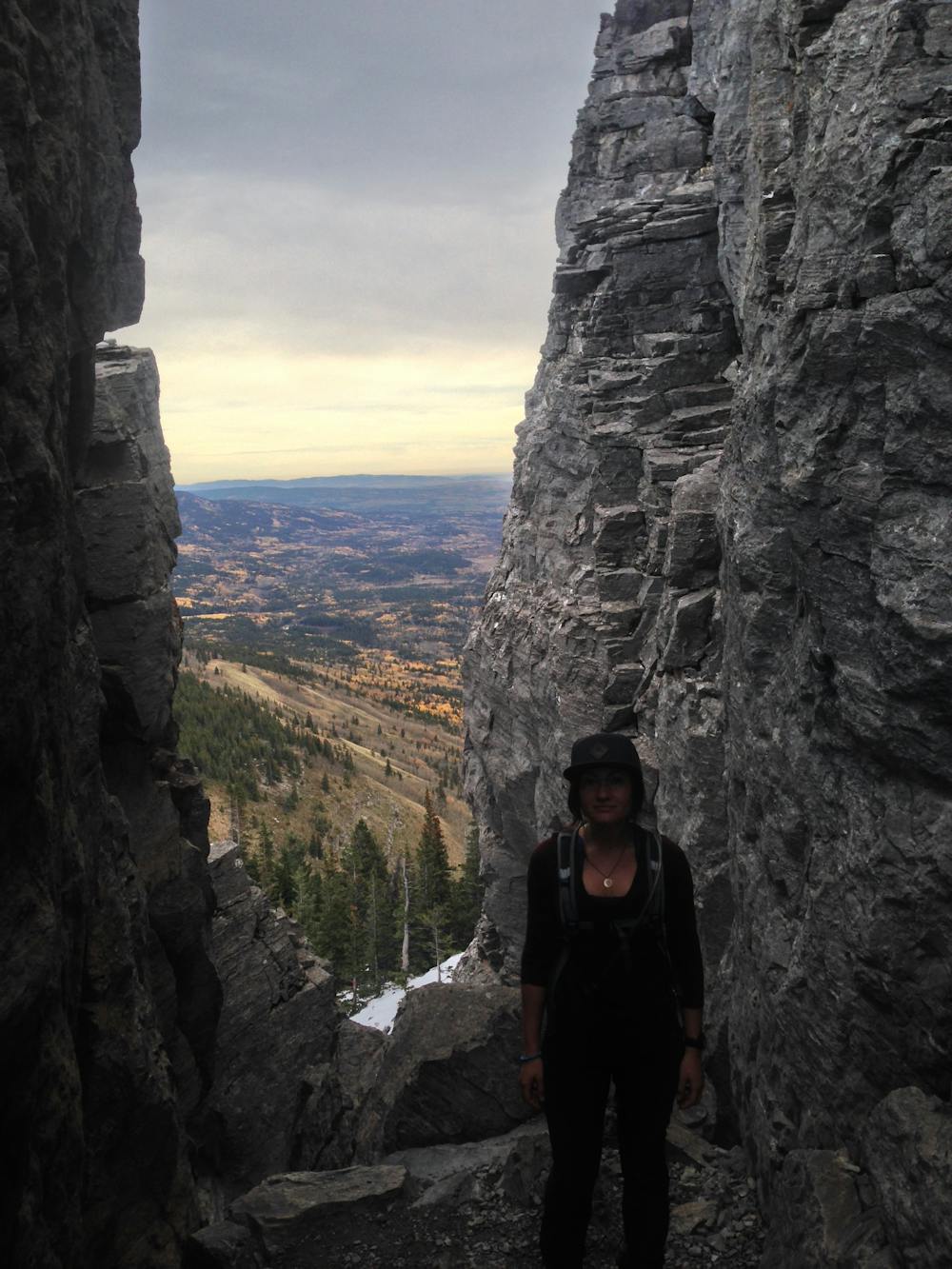
Easily one of Calgary's most popular hikes. The route is a fairly challenging hike with excellent views and wonderful alpine terrain. It does get a bit scrambly in a couple sections, but the steel chain reduces this challenge, and the footpath is at least a footwide. The scree run at the end is another highlight.
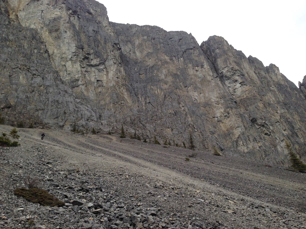
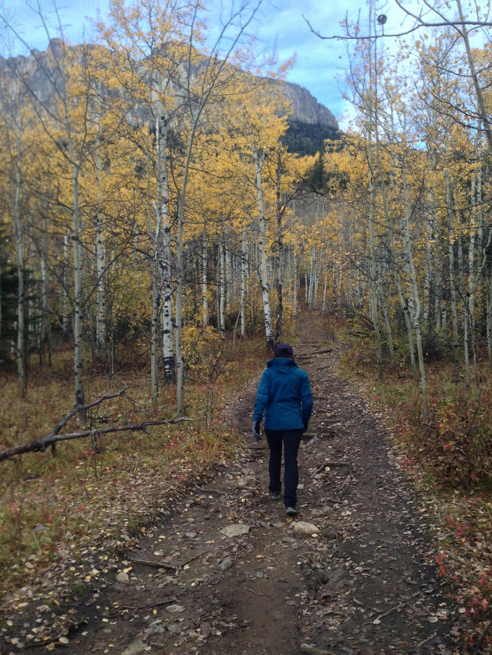
The routes is best done in a counter clockwise (South to North) direction as the scree slopes are awful to walk up. The trail begins through deciduous forest, and slowly gains elevation up to the ridge.
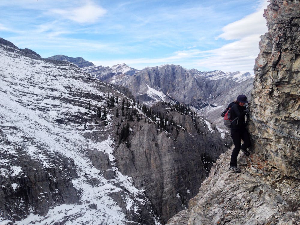
At the ridge the trail winds its way up to Yamnuska, and up between a series of boulders. A couple high steps pulls between these rocks, and you are on the backside of Yamnuska. The trail traverse beneath the main ridge, between cliff bands. As you approach the first summit the trail descends to a cliff band. Here the short 15m long chain walk begins. After this the trail is all just standard hiking on compact scree. The summit is the mostly the same views you have been seeing up until now. From here the route descends on sandy trail, wrapping around the rocks.
Numerous trails are visible with dusty lines of descent in the fine scree. Pick your line, and be sure there is no one beneath you as this extremely loose scree acts like slush. Many prefer to run down it as it is "soft" to walk on, like stomping on grapes to make wine. At the base of the scree the trail resumes past waterfalls, and reconnects with the start.
Severe
Hiking challenging trails where simple scrambling, with the occasional use of the hands, is a distinct possibility. The trails are often filled with all manner of obstacles both small and large, and the hills are very steep. Obstacles and challenges are often unexpected and can be unpredictable.

Some trail sections have exposed ledges or steep ascents/descents where falling could cause serious injury.

Away from help but easily accessed.
17 m away
A classic Kananaskis hike with some scree skiing on the way down!
Moderate Hiking
9.8 km away
An easy scramble at the entrance of the Canadian Rockies
Difficult Hiking
9.8 km away
A difficult scramble up Heart Mountain, followed by a very scenic ridge hike to complete the loop, with 360 views of the surrounding peaks.
Severe Hiking
4 routes · Hiking