8.5 km away
Cascade Amphitheatre
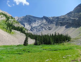
A dramatic alpine valley tucked high in the mountains near Banff.
Difficult Hiking
- Distance
- 14 km
- Ascent
- 782 m
- Descent
- 782 m
A long walk near the lakeside, then a steep climb to an elevated panorama.
Hiking Difficult

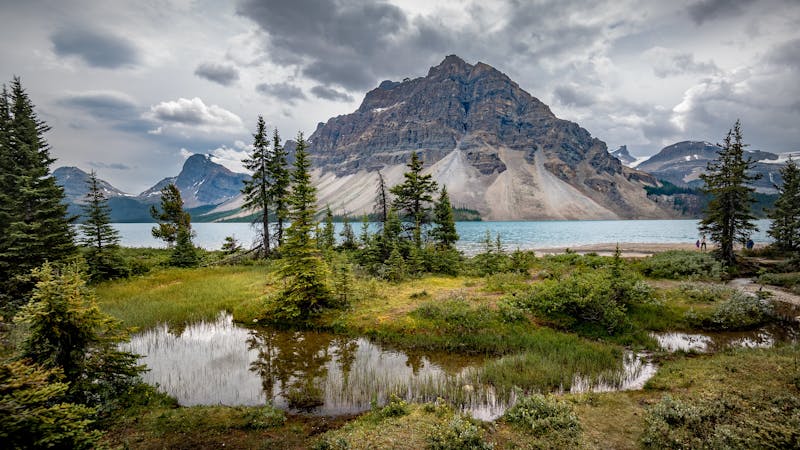
The first half of this hike is on the trail along Lake Minnewanka––a wide and relatively flat path that’s popular with hikers and bikers. It’s a pleasant walk through the forest, with intermittent views over the large, blue reservoir. The farther you get from the trailhead, the lesser the crowds become, and comparatively few people make the turn onto Aylmer Pass Trail and journey uphill.
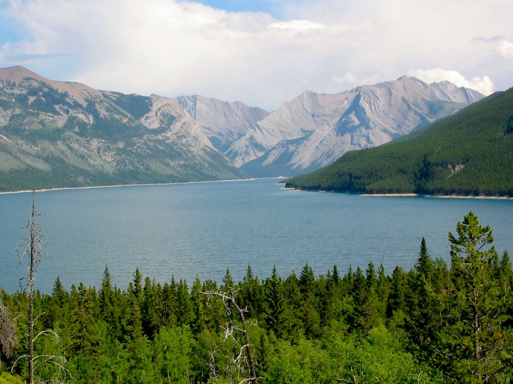
The trail turns away from the lake to ascend a forested valley. The gradient is gentle at first but becomes steeper. After turning toward the lookout at another junction, it gets steeper still. These slopes can be hot in summer, so bring lots of water. At the lookout site, your toil finally finds its reward. No lookout tower stands today, though you can see the foundation of one. Instead, it’s an open, grassy hilltop with a wide panorama over the lake and mountain skyline.
Sources: https://www.pc.gc.ca/en/pn-np/ab/banff/activ/randonee-hiking/banff https://banff.ca/645/Aylmer-Pass
Difficult
Hiking trails where obstacles such as rocks or roots are prevalent. Some obstacles can require care to step over or around. At times, the trail can be worn and eroded. The grade of the trail is generally quite steep, and can often lead to strenuous hiking.

The trail contains some obstacles such as outcroppings and rock which could cause injury.
Away from help but easily accessed.
8.5 km away
A dramatic alpine valley tucked high in the mountains near Banff.
Difficult Hiking
8.5 km away
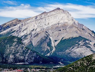
Hike and scramble to the top of an impressive peak just outside the town of Banff.
Extreme Hiking
8.5 km away
CascadeMountain, hiking the mythical Mountain of Banff
Severe Hiking
5 routes · Hiking