35 m away
Cascade Amphitheatre
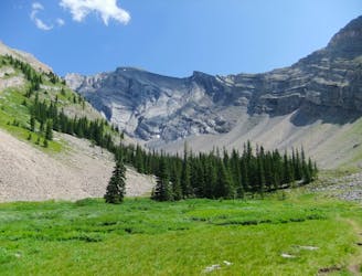
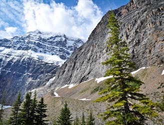
A dramatic alpine valley tucked high in the mountains near Banff.
Difficult Hiking
- Distance
- 14 km
- Ascent
- 782 m
- Descent
- 782 m
Hike and scramble to the top of an impressive peak just outside the town of Banff.
Hiking Extreme

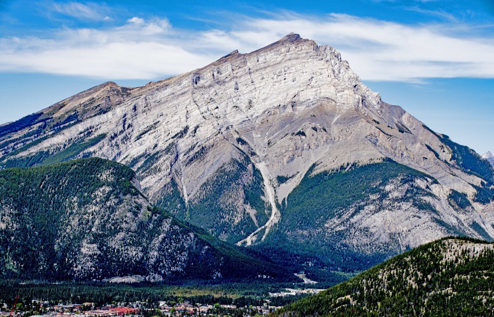
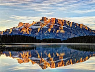
Cascade Mountain is the huge pyramid rising north of Banff townsite. The Cascade Amphitheatre, forming the backside of the mountain in relation to Banff, is a popular summer hike from Mount Norquay Ski Area. Huge cliffs of an arcing ridgeline form the amphitheatre, and the route to Cascade’s summit follows this same ridge. The ascent is mostly a hike, but careful route finding and light scrambling are required. It’s best done in midsummer when free of snow, otherwise expect a much more serious route.
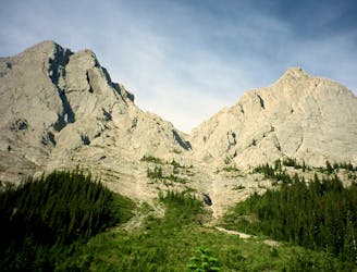
Begin by taking the hiking trail to Cascade Amphitheatre. Soon after entering the amphitheatre, find the climbers trail through the trees to gain the east ridge. Do not go through the steep cliffs near the base of this ridge, just keep angling around them until easier terrain appears. Continue upward, staying on or to the right of the ridge crest, soon leaving the trees behind. Ahead is First Peak, a sub-summit on the ridgeline. It’s easiest to contour wide around the right side of this feature, though multiple worn paths will be visible. Look for cairns and colored tape that mark the standard route.
Next, the False Summit comes into view ahead. Avoid the temptation to go straight over this feature, because vertical cliffs make up the other side. Instead, make another wide contour to the right, again looking for markers to lead the way. After passing the False Summit, work your way back up to the main ridgeline. In places, you’ll encounter loose scree and short scrambles, but nothing too difficult if you stay on route.
Once back on the main ridge, it’s a straightforward but long slog up loose scree to the summit. Snow can linger well into the summer, so be prepared to turn back if you encounter unsafe conditions and aren’t well equipped.
The panorama on top is of course incredible, but it’s rivaled by the views you’ll have on the entire descent. To return, retrace the ascent route, paying careful attention so as not to lose the way.
Sources: https://www.pc.gc.ca/en/pn-np/ab/banff/activ/escalade-scrambling/cascade
Extreme
Scrambling up mountains and along technical trails with moderate fall exposure. Handholds are necessary to navigate the trail in its entirety, although they are not necessary at all times. Some obstacles can be very large and difficult to navigate, and the grades can often be near-vertical. The challenge of the trail and the steepness of the grade results in very strenuous hiking. Hikes of this difficulty blur the lines between "hiking" and "climbing".

The trail contains some obstacles such as outcroppings and rock which could cause injury.
Away from help but easily accessed.
35 m away
A dramatic alpine valley tucked high in the mountains near Banff.
Difficult Hiking
289 m away
CascadeMountain, hiking the mythical Mountain of Banff
Severe Hiking
5.1 km away
Beginner-friendly scramble to a summit just outside the town of Banff.
Extreme Hiking
5.1 km away
A steep, rocky, and shaded hike with seriously beautiful scenery.
Difficult Hiking
5.1 km away
Hike and scramble to the first of Mount Edith's three peaks.
Extreme Hiking
8.5 km away
A long walk near the lakeside, then a steep climb to an elevated panorama.
Difficult Hiking
5 routes · Hiking