4.8 km away
Mount Jimmy Simpson
The perfect day hike to avoid the crowds and experience the very best of the Icefields Parkway.
Severe Hiking
- Distance
- 15 km
- Ascent
- 1.1 km
- Descent
- 1.1 km
A fantastic day hike with picturesque lakes and stunning glaciers.
Hiking Difficult

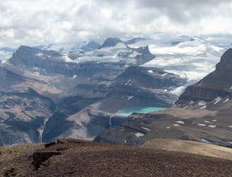
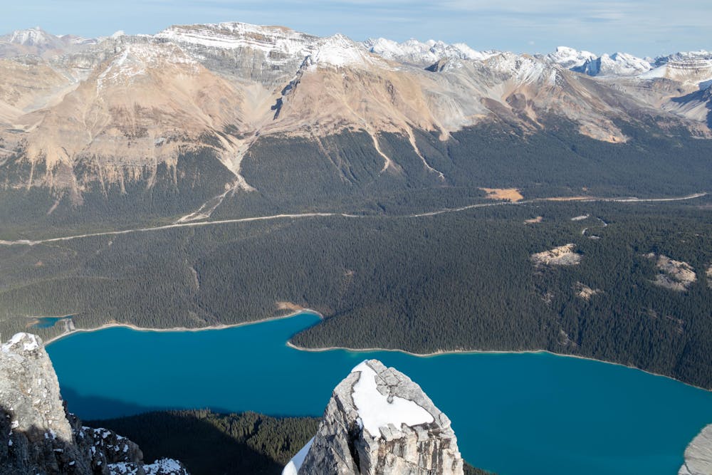
Caldron Peak is one of the most photographed mountains in all of Banff National Park. It towers over the iconic Peyto Lake, which is what draws most people to the area.


The trail starts at the Peyto lake parking lot and follows the popular route to the famous viewpoint. With the huge crowds here, it's easy to forget you are in a remote area, but that would be a mistake. This trail is extremely remote and as soon as you leave Peyto Lake the maintained trails disappear, along with all the crowds. It's now just you and the mountains.
Generally, you need to rely on your own route-finding abilities here. There is the occasional rock cairn and some sections do have a more obvious trail, but for the most part, you are choosing your own route.
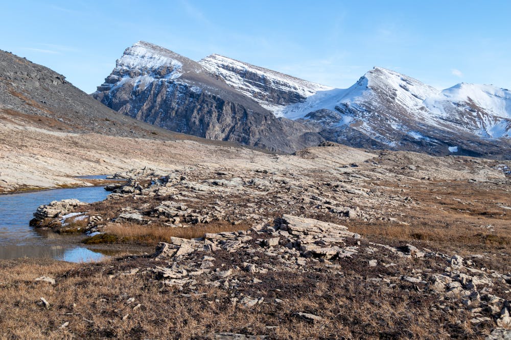
As you might expect given the lack of a maintained trail, there are no bridges here either. You will have to ford the ice-cold stream that flows through the moraine.
There are two more water crossings on route to the summit, but you should be able to navigate these without removing your boots, depending on water levels.
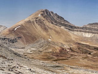
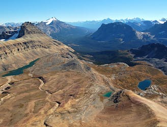
As you climb up the ridge on the moraine, you will be able to see the traverse to Caldron Lake. This is the crux of the route and isn't for the faint of heart.
The traverse involves side hilling on loose shale with a huge cliff directly below. Due to the slope angle and the loose rock, it would be very difficult to stop yourself going over the edge if you were to fall.
It isn't particularly difficult to do the short traverse, but I can imagine if you have a fear of heights or aren't confident on loose shale, then you would find this terrifying. Personally, I was actually more concerned about natural rockfall from above than I was about sliding over the cliff below.
Assuming you survived the traverse (!) what awaits you is the beautiful Caldron Lake. This is a magnificent lake and is well worth a visit, even if you don't go all the way to the peak.
From the lake it's still a big climb to the summit. The final climb travels over some very uneven terrain, that requires a lot of care to navigate safely.
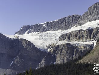
The views from the summit are spectacular. You are surrounded by huge glaciers that have carved out this amazing landscape. That's not to mention the stunning views of Peyto and Caldron Lakes with their iconic turquoise colours.
After admiring the fantastic scenery, it's soon time to retrace your steps for the descent. The traverse back over the crux is just as scary as it was the first time, but other than that it's a relatively straightforward hike back to the car.
The high exposure can deter people from completing this trail. But if you are an experienced hiker who doesn't mind the short exposed section, then this is an epic hike that is well worth the effort.
Difficult
Hiking trails where obstacles such as rocks or roots are prevalent. Some obstacles can require care to step over or around. At times, the trail can be worn and eroded. The grade of the trail is generally quite steep, and can often lead to strenuous hiking.

Some trail sections are extremely exposed where falling will almost certainly result in serious injury or death.
In the high mountains or remote conditions, all individuals must be completely autonomous in every situation.
4.8 km away
The perfect day hike to avoid the crowds and experience the very best of the Icefields Parkway.
Severe Hiking
7.2 km away
Popular hike to a photogenic lake, plus an extension to get higher and farther into the backcountry.
Moderate Hiking
7.2 km away
The popular hike to Helen Lake can be extended with this straightforward scramble to the peak overhead.
Extreme Hiking
7.2 km away
A unique hike on the Icefield Parkway
Severe Hiking
5 routes · Hiking