2.4 km away
Helen Lake and Dolomite Pass
Popular hike to a photogenic lake, plus an extension to get higher and farther into the backcountry.
Moderate Hiking
- Distance
- 18 km
- Ascent
- 808 m
- Descent
- 808 m
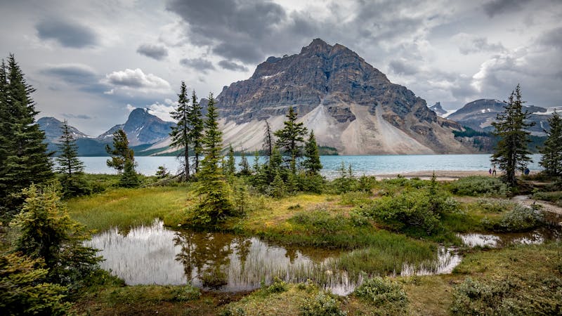
The perfect day hike to avoid the crowds and experience the very best of the Icefields Parkway.
Hiking Severe

Hiking on the Icefields Parkway is always a magical experience. This is the perfect place to avoid the crowds and take in the exceptional scenery.
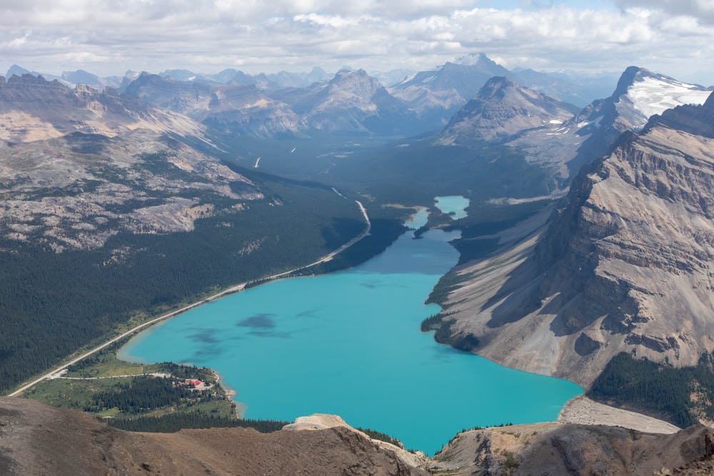
I've done many hikes around here and this is one of my favourites. There's some incredible views all along the trail that will keep you distracted on the long approach to the summit.
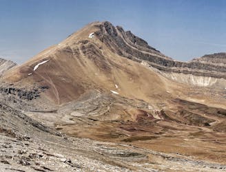
The trail starts at the Bow Lake parking lot and follows the Bow falls trail. This is a very popular trail, however; you will soon leave the crowds behind as you turn off the main trail to head up Jimmy Simpson.
The trail here isn't very well defined and can be a little hard to follow, so make sure you have the map downloaded to keep yourself on track.
The route through the treeline is steep and loose, there is also some exposure on the upper sections as you traverse across cliff bands. You may have to do a little bit of scrambling here.
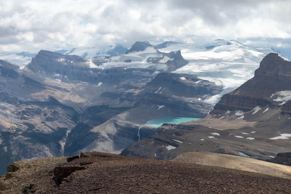
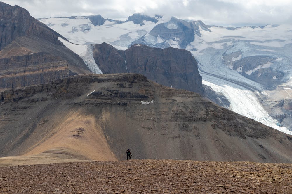
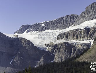
Above the treeline, you can enjoy some of the marvellous views you find on this trail. Looking back towards Bow Falls, you will now be able to see the stunning Iceberg Lake and the Bow Glacier.
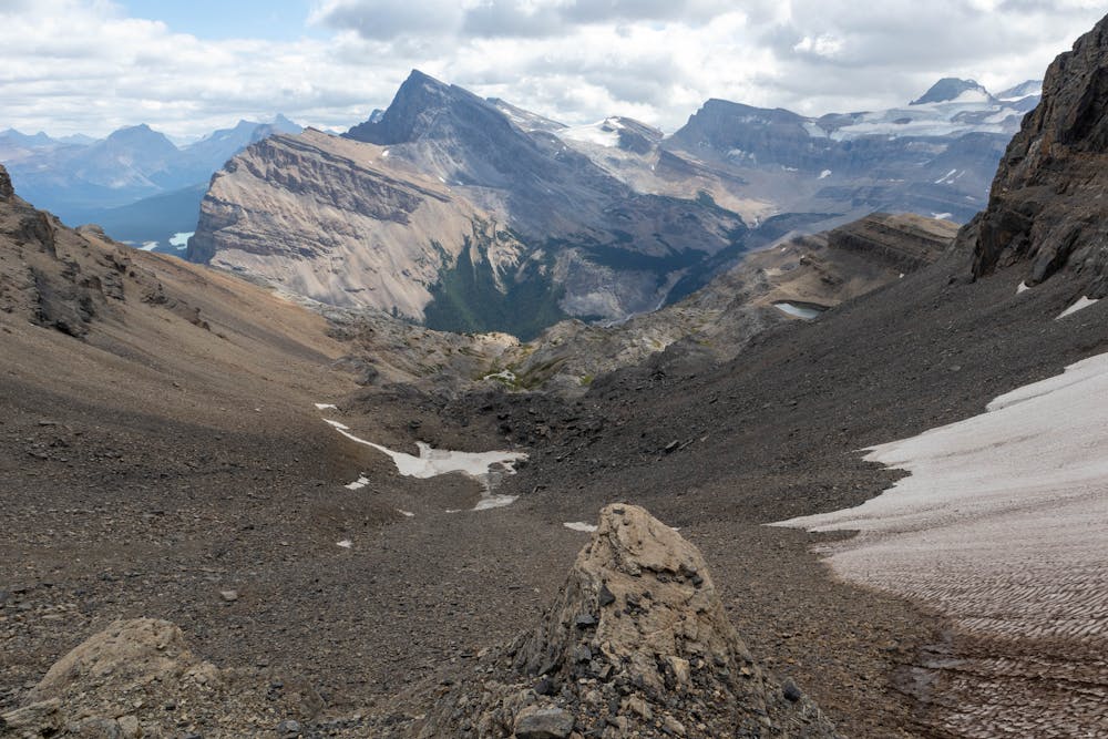
The ascent up to the col is the crux of this route. It's a steep climb on a mix of loose scree and rocks. Choosing a good line here will save you a significant amount of time. There are a few rock ledges to climbers left of centre, I found the easiest way up was to zig-zag through here, avoiding the worst of the scree.
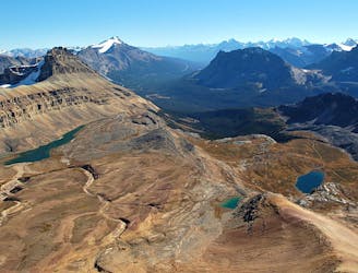
From the col, it's a straightforward hike to a magnificent view from the summit. This is a breath-taking summit panorama - you can see an abundance of spectacular lakes and glaciers from here.
The biggest challenge with this trail is the route-finding and exposure. It's really for experienced hikers who don't have a fear of heights and are comfortable with simple scrambling and loose scree.
Severe
Hiking challenging trails where simple scrambling, with the occasional use of the hands, is a distinct possibility. The trails are often filled with all manner of obstacles both small and large, and the hills are very steep. Obstacles and challenges are often unexpected and can be unpredictable.

Some trail sections have exposed ledges or steep ascents/descents where falling could cause serious injury.
Little chance of being seen or helped in case of an accident.
2.4 km away
Popular hike to a photogenic lake, plus an extension to get higher and farther into the backcountry.
Moderate Hiking
2.5 km away
A unique hike on the Icefield Parkway
Severe Hiking
2.5 km away
The popular hike to Helen Lake can be extended with this straightforward scramble to the peak overhead.
Extreme Hiking
4.8 km away
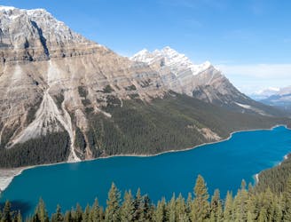
A fantastic day hike with picturesque lakes and stunning glaciers.
Difficult Hiking
5 routes · Hiking