3.9 km away
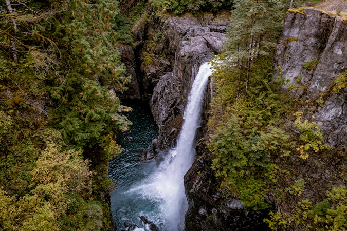
Comox Lake: Falls and Overlook

Hike to a hidden waterfall and a stunning overlook of Comox Lake.
Difficult Hiking
- Distance
- 1.8 km
- Ascent
- 191 m
- Descent
- 191 m
The most popular hike in Cumberland Forest.
Hiking Moderate

The hike to China Pots is one of the most popular hiking routes in the Cumberland Forest. This mellow 3.2-mile round-trip jaunt is a great leg-stretcher leading to a fantastic destination without requiring an epic adventure (like many hikes in BC).
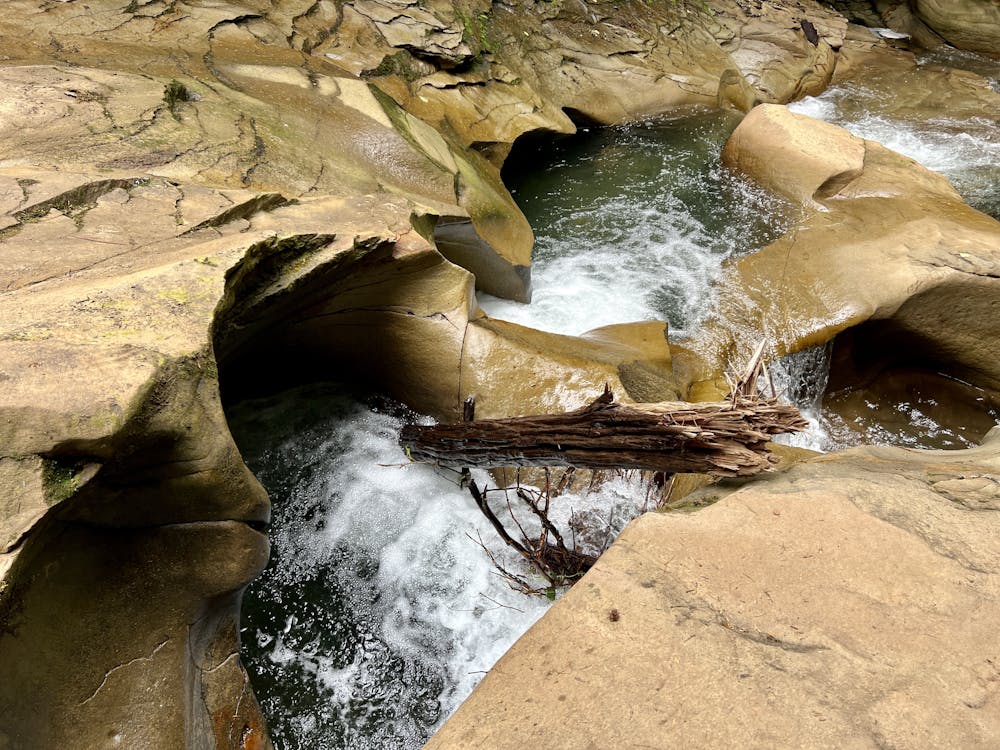
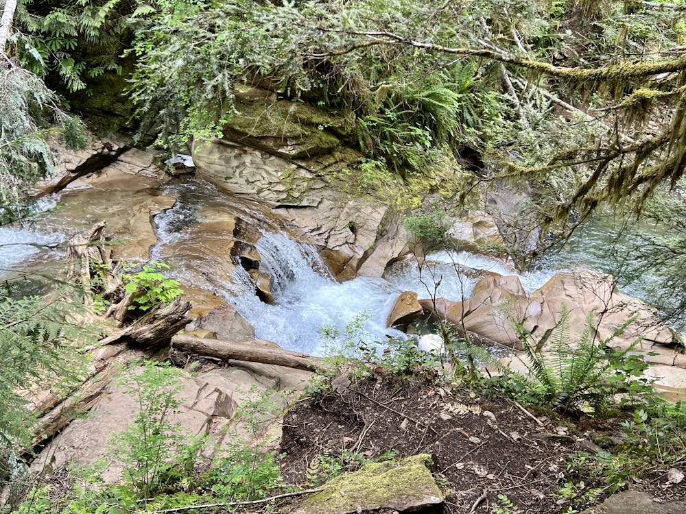
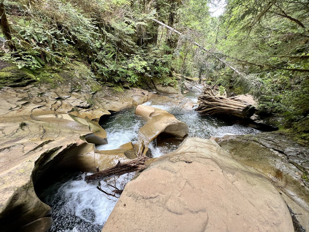
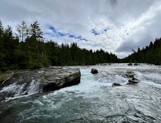
The destination is the "China Pots," which are hollowed-out holes in slabs of rock that Perseverance Creek flows over and through. The water swirls in the pots before cascading down to the next ledge and the next set of pots, making for a visually surreal experience. It's a great spot to sit on the bank of the stream and soak in the incredible natural beauty of this British Columbia rainforest!
The hike to get there is quite achievable. It begins by following the Mama Bear trail, which is a mellow walk that doesn't see much bike traffic. This is notable, as Cumberland Forest is an exceedingly popular mountain bike destination. If you're coming from out of town and aren't familiar with how popular these trails are with mountain bikers, you'll be amazed by the streams of cyclists going in and out of the forest. However, this hike avoids most of the cycling crowds.
Once off of Mama Bear, you'll connect to The Pig trail, which is the original technical mountain bike trail in the forest. However, due to its location and old-school nature, it doesn't see nearly as many riders as other newer trails in the trail system. You can still enjoy a beautiful hike through this deep, dark section of forest, where the trees have been allowed to grow older and taller.
From where The Pig hits the dirt road, take a right, and then take a right down an unmarked trail next to the stream to hike over a rise and then down to the stream. There are a couple of different spots where you can access the China Pots. However, note that this final ascent and descent to the stream is steep, rooted, and can be quite slippery. The difficulty of this short final section is not considered in the "Moderate" FATMAP difficulty assigned to this hike.
Once done enjoying the serenity of the China Pots, you can either return to your car the same way you came or chart a different route through the complex trail system here in Cumberland Forest.
Moderate
Hiking along trails with some uneven terrain and small hills. Small rocks and roots may be present.

The path is on completely flat land and potential injury is limited to falling over.
Close to help in case of emergency.
3.9 km away
Hike to a hidden waterfall and a stunning overlook of Comox Lake.
Difficult Hiking
6.9 km away
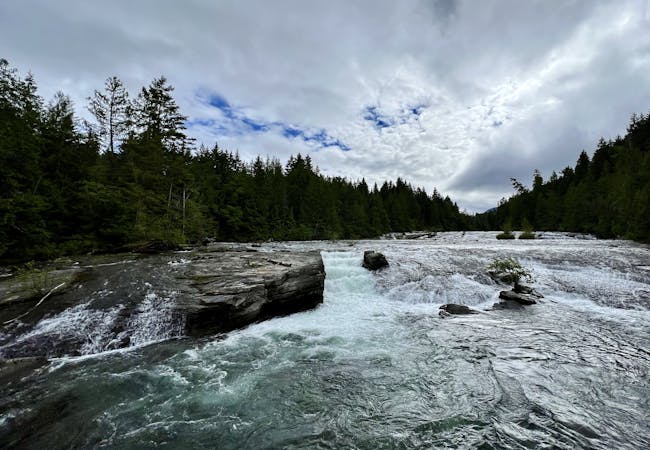
Enjoy Nymph Falls: a lengthy series of small cascades where the Puntledge River flows over undulating rock slabs.
Easy Hiking
3 routes · Hiking
4 routes · Hiking