3.9 km away
China Pots
The most popular hike in Cumberland Forest.
Moderate Hiking
- Distance
- 5.2 km
- Ascent
- 138 m
- Descent
- 138 m
Hike to a hidden waterfall and a stunning overlook of Comox Lake.
Hiking Difficult

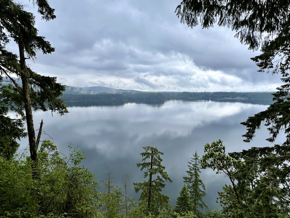
Comox Lake Park is one of the sparkling gems in Cumberland's crown. This small park and campground is nestled on the shores of the gorgeous Comox Lake and provides a fantastic place to camp, swim, paddle, rock climb, and there are even a few beautiful trails to hike.
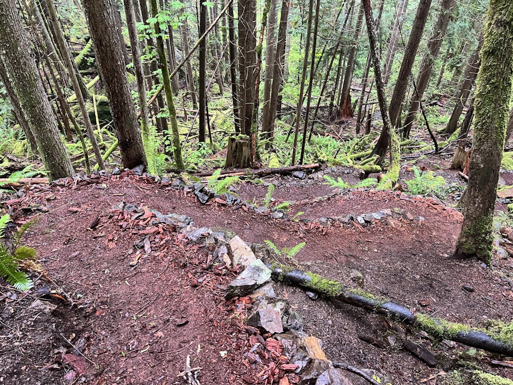
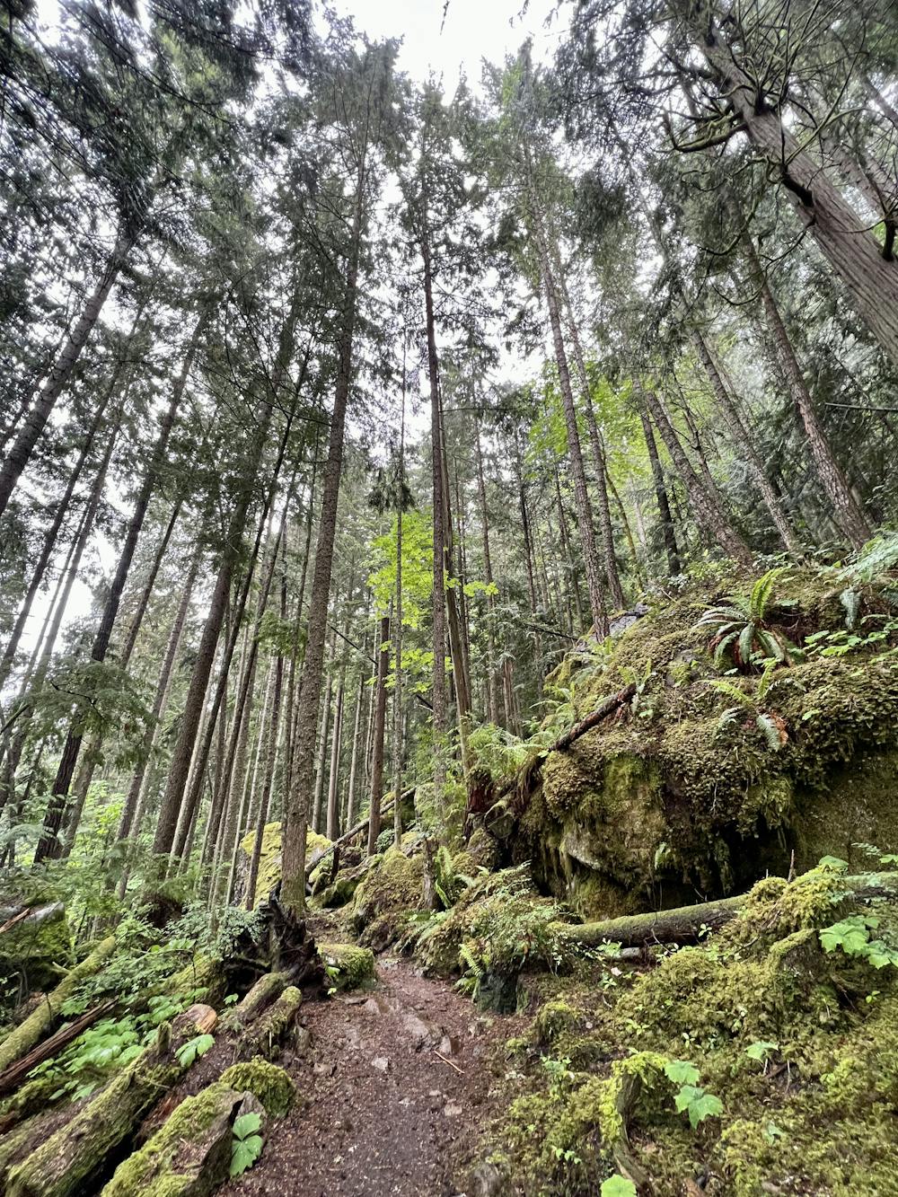
The most popular hike at Comox Lake begins directly from the large parking area and heads toward the steep mountainside between the park and the lake. There are several (mostly unmarked) trails stretching along this expanse. Most of them function primarily as access routes to reach bouldering problems and rock climbing routes on the cliffs and boulders hidden beneath the towering canopy of the rainforest.
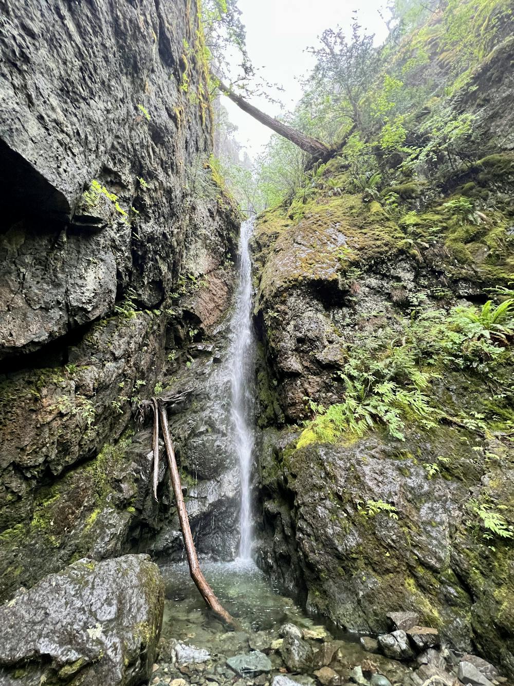
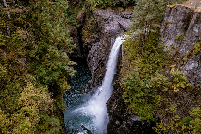
If you carry along and up to the right (reference this map and be sure to download it for offline navigation), you can take a left turn and head steeply uphill to reach a narrow but tall waterfall cascading down a notch in the cliff face. This hidden waterfall is a beautiful destination and is popular with the locals.
While the trail to reach the falls is short, well-trod, and has seen some recent trail work, it still isn't easy. The climb is steep and strenuous, negotiating sharp switchbacks, slippery rocks and roots, staircases, and more. The upper reaches are less-developed, and slipping and falling is a very real possibility. That said, due to the short distance, most people will be able to make it to the falls.
For a longer adventure, retrace your steps down from the falls and take a left to continue following the traverse trail. Take another few left turns, and you'll begin to climb steeply uphill again. This ascent is rougher and less maintained than the climb to the falls, making for another stiff climb.
But the payoff is worth it: you'll soon reach an opening in the trees on top of a cliff that affords breathtaking views of Comox Lake below you and the mountains in the distance. Be sure to sit down and soak in this stunning view—it's well-worth savoring!
To return to your car, you can follow the traversing trail all the way back. Or, for an easier return trip, before you reach the falls you can turn off and drop down to the group campsite and then walk along the gravel road to return to the parking lot.
Difficult
Hiking trails where obstacles such as rocks or roots are prevalent. Some obstacles can require care to step over or around. At times, the trail can be worn and eroded. The grade of the trail is generally quite steep, and can often lead to strenuous hiking.

Some trail sections have exposed ledges or steep ascents/descents where falling could cause serious injury.

Away from help but easily accessed.
3.9 km away
The most popular hike in Cumberland Forest.
Moderate Hiking
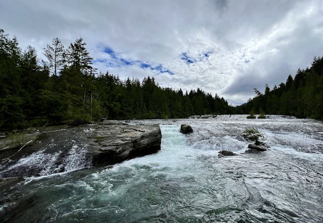
5 km away
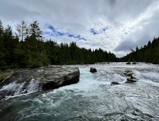
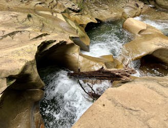
Enjoy Nymph Falls: a lengthy series of small cascades where the Puntledge River flows over undulating rock slabs.
Easy Hiking
3 routes · Hiking
4 routes · Hiking