1 m away
Sea to Summit Trail
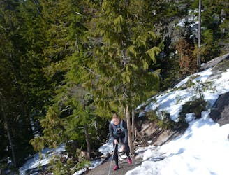
Grunty climb with Howe Sound vistas and a gondola download.
Difficult Hiking
- Distance
- 8.2 km
- Ascent
- 940 m
- Descent
- 98 m
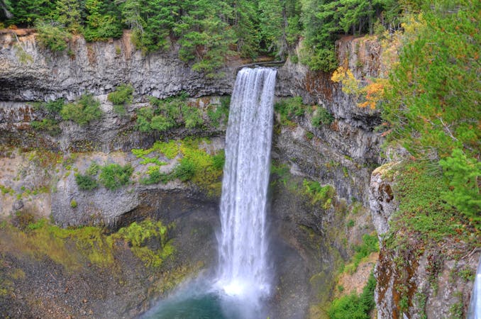
One of the tallest waterfalls in British Columbia—a stunning 335m cascade!
Hiking Easy

There’s absolutely nothing challenging about reaching the lower viewpoint of Shannon Falls and yet, this waterfall is a sight to behold! A short walk on a paved path will bring visitors to a view of the stunning 335-meter-tall cascade that plummets down the steep mountainside. Shannon Falls’ 335m height makes it one of the tallest waterfalls in all of British Columbia!
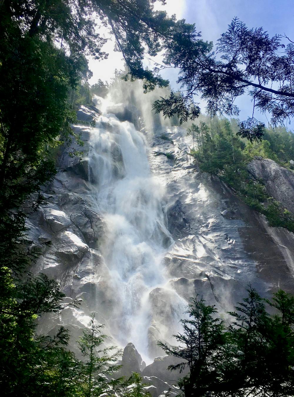
Shannon Creek that forms Shannon Falls “originates from the alpine massif below Sky Pilot Mountain and the Stadium Glacier,” and then it tumbles “over granite cliffs to the valley below,” according to ExploreSquamish.com.
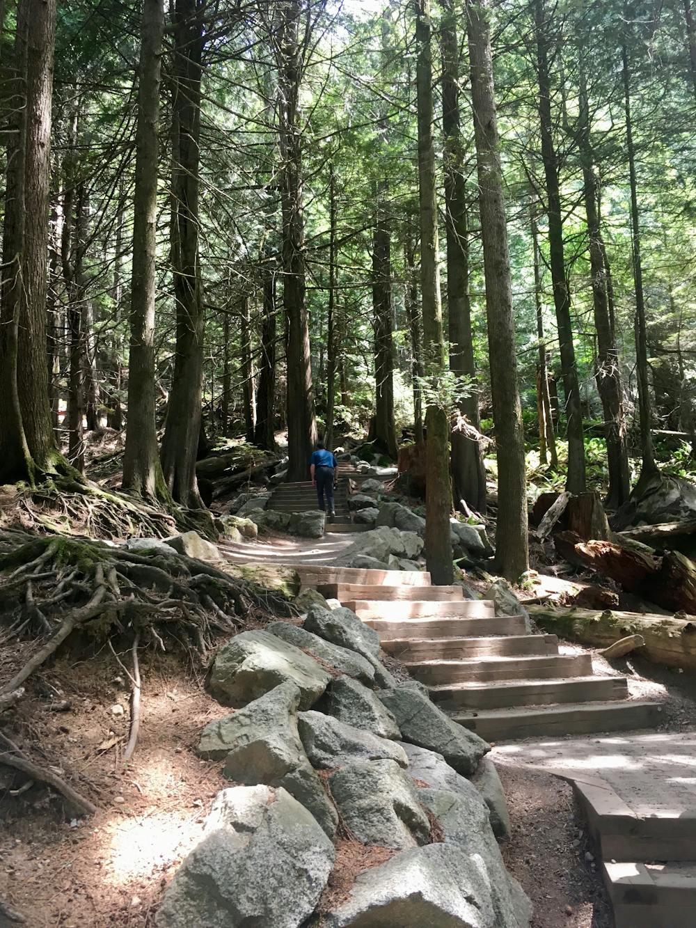
If you choose to extend your hike, continue heading uphill on the well-maintained trail. While you’ll have to ascend large, built-up steps, the trail offers an easy hike through the massive old growth forest to a higher viewpoint.
If you want to tackle a more significant hike, you can easily connect from these well-maintained trails to other more natural hiking routes in the area. The Sea to Summit Trail, which climbs all the way to the top of the gondola, begins in the exact same spot, splitting off from the Shannon Falls Trail. Be forewarned: the climb up the Sea to Summit Trail is a true challenge, and requires adequate preparation!
But don’t worry if you don’t want to climb the Sea to Summit—you can simply bask in the stunning natural glory of Shannon Falls!
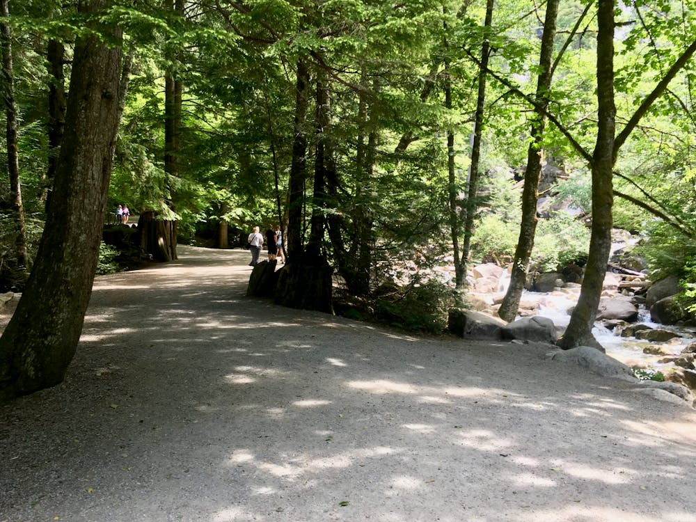
Easy
Walking along a well-kept trail that’s mostly flat. No obstacles are present.

The path is on completely flat land and potential injury is limited to falling over.
Close to help in case of emergency.
1 m away
Grunty climb with Howe Sound vistas and a gondola download.
Difficult Hiking
3 routes · Hiking
18 routes · Hiking