6.5 km away
The Rockwall: Helmet Creek to Helmet Falls
Hike to a backcountry campground near a huge, double-forked waterfall along The Rockwall trek.
Moderate Hiking
- Distance
- 8.2 km
- Ascent
- 408 m
- Descent
- 154 m
With steep switchbacks at either end, this stage undulates through larch groves and meadows, and passes the only gap in the Rockwall.
Hiking Difficult

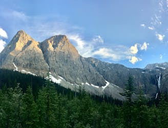
If you began the trek via Helmet/Ochre Junction, then you are hopefully warmed up and feeling fit, because the work starts just after Helmet Falls Camp. The day begins with steep switchbacks to climb out of the Helmet Creek drainage. Through the trees you’ll see the Rockwall ahead, looming ever larger as you get higher and closer.
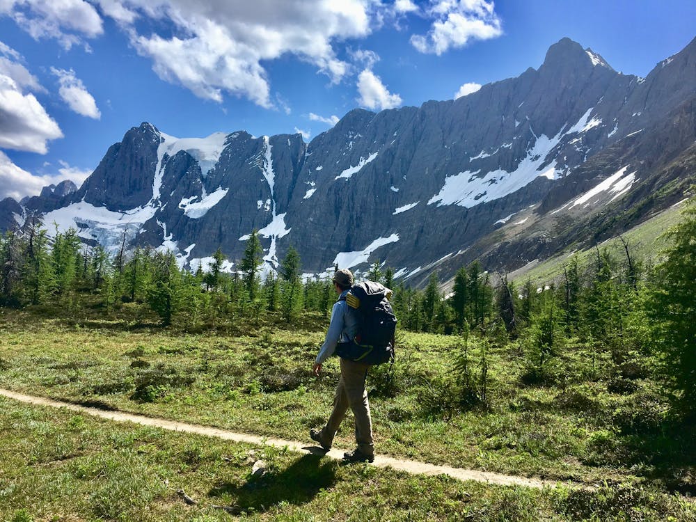
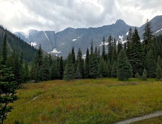
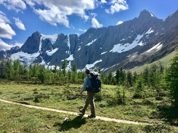
The trail then crosses a plateau beneath Limestone Peak, which is part of the Rockwall. The gradient lessens, and the forest thins into meadows and larch groves, granting better views of the surroundings. The plateau soon dips in elevation and the trail enters a broad, rocky basin where it crosses the outlet of a small lake. Next comes another tough climb (not super steep, but rather long) to reach Rockwall Pass, going above treeline and crossing wide-open alpine meadows.
After Rockwall Pass comes the only break in the Rockwall, at a gap called Wolverine Pass. A side trail leads there and exits Kootenay National Park, but the trail to Tumbling Creek continues up and over another shoulder, then into the next drainage to the south. There it re-enters the forest and switchbacks down to camp.
Sources: https://www.pc.gc.ca/en/pn-np/bc/kootenay/activ/arrierepays-backcountry https://mountaincathedrals.wordpress.com/2016/11/13/the-rockwall-trail-part-2-rockwall-pass-and-tumbling-creek/
Difficult
Hiking trails where obstacles such as rocks or roots are prevalent. Some obstacles can require care to step over or around. At times, the trail can be worn and eroded. The grade of the trail is generally quite steep, and can often lead to strenuous hiking.

The trail contains some obstacles such as outcroppings and rock which could cause injury.

Little chance of being seen or helped in case of an accident.
6.5 km away
Hike to a backcountry campground near a huge, double-forked waterfall along The Rockwall trek.
Moderate Hiking
7.9 km away
Between Tumbling and Numa Creek camps you’ll cross steep avalanche slopes and a high pass with breathtaking views of the Rockwall.
Difficult Hiking
6 routes · Hiking