4.9 km away
The Rockwall: Numa Creek to Floe Lake
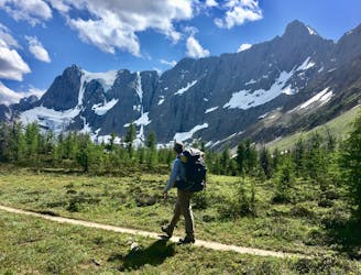
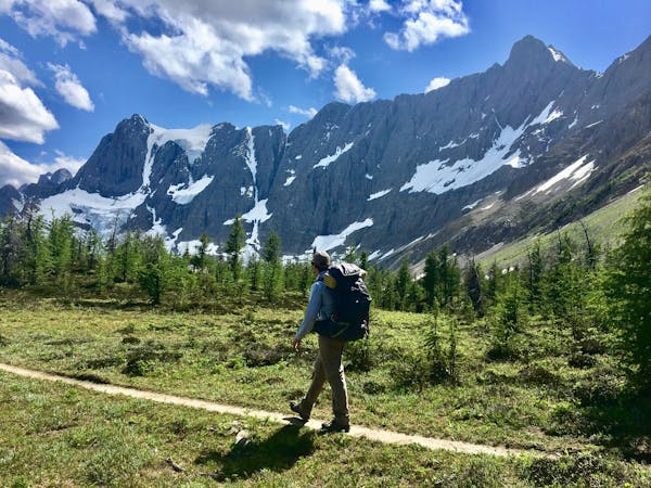
Up and over Numa Pass, the highpoint of the Rockwall Trek.
Difficult Hiking
- Distance
- 9.4 km
- Ascent
- 811 m
- Descent
- 318 m
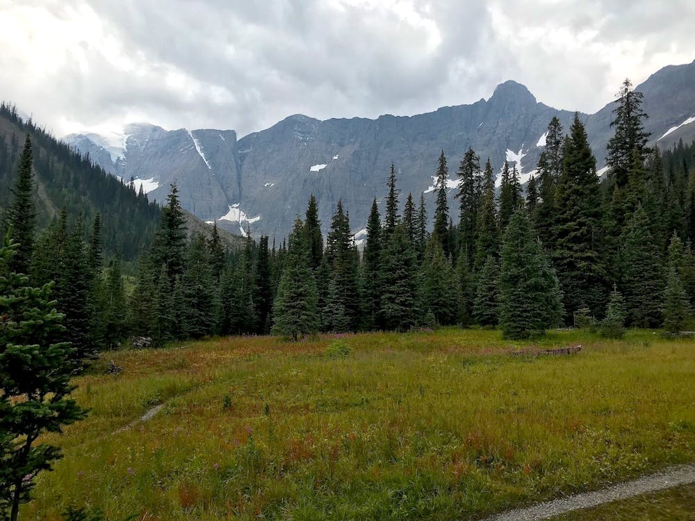
Between Tumbling and Numa Creek camps you’ll cross steep avalanche slopes and a high pass with breathtaking views of the Rockwall.
Hiking Difficult

This segment is approximately the middle of the Rockwall trek. On a typical 4-day itinerary, Numa Creek is the second night’s camp, whether hiking northbound or southbound. Thus, it’s popular and should be booked far in advance if possible. It’s a rather spacious campground, however, and even when full, it’s a comfortable place to spend the night.
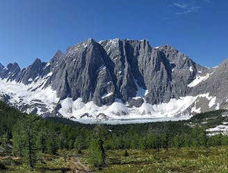
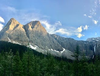
If hiking southbound, you’ll cross Tumbling Creek and begin climbing to another high pass. The gradient lessens eventually, and you’ll stroll among larches and wildflowers while enjoying one of the best views yet. Below lies an expansive rocky plain with blue-gray lakes and glaciers clinging to the base of the towering Rockwall.
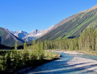
When the trail turns downhill, it’s gradual at first, but doesn’t stay that way. You’ll cross a small creek then go uphill for a bit, before turning dramatically downhill toward Numa Creek. The steep descent crosses several avalanche paths, sometimes in the barren chutes but usually among an assortment of berry bushes. Look for the edible ones and watch out for bears. A final stretch of flatter terrain in the forest brings you to camp.
Sources: https://www.pc.gc.ca/en/pn-np/bc/kootenay/activ/arrierepays-backcountry https://www.inafarawayland.com/rockwall-trail-guide/ https://peanutbutterkait.wordpress.com/2017/09/10/hike-rockwall-trail-day-2/
Difficult
Hiking trails where obstacles such as rocks or roots are prevalent. Some obstacles can require care to step over or around. At times, the trail can be worn and eroded. The grade of the trail is generally quite steep, and can often lead to strenuous hiking.

The trail contains some obstacles such as outcroppings and rock which could cause injury.

Little chance of being seen or helped in case of an accident.
4.9 km away
Up and over Numa Pass, the highpoint of the Rockwall Trek.
Difficult Hiking
6.1 km away
Hike to a backcountry campground near a huge, double-forked waterfall along The Rockwall trek.
Moderate Hiking
7 km away
An easy overnight backpacking trip, or one end of the difficult Rockwall trek.
Moderate Hiking
7.9 km away
With steep switchbacks at either end, this stage undulates through larch groves and meadows, and passes the only gap in the Rockwall.
Difficult Hiking
9.4 km away
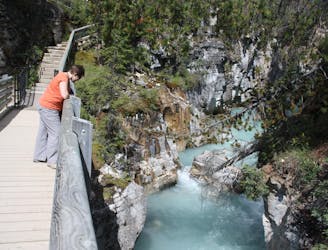
Walk along a remarkably narrow gorge flowing with water.
Easy Hiking
6 routes · Hiking
5 routes · Hiking