9.4 km away
Myra Bailout
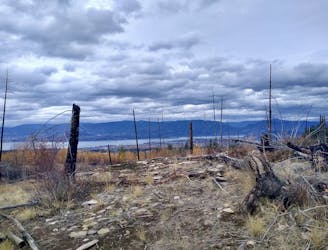
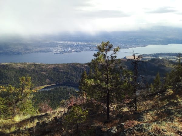
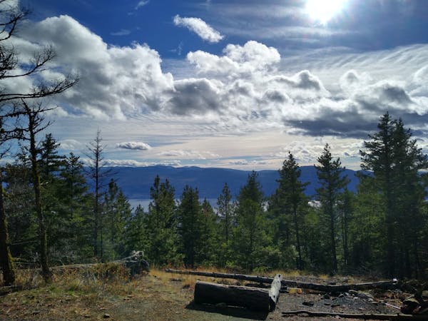
One of the longest and best loops at Crawford - this trip is all about the journey and the views.
Moderate Mountain Biking
- Distance
- 25 km
- Ascent
- 845 m
- Descent
- 845 m
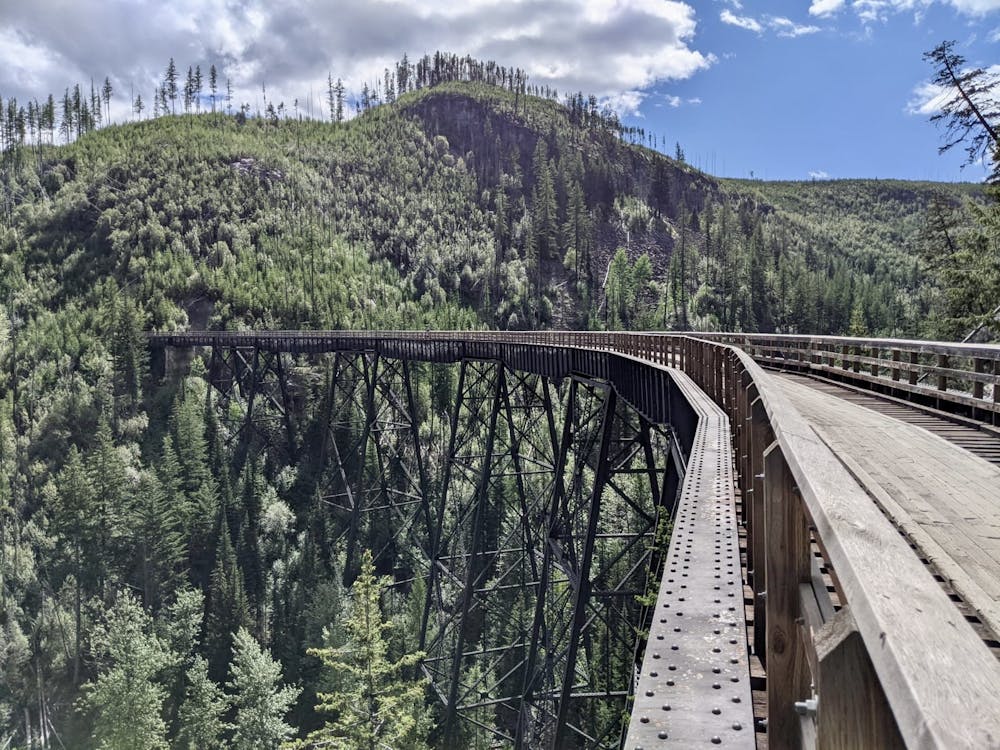
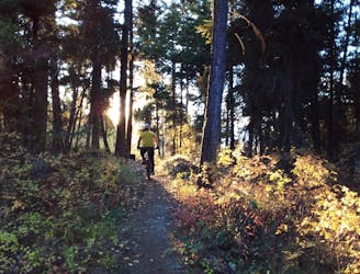
Kelowna's most famous easy ride is well worth the hype!
Mountain Biking Easy

Easy bike rides really don't get any better than this - a smooth track links 2 well equipped parking lots, and passes over some spectacular bridges.
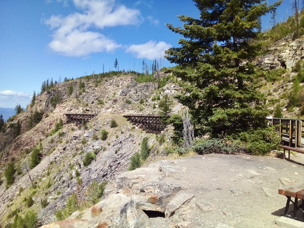
This route can be done in either direction but is more popular the way it's drawn here - starting at Myra parking lot and going to Ruth Station. Myra parking lot can be reached in most vehicles via a well maintained forest service road. If you're driving a low clearance car the road might be impassable, but any standard sedan should get up there fine.
Once at the parking lot there are several useful information signs and a bike hire service too, so you don't even need to bring your own bike!
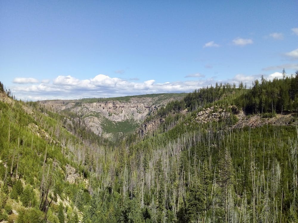
The ride itself is virtually flat for its entire length, and the only things to be aware of are your fellow riders and the occasional big drops next to the trail. The trestles (bridges) for which the ride is so famous are utterly spectacular, and a testament to the determination with which western Canada was settled by the pioneers. Trestle number 6 is the longest, highest and best known of all, and sweeps around a deep canyon which will induce butterflies in the stomach of anyone who peers over the edge!
Once at Ruth station, turn about face and retrace your steps back to Myra. On the way back you'll notice a few information boards along the trail which are much more visible in this direction than when coming from Myra. Taking the time to read these is highly recommended as the trestles and the canyon which they inhabit are fascinating.
Easy
Mostly smooth and non-technical singletrack with unavoidable obstacles 2in/5cm tall or less. Avoidable obstacles may be present. Ideal for beginner riders.

The trail contains some obstacles such as outcroppings and rock which could cause injury.
Away from help but easily accessed.
9.4 km away
One of the longest and best loops at Crawford - this trip is all about the journey and the views.
Moderate Mountain Biking
9.4 km away
Crawford's longest ascent leads to one of its fastest descents!
Difficult Mountain Biking
9.4 km away
A wonderful loop linking some of Crawford's best trails
Difficult Mountain Biking
5 routes · Mountain Biking
7 routes · Mountain Biking · Hiking