Kager Lake Loop
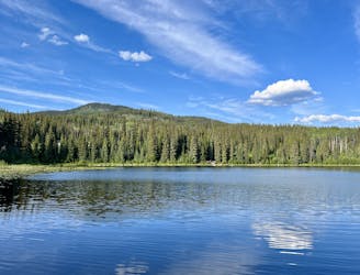
A scenic beginner ride around Kager Lake.
Easy Mountain Biking
- Distance
- 2.8 km
- Ascent
- 65 m
- Descent
- 65 m
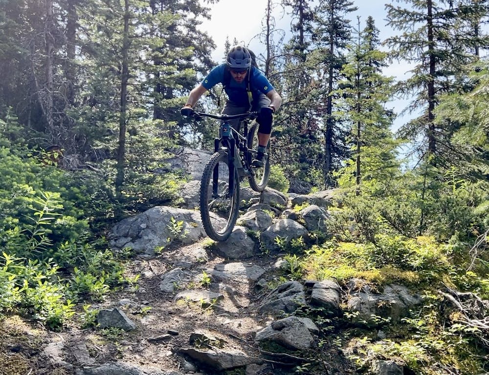
A full-blooded all-mountain loop with steep climbing and ripping descending.
Mountain Biking Severe

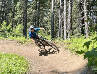
This 16-mile loop through the Boer Mountain trail system is an all-mountain ride of the first degree. You'll climb a burly 2,500 vertical feet along this route, but that climbing yields just as much descending on fantastic singletrack ranging from smooth to gnarly.
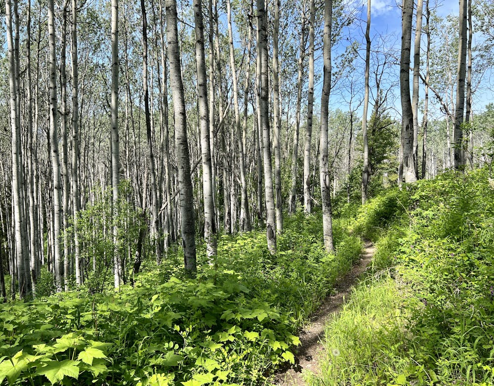
The route begins from the main Kager Lake trailhead, connecting to the Razorback Trail via Pumba. Razorback is far from the easiest way to get up the mountain, but it's definitely one of the most entertaining. This two-way trail also serves as a great descent off the mountain, thanks to a variety of technical rock gardens, flowy berms, jumps, and more. However, it also functions as a good way to get up to the top, and it sees much less traffic than some of the other trails in the Boer Mountain trail system.
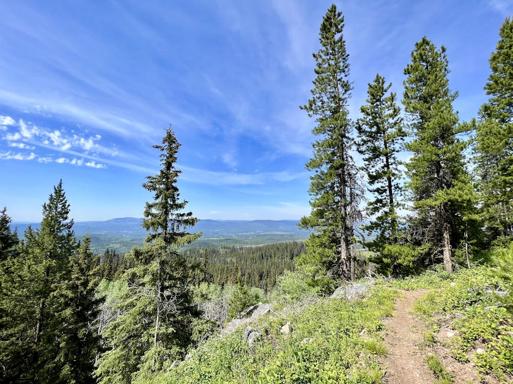
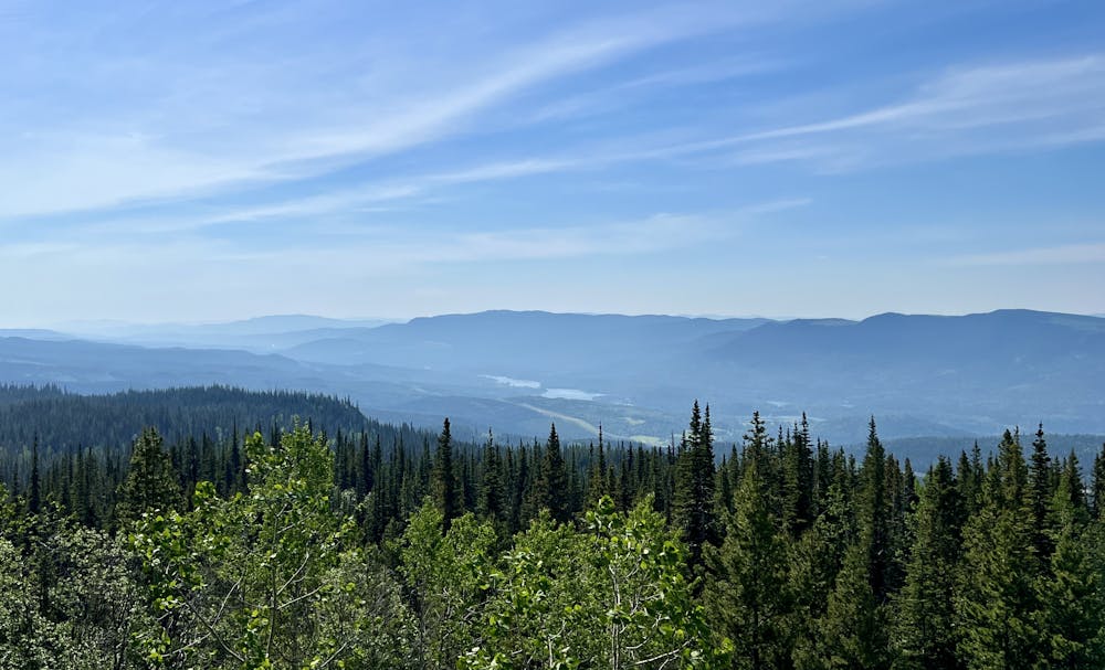
Once at the top of the mountain, take some time to soak in the incredible views across Central BC. You might be impressed by how far you've climbed to get here!
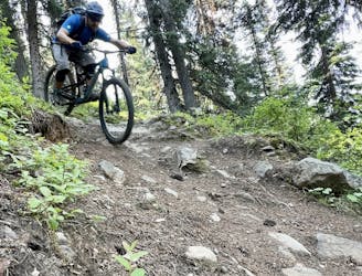
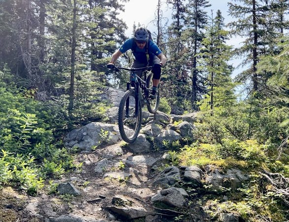
The Pigasus trail begins to the right of the towers. The first section of the descent features rocky, technical switchbacks with some spicy lines in hairpin turns. You'll be put through the wringer immediately on the steep upper sections of the mountain.
This "descending" trail features plenty of fantastic downhill ripping, but it will definitely throw a few punchy climbs at you, especially in the first few miles after the initial drop off the summit. Don't be surprised—here's that promised all-mountain character! The pedally section leads over to a different mountain slope that feels quite isolated from the center of the trail system, providing an enjoyable out-there feeling.
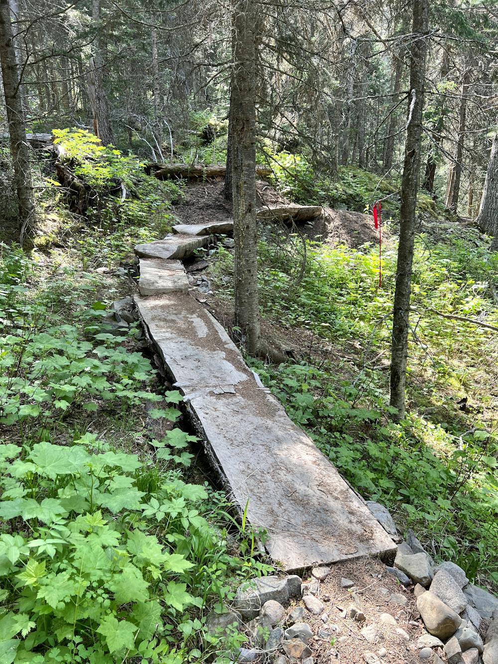
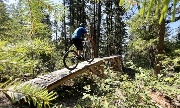
After some up-and-down pedaling through beautiful terrain, you'll be challenged by a few stiff rock gardens and then finally drop into the bulk of the descent. After the technical rock gardens up high, the majority of the descent actually rips down flowy, narrow singletrack that swoops through the forest. The sinuous trail swoops and flows along the mountainside, with a few natural-style hits providing optional airtime. After all of the built-up jumps and features in the center of the trail system, this classic singletrack experience is a wonderful change of pace.
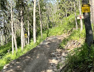
Pigasus dumps out at the bottom of the bike park, giving you the option to pedal short laps on these feature-filled trails. Or, if you've had enough already, take the Conveyor Belt trail to Pork Grind (despite their grisly names) to return to Kager Lake.
Severe
Widely variable, narrow trail tread with steeper grades and unavoidable obstacles of 15in/38cm tall or less. Obstacles may include unavoidable bridges 24in/61cm wide or less, large rocks, gravel, difficult root sections, and more. Ideal for advanced-level riders.

The trail contains some obstacles such as outcroppings and rock which could cause injury.
Away from help but easily accessed.
A scenic beginner ride around Kager Lake.
Easy Mountain Biking
2 m away
A fantastic, varied descent mixing tech with flow.
Difficult Mountain Biking
2.2 km away
A fantastic advanced jump line at Boer Mountain.
Severe Mountain Biking
2.2 km away

The OG trail on Boer Mountain is a true technical testpiece!
Severe Mountain Biking
2.2 km away
A signature downhill flow trail built by Gravity Logic.
Moderate Mountain Biking
6 routes · Mountain Biking
8 routes · Mountain Biking