
Mount des Poilus
A classic objective from the Guy Hut
Difficult Ski Touring
- Distance
- 5.8 km
- Ascent
- 661 m
- Descent
- 661 m
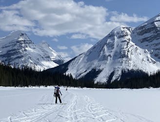
A wild and scenic trip to the head of the Poilus Glacier
Ski Touring Difficult

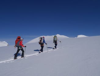
This is a fabulous but deceptively long trip up the Poilus Glacier to a subpeak of Mount des Poilus itself. The objective hazards are lower than on Mount des Poilus but there is still some cornice danger to be managed when you pass under the mountain's north face.
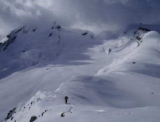
Start out by skiing a couple of fun little faces immediately north-west of the Guy Hut which lead to the Poilus Glacier. In bad weather, these mini faces are worth lapping on their own, but they're steep enough to be capable of avalanching - don't be lulled into a false sense of security by their proximity to the hut!
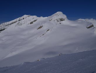
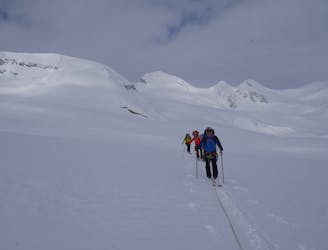
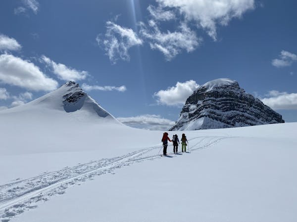
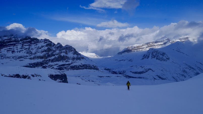
Once on the glacier it's a long but scenic pull up towards your objective for the day. The trip up the glacier feels flat but it's actually just about steep enough that you can ski down it on the way back to the hut provided you have the right conditions. Keep on trucking and you will - eventually - find yourself climbing more steeply up the glaciated slopes to the north-east of Mount des Poilus. The north face of the mountain has been the scene of several fatal accidents so give it - and its huge cornices - a wide berth.
Keep skinning up beneath a rocky buttress on the right and then swing around to its left and climb up to the corniced ridge directly north of Mount des Poilus. The ridge itself should be treated with caution due its cornices, so - if in doubt - stop a few metres short of the ridge crest itself.
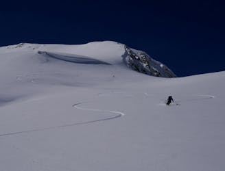
Rip skins off and enjoy a fun, flowing descent back to the Glacier des Poilus. Blast across this (possibly by skiing down your skin track) and then climb back up to the hut. If condition are not conducive with going directly back to the hut then it's possible to follow a ramp line just to the south of the hut and using this to make the re-ascent.
Difficult
Serious gradient of 30-38 degrees where a real risk of slipping exists.

As well as the slope itself, there are some obstacles (such as rock outcrops) which could aggravate injury.

Little chance of being seen or helped in case of an accident.
A classic objective from the Guy Hut
Difficult Ski Touring
14 m away
A stunningly positioned peak which can be reached from a number of start points
Difficult Ski Touring
17 m away
A short but breathtaking tour to a summit in the heart of the Wapta
Difficult Ski Touring
23 m away
A day which takes in wild, remote terrain and some fabulous skiing.
Difficult Ski Touring
7.5 km away
A long and rewarding trip which can be split with a night at the Scott Duncan hut.
Difficult Ski Touring
9.4 km away
A long, wild and adventurous journey to a spectacularly positioned hut
Difficult Ski Touring
4 routes · Ski Touring
4 routes · Ski Touring