7.5 km away
Guy Hut to Balfour Hut via Mount Gordon's West Face
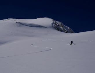
A day which takes in wild, remote terrain and some fabulous skiing.
Difficult Ski Touring
- Distance
- 13 km
- Ascent
- 859 m
- Descent
- 1 km
A long and rewarding trip which can be split with a night at the Scott Duncan hut.
Also in Alberta, Canada
Ski Touring Difficult

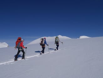
Covering a large distance, 2 ascents and descents and every type of terrain from crevasse fields to forests and frozen lakes, this is a wonderful route. There is some hazard from large, snow-laden overhead slopes on the journey down the Sherbrooke valley so only commit to the descent if conditions are right. The Scott Duncan Hut - situated just north-west of Mount Daly - was built so that skiers would have the choice of doing this route in one go or breaking it up if conditions dictated it.

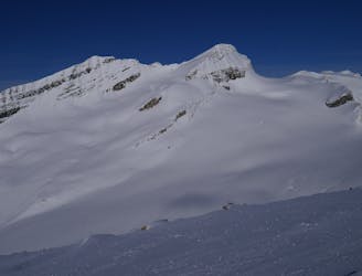
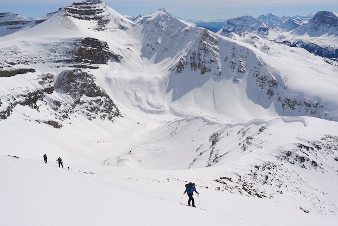
The day begins with a gradual climb over Balfour Creek and up onto the heavily crevassed glacier beneath Mount Balfour's east face. The east face itself is home to some huge and scary seracs, and these present the greatest objective hazard of the day. Serac fall is related more to glacial movement than temperature so starting in the cold of the early morning doesn't provide much safety from the risk of serac collapse. The best thing you can do is climb towards the seracs, grab a drink just before you get into their fall line, and then skin as fast as you can until you're out of harm's way. Once clear of the serac it's an easy and scenic skin up to the col which links the Balfour basin with the Waputik Icefield.
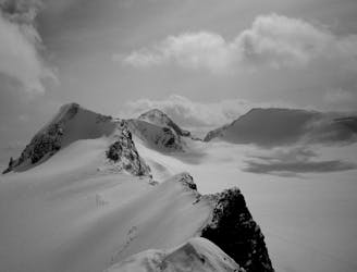
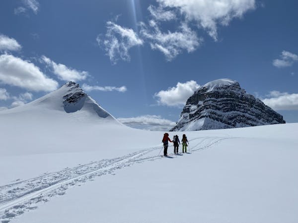
The col enjoys a huge view across hundreds of Rockies peaks, so take some time to enjoy the panorama - it is truly spectacular. Having taken it all in, continue to enjoy it as you make the fun and fast trip down the Waputik Icefield. With a bit of pushing and poling you can get past the Scott Duncan hut and down to a flat spot north-west of Mount Daly. Put skins back on and climb easily up to another spectacular col, this time between Mounts Daly and Niles.
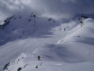
From here there are 2 options - either descending down the guts of the Sherbrooke valley, or following our line and descending the Schiesser-Lomas route which wraps around Mount Niles. The option straight down the valley has significant objective hazard from the huge west-facing slopes above it, and the frequency of accidents on the descent was the main reason that the Scott Duncan hut was built (because it enabled skiers to descend the valley early in the morning before the west facing slopes had heated up). The Schiesser-Lomas route, on the other hand, is accessed via some steeper (and, in the right conditions, avalanche-prone) slopes but doesn't have much objective hazard once you're established on it. On balance, the Schiesser-Lomas route is probably safer overall, but careful consideration of both options is required before you make a decision.
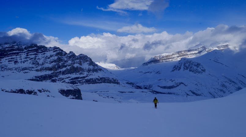
To access the Schiesser-Lomas route, hold a high traverse across the east face of Mount Niles to reach a shelf beneath the crevassed south ridge of the mountain. The traverse over to the shelf is probably the most dangerous part of the descent avalanche-wise, so space out and only do it if conditions are right. Once established on the shelf, follow it down to where it wraps around Mount Niles' south ridge. The ridge has some impressive cornices but it's easy enough to stay away from them by skiing on the left side of the shelf.
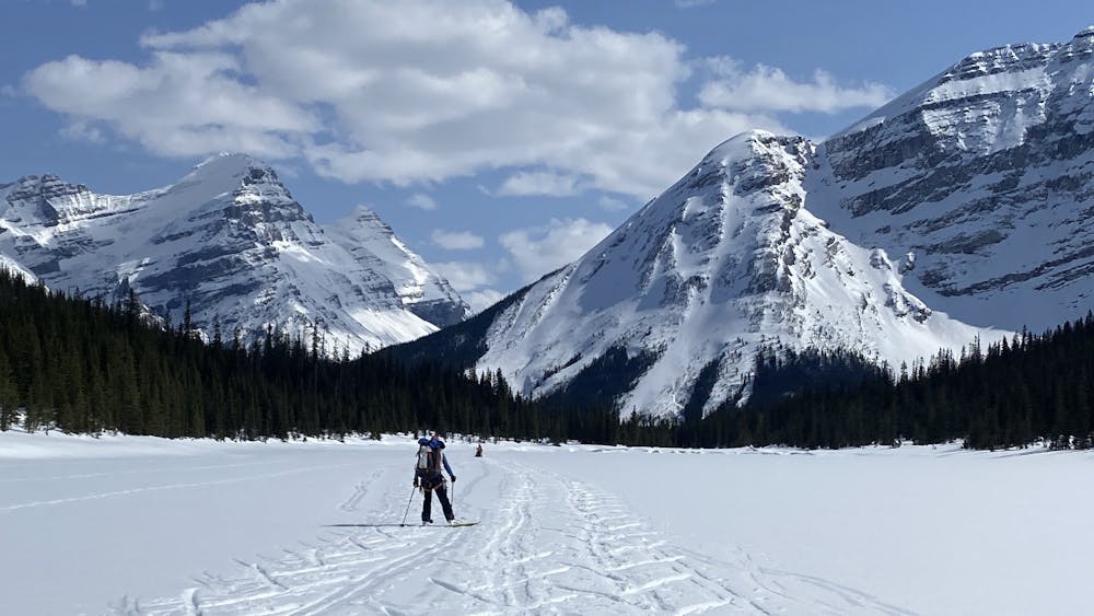
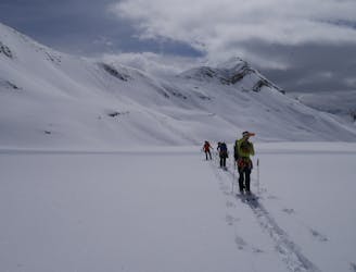
Follow the terrain intuitively as it swings around the ridge and begins to funnel you down towards the trees. Once in the trees, follow one of several gullies which lead down to Sherbrooke Creek. Follow this easily, with the occasional tricky section, all the way to the flats just north of Sherbrooke Lake. Cross these and then the lake itself, which should be frozen roughly until the end of April. The skate/pole across the lake is pretty tedious but the thought of burgers and beers in Lake Louise should maintain your morale!
Once clear of the lake there's an awkward section of shuffling/poling/sidestepping in the forest before a final whoop down to the Great Divide Lodge on Highway 1.
Toast a fabulous trip with the beverage of your choice!
Difficult
Serious gradient of 30-38 degrees where a real risk of slipping exists.

As well as the slope itself, there are some obstacles (such as rock outcrops) which could aggravate injury.

Little chance of being seen or helped in case of an accident.
7.5 km away
A day which takes in wild, remote terrain and some fabulous skiing.
Difficult Ski Touring
7.5 km away
A stunningly positioned peak which can be reached from a number of start points
Difficult Ski Touring
7.5 km away
A short but breathtaking tour to a summit in the heart of the Wapta
Difficult Ski Touring
7.5 km away
A classic objective from the Guy Hut
Difficult Ski Touring
7.5 km away
A wild and scenic trip to the head of the Poilus Glacier
Difficult Ski Touring
9.7 km away
A spectacular peak on the Wapta Icefields
Difficult Ski Touring
9.7 km away
A great glacier tour, topped with a fantastic ridge
Moderate Ski Touring
3 routes · Ski Touring
4 routes · Ski Touring
4 routes · Ski Touring