1 km away
Lost Lake Blue Loop
The easiest singletrack trails in Whistler.
Moderate Trail Running
- Distance
- 7.9 km
- Ascent
- 181 m
- Descent
- 181 m
5km route on mixed terrain with a small amount of climbing
Trail Running Moderate

This is a popular trail running route which is generally considered to be moderate. It's not remote, it features low exposure and is typically done between April and October. From a low point of 641 m to the maximum altitude of 707 m, the route covers 4.5 km, 150 vertical metres of ascent and 151 vertical metres of descent.
Awesome rock slab features to test out your running shoes. Fun flowy down hill sections
Moderate

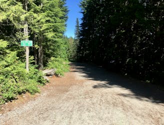
The path is on completely flat land and potential injury is limited to falling over.
Close to help in case of emergency.
1 km away
The easiest singletrack trails in Whistler.
Moderate Trail Running
1 km away
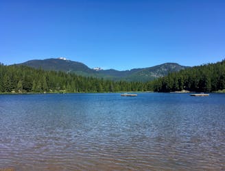
Run along a flat gravel path to a beautiful swimming lake.
Easy Trail Running
2.3 km away
A big loop on the Skywalk Trail network on Rainbow Mountain.
Easy Trail Running
8.7 km away
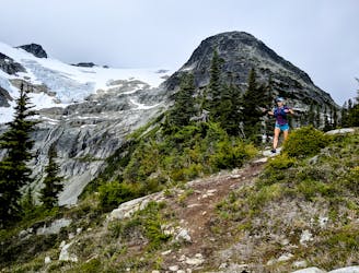
One of Whistler's most iconic trails.
Moderate Trail Running