8.2 km away
Valle Pehuenche / Cerro Cautín
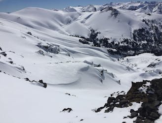
The hildden gems nearby Corralco Resort
Moderate Ski Touring
- Distance
- 6 km
- Ascent
- 724 m
- Descent
- 724 m
Great backcountry, beautiful Monkey Puzzle tree forest and a magnificent descend.
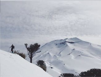
Ski Touring Moderate

Sierra Nevada is 8.379ft (2.554m). It is a must if you are fit for a full day of touring. Skinning up through the old forest of Araucaria (Monkey Puzzle Tree) it's quite the experience!, it's a dense forest where you have to aim to follow the path of an old logging road, which you can't see in winter but it's somehow doable by foreseeing the terrain often. Contact the local guides for a better experience as they are they are up to date on the season and road conditions, that turns into saving time and legs for the skiing. (Hire a local guide if not experienced with southern conditions or unsure of navigational skills for this one) once you commit to Sierra Nevada, this will be a full day and you don't want to loose time before reaching the ridge that begins at the end of the treeline. Ski and boot crampons are a must no matter the season.


Moderate
Slopes become slightly steeper at around 25-30 degrees.

As well as the slope itself, there are some obstacles (such as rock outcrops) which could aggravate injury.

In the high mountains or remote conditions, all individuals must be completely autonomous in every situation.
8.2 km away
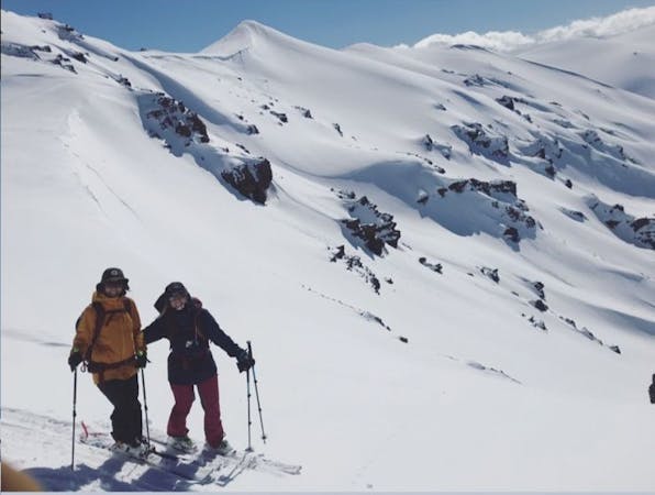
The hildden gems nearby Corralco Resort
Moderate Ski Touring
8.9 km away
A short tour with a great freeride descent
Moderate Ski Touring
3 routes · Ski Touring