1.7 km away
Sormiou
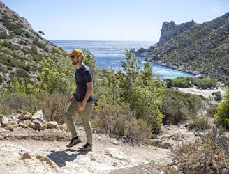
Explore one of the legendary Calanques on this gorgeous hike
Moderate Hiking
- Distance
- 5 km
- Ascent
- 271 m
- Descent
- 262 m
Ascent to Mount Puget, Sugiton beach and belvedere. / Montée au Mont Puget, plage et belvédère de Sugiton.
Hiking Moderate

Ascent to Mount Puget, Sugiton beach and belvedere. Some passages must be careful not to slip due to the wear and tear of the rocks.


Montée au Mont Puget, plage et belvédère de Sugiton. Certains passages doivent faire l'objet d'une attention particulière pour ne pas glisser en raison de l'usure des rochers.
Moderate
Hiking along trails with some uneven terrain and small hills. Small rocks and roots may be present.

The trail contains some obstacles such as outcroppings and rock which could cause injury.
Away from help but easily accessed.
1.7 km away
Explore one of the legendary Calanques on this gorgeous hike
Moderate Hiking
5.7 km away

A beautiful linear hike through the famous Calanques
Severe Hiking