45 m away
Moraine des Rognons

An interesting direct line through the moraine wall to the Argentiere Glacier
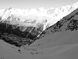
Difficult Freeride Skiing
- Distance
- 1 km
- Ascent
- 0 m
- Descent
- 537 m
An alternative to the main Dome line.
Freeride Skiing Difficult

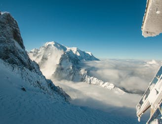
This is a popular freeride skiing route which is generally considered to be difficult. It's very remote, it features medium exposure (e2) and is typically done between January and April. From a low point of 2.7 km to the maximum altitude of 2.9 km, the route covers 687 m, 0 vertical metres of ascent and 290 vertical metres of descent. It's graded 2.2 and Labande grade 3. You'll need rope to complete it safely.
This skis the huge wide open glacial slopes diagonally down and L. There is no distinct line and it has a slight convexity on it. You join the tracks from the main Dome line to enter the lower slopes through the rocks.
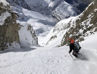
Difficult
Serious gradient of 30-38 degrees where a real risk of slipping exists.

As well as the slope itself, there are some obstacles (such as rock outcrops) which could aggravate injury.

Little chance of being seen or helped in case of an accident.
45 m away
An interesting direct line through the moraine wall to the Argentiere Glacier
Difficult Freeride Skiing
364 m away
A wide open glacier run with a steep exit
Difficult Freeride Skiing
436 m away
A serious glacier run in the spectacular Argentiere Glacier basin
Difficult Freeride Skiing
634 m away

A short steep hanging snowfield, approached by a scramble over the Grands Montets summit
Severe Freeride Skiing
641 m away

A hidden gem; varied and interesting skiing high above the Argentiere Glacier
Difficult Freeride Skiing
731 m away

A wide open glacier run in a small dip below the bounding cliffs
Moderate Freeride Skiing
741 m away
A legendary Chamonix off-piste run. Serious skiing in a spectacular big mountain environment
Difficult Freeride Skiing
742 m away

An imposing line down the small glacier at the top of the front face of the Grands Montets
Difficult Freeride Skiing
1.1 km away
A steep, narrow couloir in wild high mountain terrain
Severe Freeride Skiing
1.4 km away

Another classic Grands Montets line, accessing a hidden bowl below steep cliffs
Difficult Freeride Skiing

10 routes · Freeride Skiing