45 m away
Dome Traverse

An alternative to the main Dome line.
Difficult Freeride Skiing
- Distance
- 687 m
- Ascent
- 0 m
- Descent
- 290 m
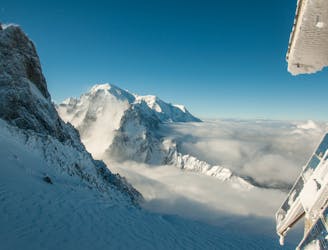
An interesting direct line through the moraine wall to the Argentiere Glacier
Freeride Skiing Difficult

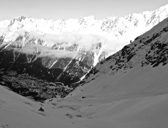
This is more direct, slightly steeper and more enclosed line that the main Rognons Glacier descent. You spend a shorter time on the Rognons Glacier so it may be a better choice if this is poor condition, though you do rejoin the Argentiere Glacier at the bottom of the run. Start at the foot of the iron steps that descend from the top station of the Grands Montets. Ski defensively or sideslip down the initial icy slope on the Pointe de Vue piste. Exit this to the R under the fence and ski down, as for the Rognon Glacier run initially, leaving the obvious Rognon on its R. Once below here you will see tracks below here that descend down and L on the main glacier. Ignore these and descend to the L of a blunt rocky ridge. This leads you into the slope you will ski straight down, bounded by broken rocks on either side. There are occasional narrower sections and it generally steepens as it descends. Be careful not to go too far L as there are many blind ending lines that cliff out towards the bottom. A final steep section puts you down onto the often crevassed lower section of the Rognons run, as you meet the Argentiere Glacier. This sweeps you back L on a big traverse to rejoin the Pointe de Vue piste.
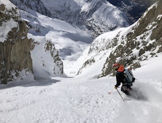
You are on a glacier so make sure you are equipped, prepared and have practised crevasse rescue, however unlikely you think falling in a crevasse is- it is possible! A minimum would be each person to have harness, axe, crampons, an ice screw, 3 prussiks, several screwgates, a pulley/DMM Revolver karabiner, a couple of slings and 2 30m ropes in the group. A more modern simple solution substituting for many of the above might be 2 Petzl RAD systems in the group. If you have any doubts about this ski with an IFMGA Mountain Guide.
Difficult
Serious gradient of 30-38 degrees where a real risk of slipping exists.

As well as the slope itself, there are some obstacles (such as rock outcrops) which could aggravate injury.

Little chance of being seen or helped in case of an accident.
45 m away
An alternative to the main Dome line.
Difficult Freeride Skiing
385 m away
A wide open glacier run with a steep exit
Difficult Freeride Skiing
471 m away
A serious glacier run in the spectacular Argentiere Glacier basin
Difficult Freeride Skiing
639 m away

A hidden gem; varied and interesting skiing high above the Argentiere Glacier
Difficult Freeride Skiing
667 m away

A short steep hanging snowfield, approached by a scramble over the Grands Montets summit
Severe Freeride Skiing
745 m away

A wide open glacier run in a small dip below the bounding cliffs
Moderate Freeride Skiing
778 m away
A legendary Chamonix off-piste run. Serious skiing in a spectacular big mountain environment
Difficult Freeride Skiing
779 m away

An imposing line down the small glacier at the top of the front face of the Grands Montets
Difficult Freeride Skiing
1.2 km away
A steep, narrow couloir in wild high mountain terrain
Severe Freeride Skiing
1.4 km away

Another classic Grands Montets line, accessing a hidden bowl below steep cliffs
Difficult Freeride Skiing

10 routes · Freeride Skiing