3.6 km away
Via Alpina: Samoens to Le Buet via the Aiguilles Rouges
A 3-day hike along part of the Via Alpina in the stunning Haute-Savoie region of France.
Moderate Hiking
- Distance
- 53 km
- Ascent
- 3.8 km
- Descent
- 3.2 km
2 hour circuit starting and finishing at Chalet Ski Massif
Hiking Moderate

This is a popular hiking route which is generally considered to be moderate. It's remote, it features medium exposure and is typically done in April, May, June, September, October and November. From a low point of 1.2 km to the maximum altitude of 1.4 km, the route covers 5.2 km, 316 vertical metres of ascent and 315 vertical metres of descent.
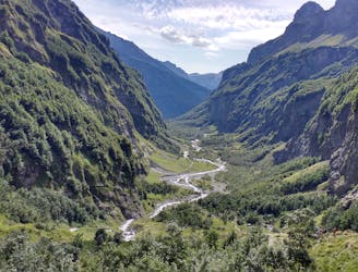
This route is nice and varied, with views down to the Giffre Valley as well as the Nant d'Ant Valley that is below the chalet.
Moderate
Hiking along trails with some uneven terrain and small hills. Small rocks and roots may be present.

The trail contains some obstacles such as outcroppings and rock which could cause injury.
Away from help but easily accessed.
3.6 km away
A 3-day hike along part of the Via Alpina in the stunning Haute-Savoie region of France.
Moderate Hiking
6.4 km away
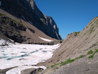
A hike beginning with easy trails and ending by scrambling to a summit.
Extreme Hiking
9.9 km away
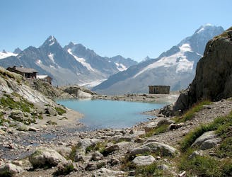
Visit an alpine lake before discovering one of France's 17 "Grand Sites de France," the glacial cirque of Fer à Cheval.
Difficult Hiking

3 routes · Hiking