930 m away
Pointe de Bellegarde
A hike beginning with easy trails and ending by scrambling to a summit.
Extreme Hiking
- Distance
- 18 km
- Ascent
- 1.7 km
- Descent
- 1.7 km
2 exciting Cols (Ossans & Ours) and 2 favourite huts (Bonaveau & Vogealle)
Hiking Extreme

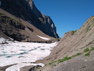
This is a popular hiking route which is generally considered to be extreme. It's very remote, it features extreme exposure and is typically done between July and September. From a low point of 998 m to the maximum altitude of 2.5 km, the route covers 37 km, 3026 vertical metres of ascent and 3123 vertical metres of descent.
Incredible scenery often quite remote with difficult scrambles although metal work in place to make it technically easy - not for those with a nervous disposition or without someone with moutaineering experience
Extreme
Scrambling up mountains and along technical trails with moderate fall exposure. Handholds are necessary to navigate the trail in its entirety, although they are not necessary at all times. Some obstacles can be very large and difficult to navigate, and the grades can often be near-vertical. The challenge of the trail and the steepness of the grade results in very strenuous hiking. Hikes of this difficulty blur the lines between "hiking" and "climbing".

Some trail sections are extremely exposed where falling will almost certainly result in serious injury or death.

Little chance of being seen or helped in case of an accident.
930 m away
A hike beginning with easy trails and ending by scrambling to a summit.
Extreme Hiking
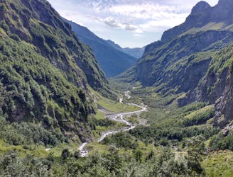
3.7 km away
A 3-day hike along part of the Via Alpina in the stunning Haute-Savoie region of France.
Moderate Hiking
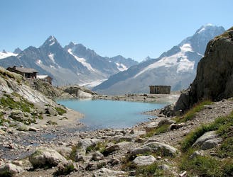
8.3 km away
Visit an alpine lake before discovering one of France's 17 "Grand Sites de France," the glacial cirque of Fer à Cheval.
Difficult Hiking

3 routes · Hiking