7 km away
Pointe de Bellegarde
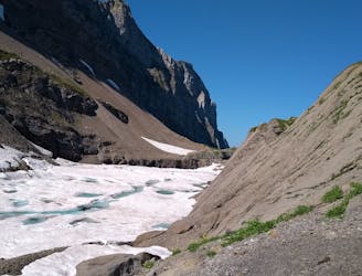
A hike beginning with easy trails and ending by scrambling to a summit.
Extreme Hiking
- Distance
- 18 km
- Ascent
- 1.7 km
- Descent
- 1.7 km
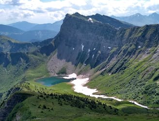
Wild and quite steep way to Nyon peak with gorgeous views
Hiking Moderate

This is a popular hiking route which is generally considered to be moderate. It's not remote, it features medium exposure and is typically done between May and November. From a low point of 1 km to the maximum altitude of 2 km, the route covers 11 km, 997 vertical metres of ascent and 997 vertical metres of descent.
A beautiful hike to nyon's peak, passing by a lot of forest , features a short but beautiful cliff side path and multiples point of views
Moderate
Hiking along trails with some uneven terrain and small hills. Small rocks and roots may be present.

The trail contains some obstacles such as outcroppings and rock which could cause injury.

Close to help in case of emergency.
7 km away
A hike beginning with easy trails and ending by scrambling to a summit.
Extreme Hiking
9.1 km away
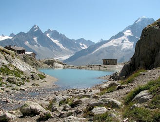
A 3-day hike along part of the Via Alpina in the stunning Haute-Savoie region of France.
Moderate Hiking
9.2 km away
An accessible summit and lake combination.
Difficult Hiking

3 routes · Hiking